

USA ROUTE 66 - 2013

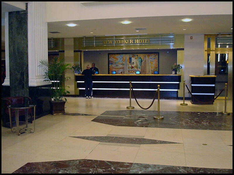
We spent a few days in New York City, exploring the Big Apple while staying at the New Yorker Hotel on 34th and 8th Avenue. Right next door was Tick Tock’s Diner, a classic spot with great food.
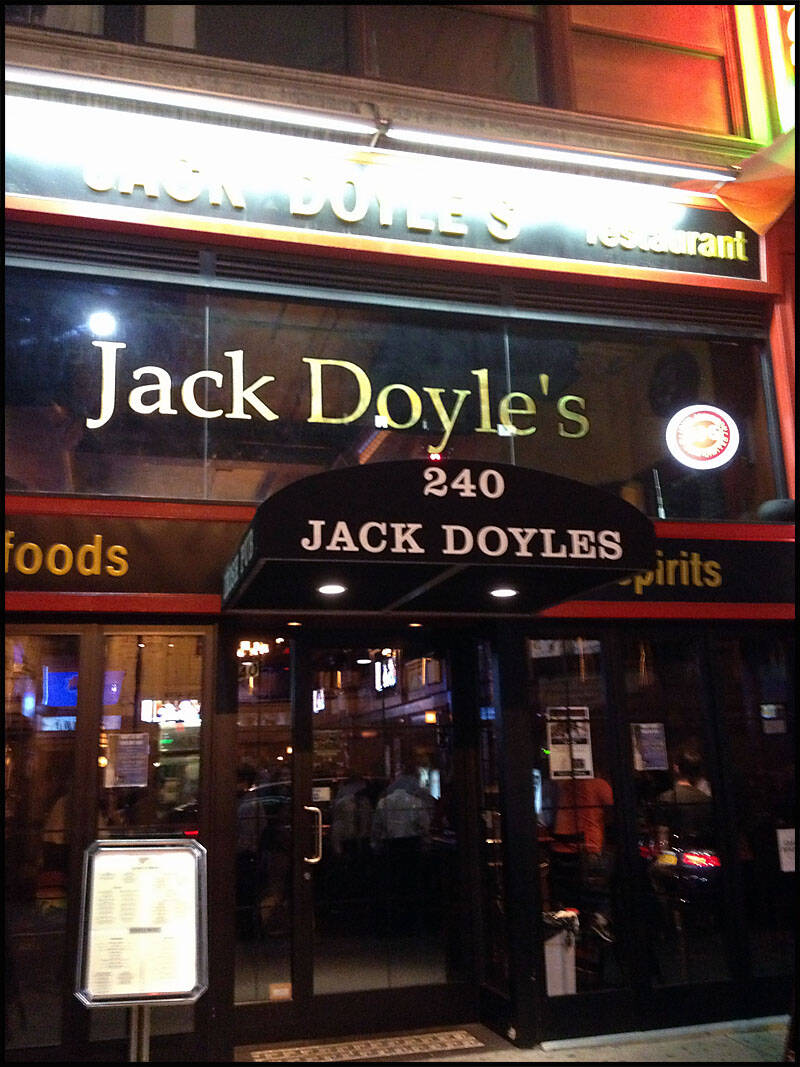
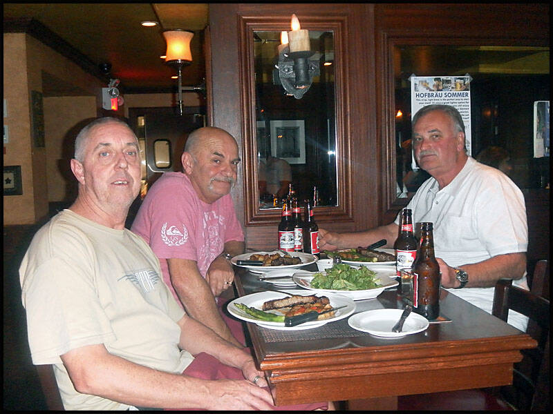
One night, we found a fantastic place to eat—Jack Doyle's Bar & Restaurant at 240 West 35th Street—and had an unforgettable evening.
Our adventures included a bus tour around NYC, a boat ride around Manhattan on the Hudson River, and a subway trip out to Coney Island in Brooklyn. We also visited Ground Zero and spent a relaxing afternoon in Central Park.
It was the perfect way to kick off our trip.

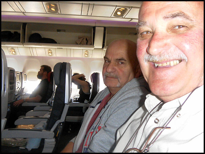
On the plane and on our way.
We’ve just arrived in Los Angeles.

We’re waiting for our connecting flight to NYC.
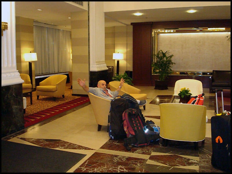
We’ve just arrived in New York City. Leigh is relaxing in the lobby of The New Yorker Hotel.
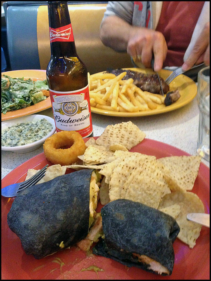
We got in late, so we checked into the hotel and then headed next door to Tick Tock’s for dinner and a few beers.
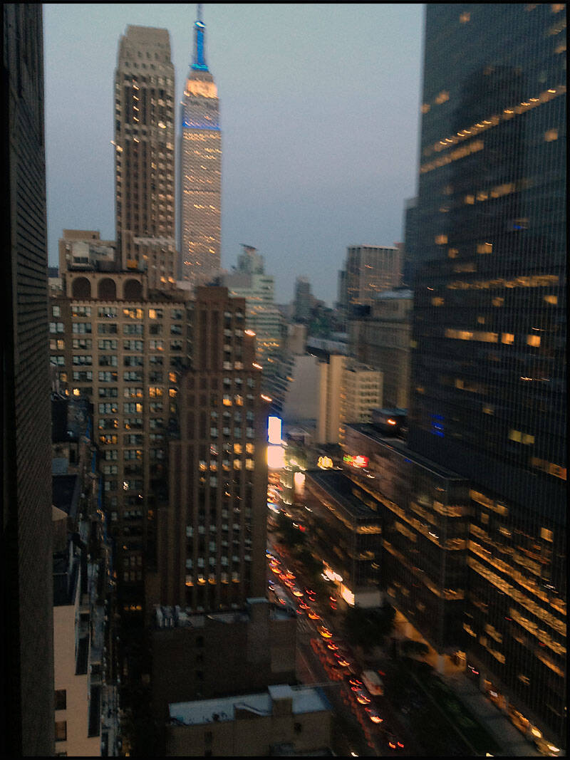
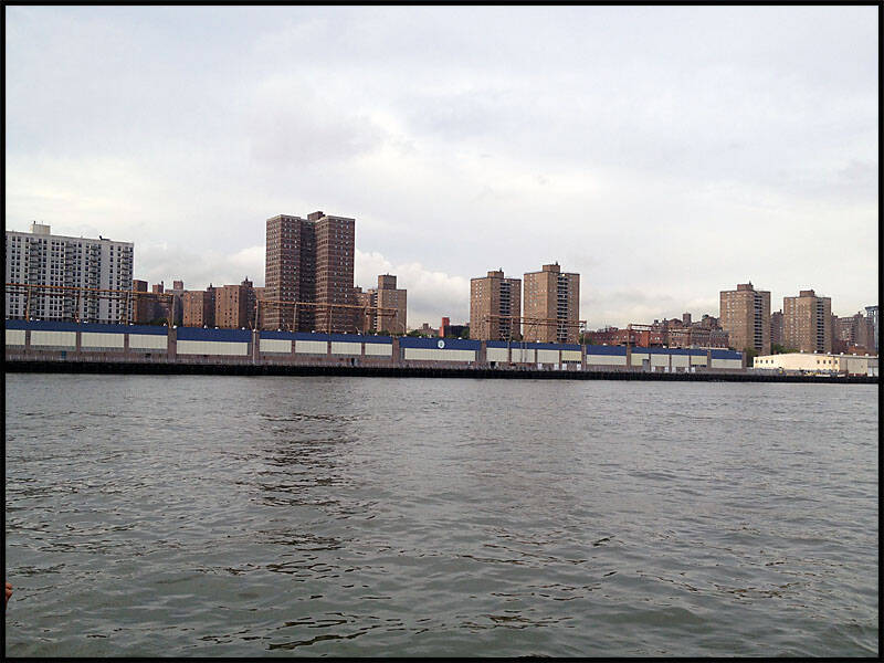
This is the view from our room, looking out at the Empire State Building.
At the corner of 34th and 7th Avenue, just one block down from where we stayed. The New Yorker Hotel looms in the background.
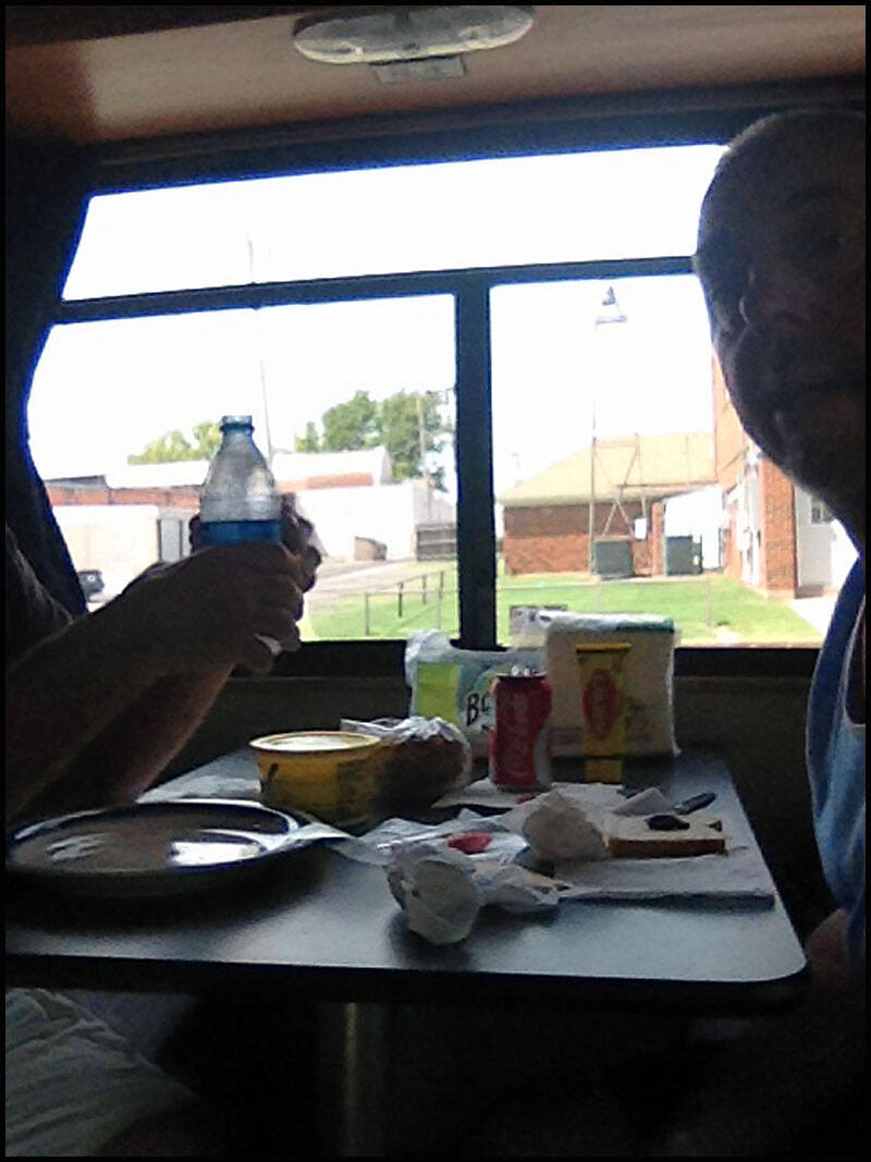
Leigh drew the short straw—he got the floor for three nights.
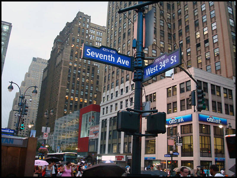

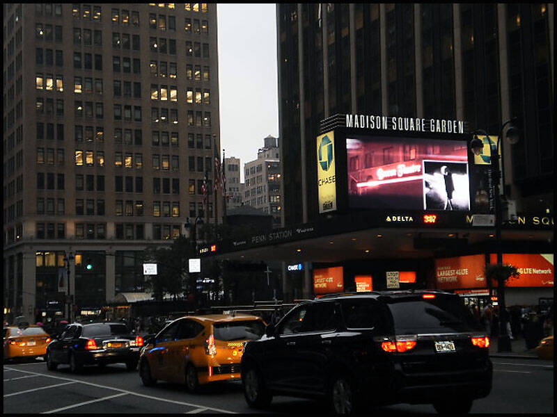
Just around the corner from Madison Square Garden and Penn Station, and a few blocks from 42nd Street (Times Square).
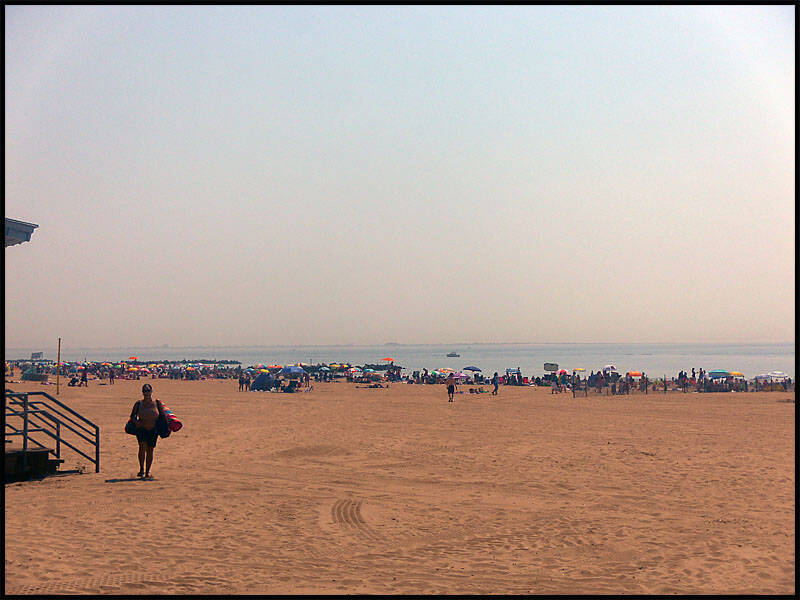
The next day, we took the subway to Union Square and then to Coney Island, Brooklyn. We spent the day down on the boardwalk. While there, we spotted a sign advertising a hot dog-eating contest. The women’s record is 450 hot dogs, and the men’s record is an astonishing 609—I have no idea how long it took them to eat that many!

We took the subway to Coney Island.
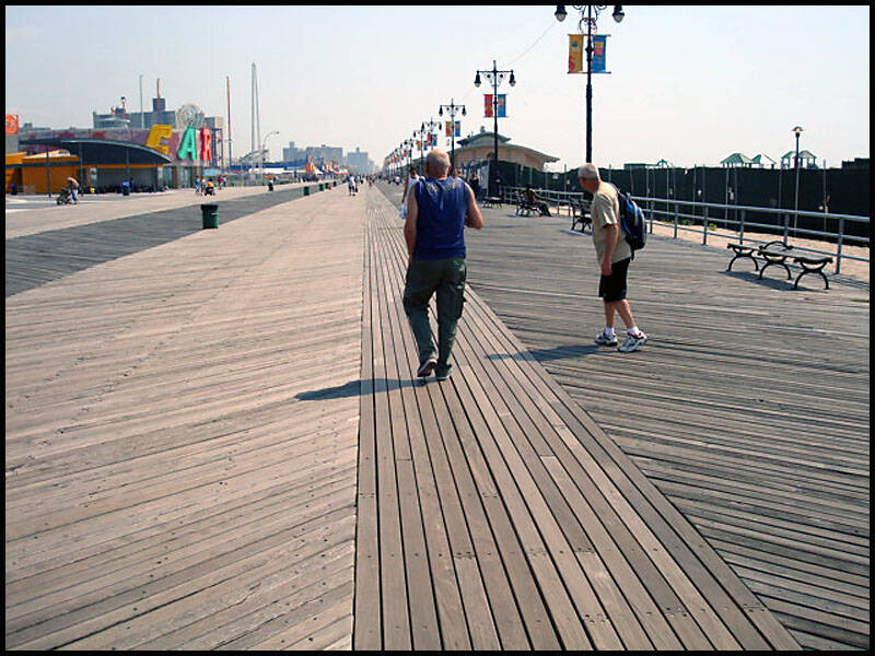
Strolling along the boardwalk at Brighton Beach, Manhattan.
Walking from Brighton Beach to Manhattan Beach along the boardwalk.


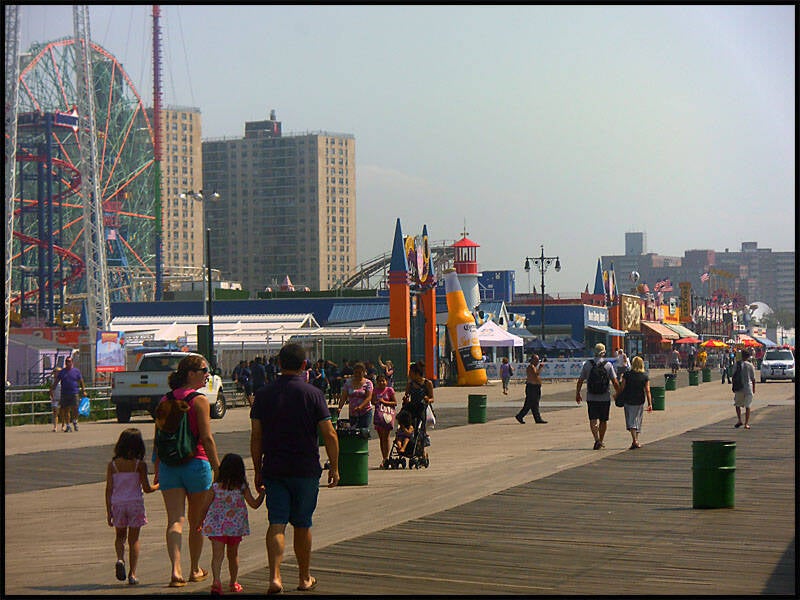
Part of the amusement park at Coney Island.
The big Ferris wheel behind Tom’s, Coney Island.
We had no idea what this ride did—it was closed.
This is the spot where the 1979 movie The Warriors was filmed.


Leigh finally got to play in the sand after finding his bucket and shovel set.
Brighton Beach, Coney Island—the pier was closed for maintenance.


This shop lives up to its name—pure sugar! The dentists on Coney Island must be doing well.
Hot dog eating contest records: 450 dogs for the women’s record and 690 for the men’s. No idea how long it took to eat that many!
And as the sign says, Ruby’s Bar and Grill on the boardwalk, Coney Island.


I’ll never hear the end of this shirt—I paid $20 for it on the boardwalk, but just around the corner it was selling for $10. Leigh and Graz never missed a chance to remind me how much I paid every time someone else bought a shirt.

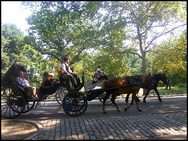
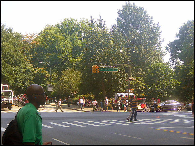
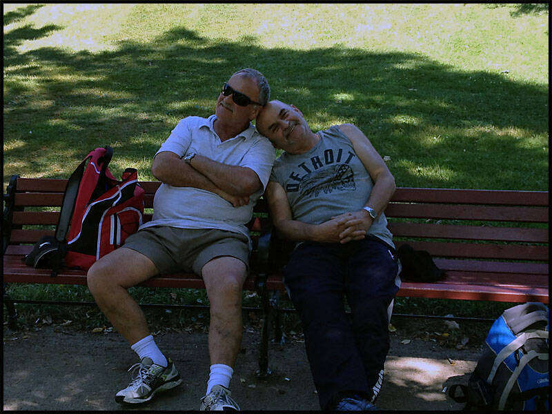
Next, we headed down to Central Park to explore, stopping by The Dakota Apartments at West Central Park & 72nd Street—where John Lennon lived and was tragically shot, right outside his building.
You can take a horse and carriage ride around Central Park to see it in style.
Here’s the entrance on Central Park West.
The Dakota Apartments at West Central Park & 72nd Street, New York—where John Lennon lived and was tragically shot, right outside his apartment.
Somehow, Leigh and Graz managed to sneak into the photo again.

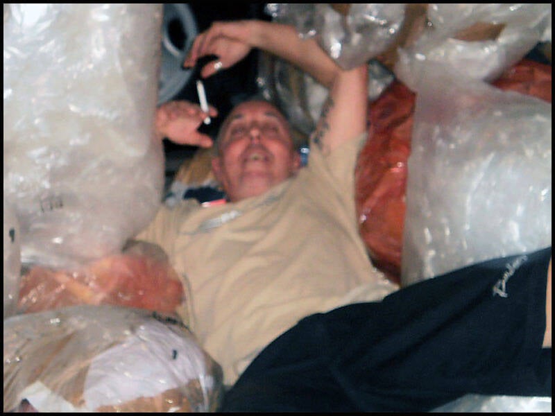
We headed back to get ready for dinner at Jack Doyle’s, a great Irish pub we found using Yelp. We enjoyed plenty of Budweisers along with a delicious meal. On the way home, I somehow fell into the rubbish that was scattered all along the NYC streets (I’m pretty sure I was pushed). After that, we stopped by Tick Tock’s for a few more beers.
Here’s Leigh getting ready to go out—it took him ages to do his hair.
I gave him the thumbs up because, honestly, his hair looked great.


Jack Doyle’s on 35th Street, New York.
Apparently, it has the longest bar in New York City—and the food is great too.
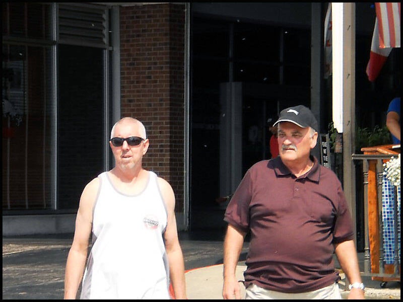
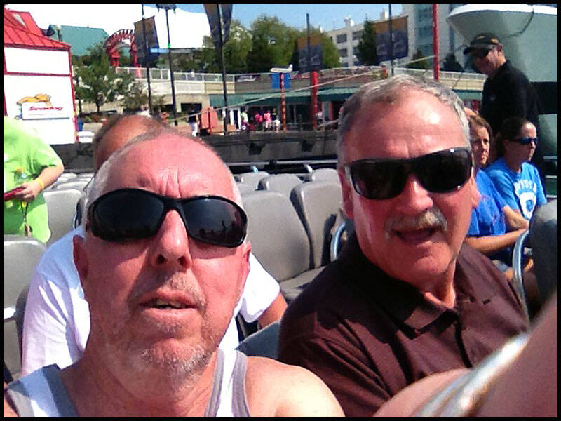
The three amigos at Jack Doyle’s—we all had a great night.
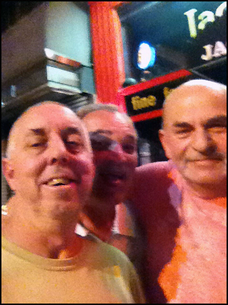
Leaving Jack’s, it was time for a selfie.
This is the spot where someone pushed me into the rubbish. They say I dove in, but somehow, I don’t remember that part.

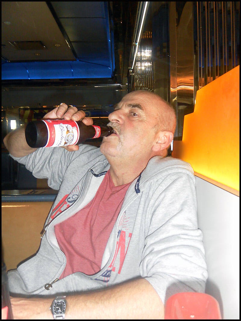
On the way back, we decided to stop for one last drink at Tick Tock’s.
Funny story from that night: a guy was arguing with his girlfriend at the table right beside us. She wanted absolutely nothing to do with him, and they were having a full-on argument while we waited for our food and drinks. We noticed he had some shots and a few plates of food on the table. Thinking “he won’t miss it,” Graz went ahead and drank his shots, and bit by bit, we helped ourselves to his food.
Still arguing, the guy turned to grab a drink—and to his surprise, his shot glass was empty. He looked around, under the table, on his seat next to him—no luck. He went right back to his argument, still clueless that we were sneaking his bacon and chips. He kept checking under the table and around his seat, but couldn’t find a thing.The poor guy.
There were two ladies at another table watching us, laughing along too. After we were full of food and beer, we decided to call it a night.
(I guess you had to be there!)

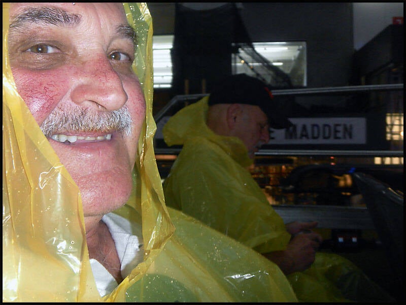
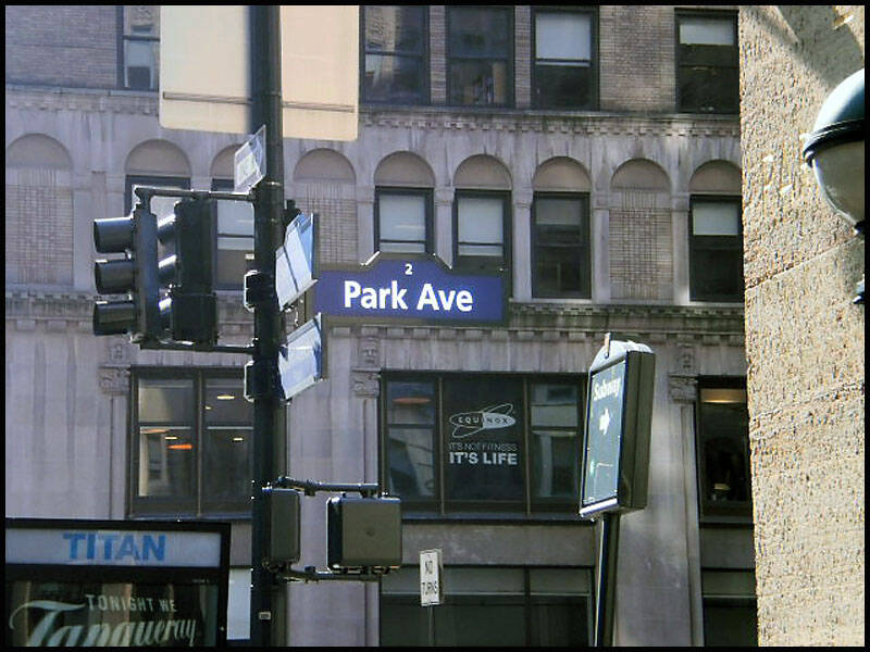
The next day, we took a hop-on, hop-off bus tour around NYC. We visited the Empire State Building, Broadway, Park Avenue, Wall Street, the 9/11 Memorial and Museum at Ground Zero, and passed by the new World Trade Center buildings. We got off at Battery Park to walk around and take in the sights.
Somehow, someone behind me wasn’t very nice.
No sooner had we boarded the bus than the rain started pouring down—but they handed out ponchos to keep us dry.


Right: The Empire State Building..
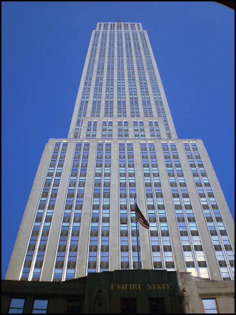
We’re heading down 34th Street toward the Empire State Building.
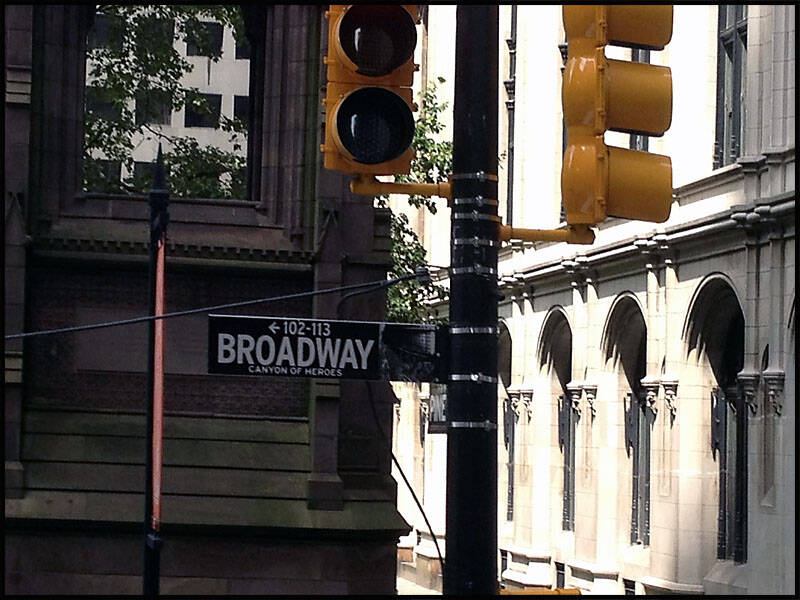
Later, we explored Broadway in Lower Manhattan.


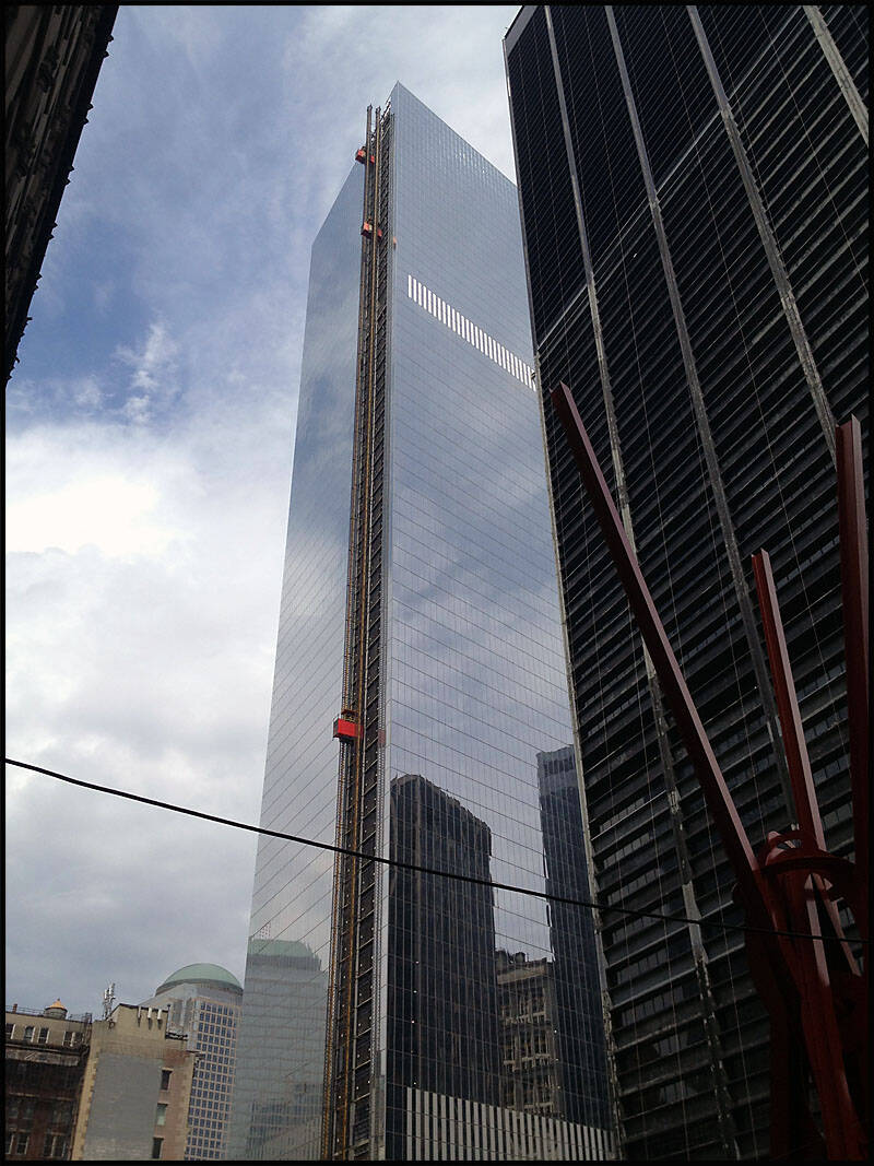
We got off the bus at the 9/11 Memorial Museum, walked past the new One World Trade Center buildings, and then visited Ground Zero.
One World Trade Center—formerly known as the Freedom Tower—is in Lower Manhattan and stands as the tallest skyscraper in the Western Hemisphere, with 104 stories.


Ground Zero—the site of the former World Trade Center towers, now home to the 9/11 Memorial and Museum.


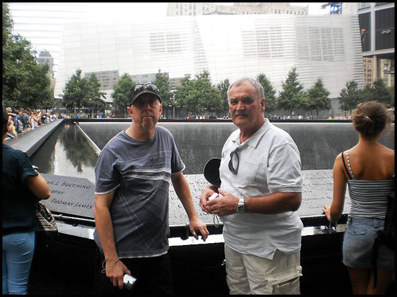
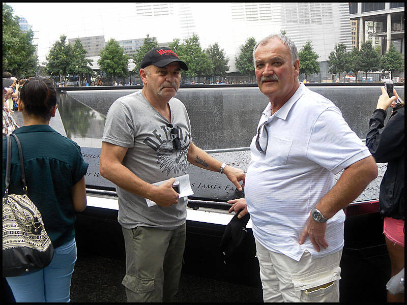
Leigh, Graz, and I at Ground Zero.
Graz and I at Ground Zero.
Graz and I had a bit of fun with the New York cops—both officers had a fantastic sense of humor.


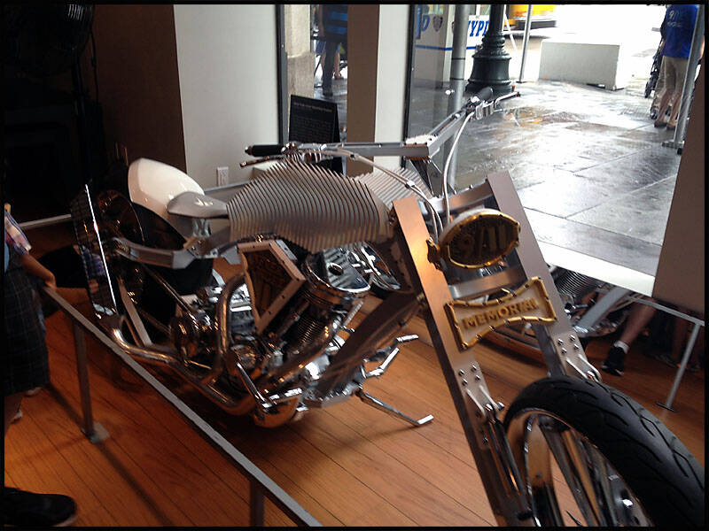
The "9/11 Tribute Bike" built by Orange County Choppers (OCC).
This custom motorcycle was designed and built to honor the victims, survivors, and first responders of the September 11, 2001 terrorist attacks. It was unveiled at the 9/11 Memorial Preview Site in New York City and later displayed at the National September 11 Memorial & Museum.

We then caught the bus down to Wall Street in the Financial District and got off at Battery Park for a walk around.
We stopped by the Charging Bull—also known as the Wall Street Bull—where legend has it you're meant to rub its nose, horns, and testicles for good luck.
(Someone really needs to move their finger before taking the photo next time!)


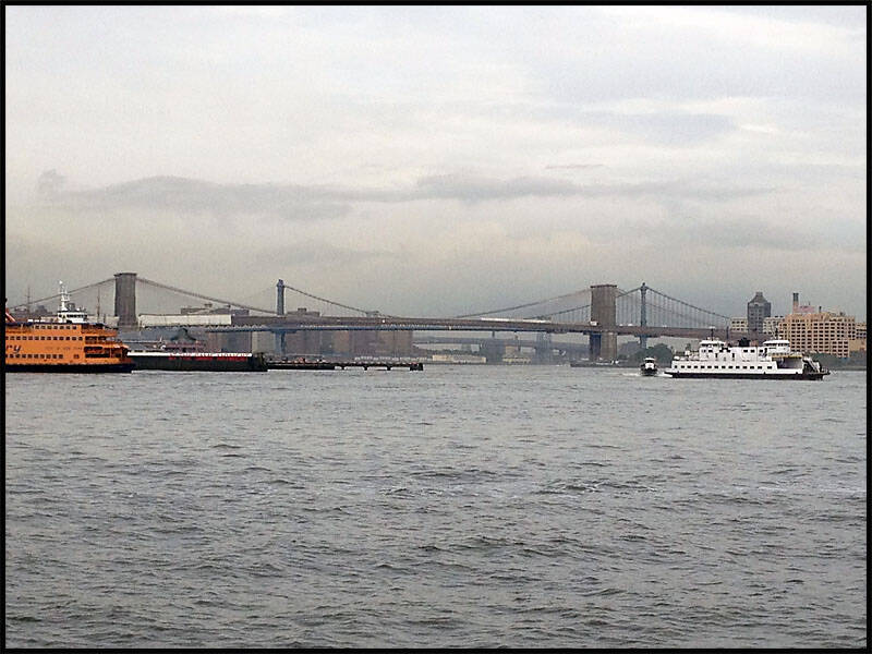
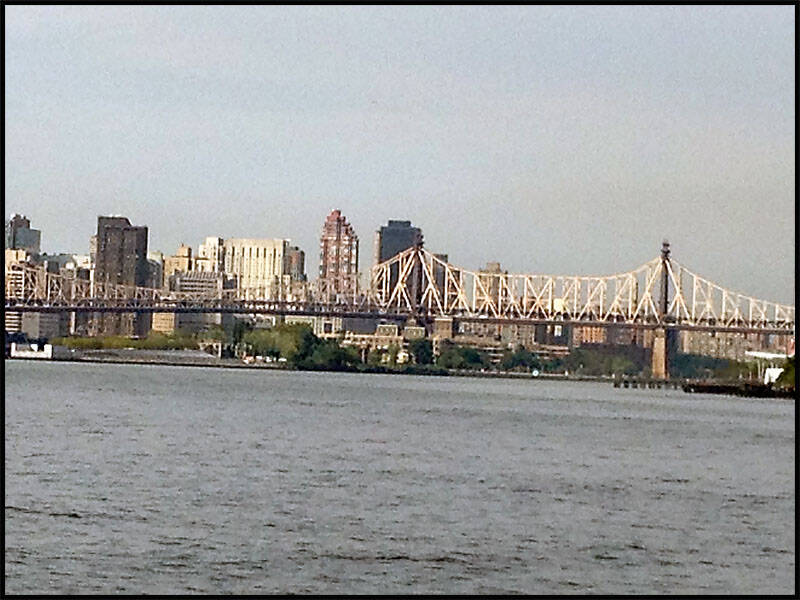
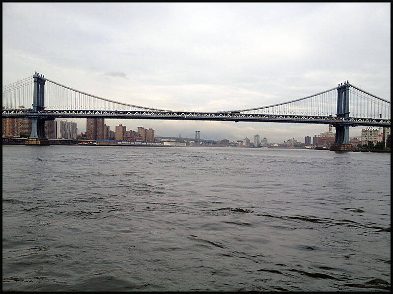
We got off the bus and walked down to the Hudson River—it took about an hour—and then boarded The Pride of the Hudson River cruise around New York City. The cruise took us past the Statue of Liberty, under the Brooklyn Bridge, Manhattan Bridge, and Williamsburg Bridge, and up to the Queensboro Bridge, which connects Manhattan to Queens—a mostly residential area, similar to Brooklyn.
We had a great view of the Brooklyn and Manhattan Bridges from the river, both of which lead into downtown Brooklyn.
Brooklyn and Manhattan Bridge, Queensboro Bridge.
Manhattan Bridge Williamsburg Bridge.

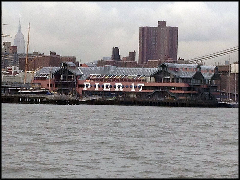
We cruised past Pier 17, which felt a lot like Darling Harbour in Sydney—full of restaurants, shops, and a lively atmosphere.
From the boat, we had an amazing view of the New York City skyline, with One World Trade Center standing tall in the background.
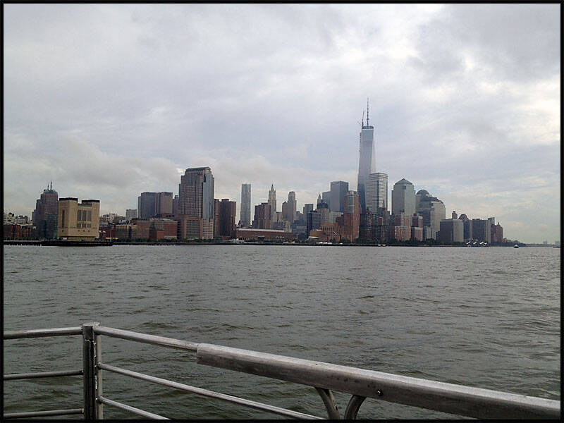
Another great view of the Financial District from the Hudson River.
We passed by the Upper East Side, with its dense housing developments lining the waterfront.
As we cruised through Midtown East, we could see the Empire State Building rising in the background.
The boat went as far as the Queensboro Bridge before turning back.


We then cruised over to the Statue of Liberty for some photos before heading back to the pier to finish the cruise.
We got back on the bus and rode past Pier 17, Little Italy, and the Village area, heading up through Midtown and back to 42nd Street. We got off again and spent some time walking around the area.
Afterwards, we walked back to the hotel, stopping along the way to do some shopping at the Harley-Davidson store and Macy’s on 34th Street.
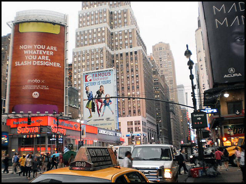
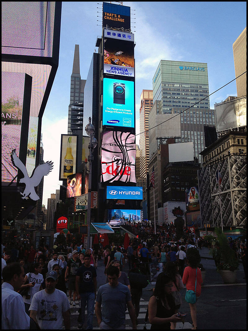
We also passed through Times Square, down at 42nd and 7th Avenue—buzzing with lights, crowds, and energy.
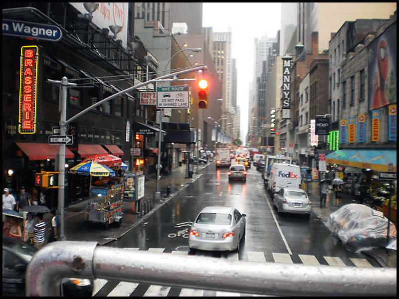
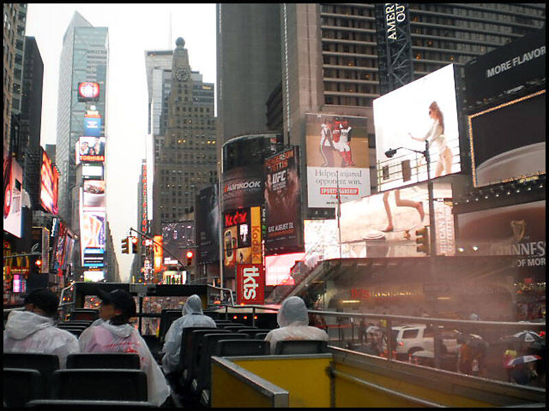


Above and Below: The hustle and bustle of Times Square—always buzzing with energy, flashing lights, and no shortage of interesting people.

New York City Car Parks: Space is limited, so they build up—not out. A true urban solution to a classic problem.

We had an early night, as we had an early flight the next morning.
It was time to leave the Big Apple—our next stop: Niagara Falls, flying into Buffalo in upstate New York.
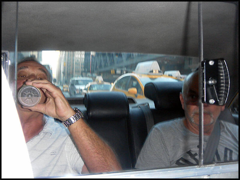
A classic big yellow NYC taxi came to pick us up and take us to JFK International Airport, where we boarded our flight to Buffalo Niagara.

On our way to the international airport—it’s just about a one-hour flight.
Waiting for our flight to Buffalo now… looks like I only managed about two hours of sleep.

We all had a great time in NYC—I just wish we’d had a few more days to explore and take it all in.

Niagara Falls New York State

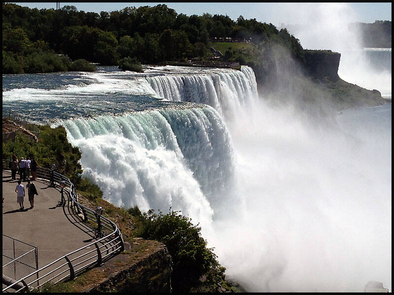
Niagara Falls sits right on the border between the USA and Canada, featuring two main waterfalls: Horseshoe Falls on the Canadian side, and American Falls—including Bridal Veil Falls—on the U.S. side.
We spent the day exploring the area and enjoyed an expensive lunch, but it was well worth it—this place is truly amazing.


Goat Island is a small island in the Niagara River, situated between Bridal Veil Falls and Horseshoe Falls. Just off its west shoreline lie the Three Sisters Islands.
We took a taxi to the falls, and Tony, our driver, dropped us off at Goat Island. He suggested we walk around to the Three Sisters Islands and follow the path all the way around to Horseshoe Falls.


At Goat Island, we crossed the bridge to the Three Sisters Islands, with a stunning view of Horseshoe Falls ahead.
Standing on one of the Three Sisters Islands, we looked upstream along the powerful flow of the Niagara River.
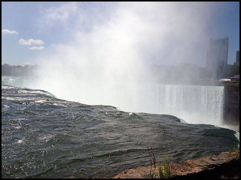
We’re standing on the east edge of Horseshoe Falls, with Canada visible in the background.
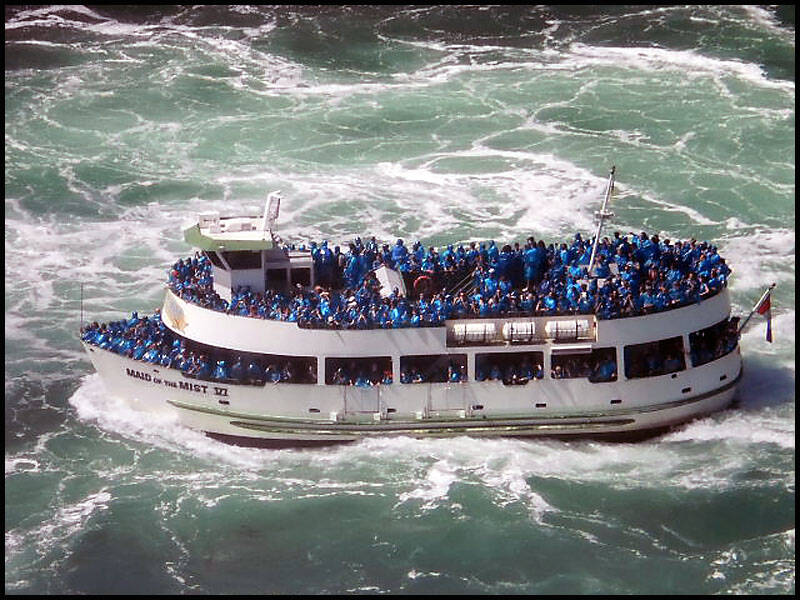
Looking back at the falls, you can see the Maid of the Mist boat making its way toward the cascading water.


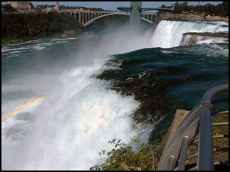
We walked down to Bridal Veil Falls and the American Falls.
Time for photos—the three amigos at Bridal Veil Falls!
You can get right up to the edge of Bridal Veil Falls, with the American Falls creating a stunning backdrop.


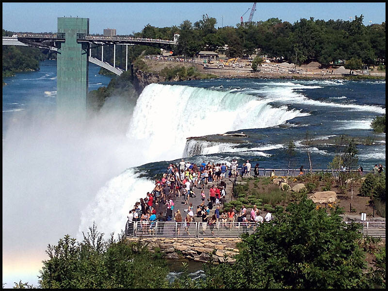
We walked around the other side of the American Falls, heading toward the observation deck. From there, we looked down onto the Maid of the Mist walkway below.

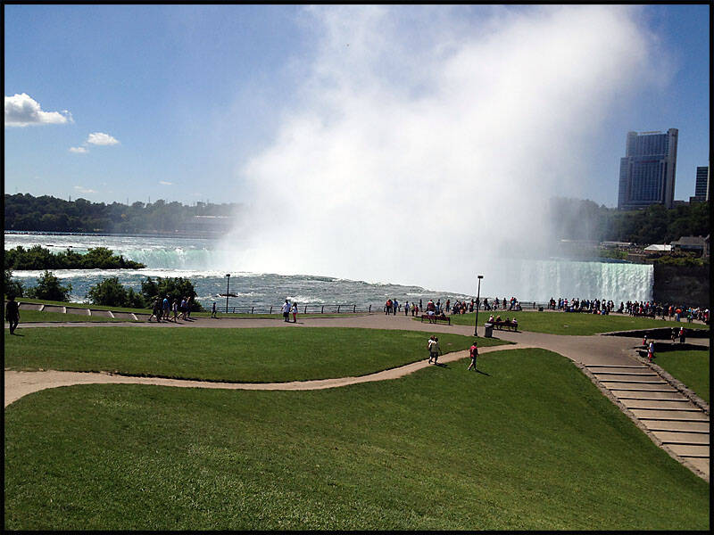
We looked down at the falls from Niagara State Park before heading out for an expensive lunch. Afterward, we walked to the Rainbow Bridge observation deck to take in our last views of the falls.
The two old guys definitely needed a well-deserved rest after walking most of the day—but I had to wake them up, or they might have missed their flight to Chicago!
Some photos of the falls at night, beautifully illuminated by colorful lights.


Chicago Illinois
Chicago — The City Where the Mother Road Begins Its Epic Journey.


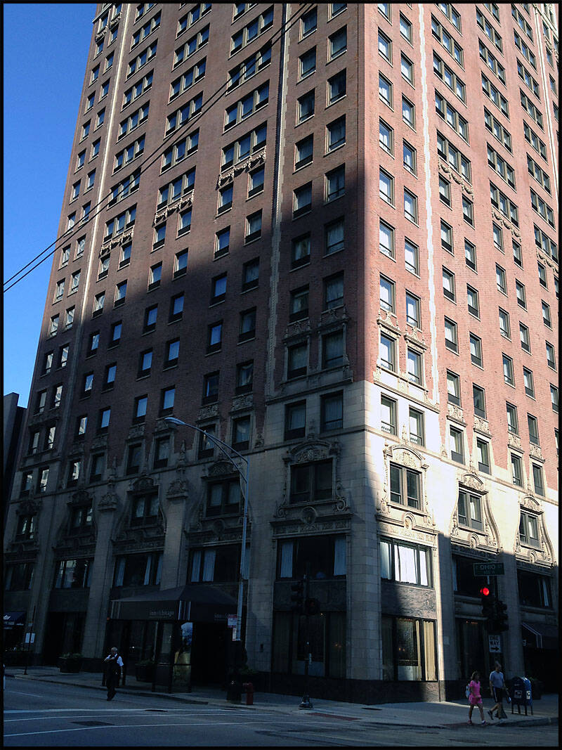
We arrived in Chicago late and checked in at the Inn of Chicago on East Ohio Street, where we stayed for four nights. It’s in a great location—within walking distance to Rush Street, Lake Michigan, and the Chicago Harbour.
On our first night, we wandered the streets looking for somewhere to eat and came across a cozy Greek café. The meal was fantastic and a great start to our time in the city.
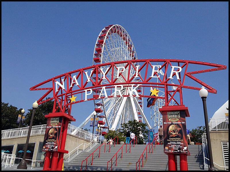
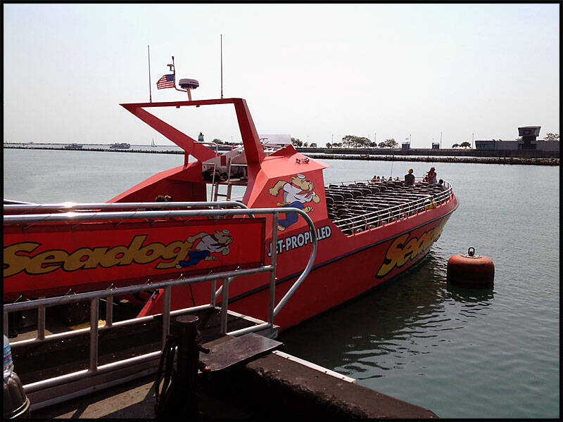
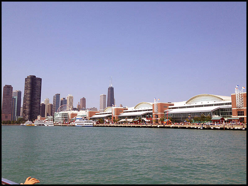
The next day was spent exploring Chicago. We walked down to Lake Michigan and visited Navy Pier, where we went for an exhilarating jet boat ride on The Sea Dog. We also set out to find the Sears Tower (yes, we know it’s now called the Willis Tower), but somehow had no luck locating it!
That evening, we had dinner on lively Rush Street and then strolled through the city to take in Chicago by night—always a beautiful experience.
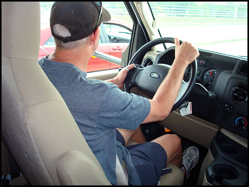
The following day, we picked up the RV and stocked it up, ready to kick off our road trip down the iconic Route 66.
We made the most of our time in Chicago—both by day and night. The rooftop of the hotel offered incredible views of the city skyline, perfect for soaking it all in.
This is the night view from the hotel’s rooftop.
And here’s the daytime view—just as impressive in a different light.


One night, we went out for dinner at Dao Thai Restaurant and Noodle Palace, just down the road from our hotel. I’d really been craving Thai food, but unfortunately, the meal was a letdown—definitely not what I was hoping for. Still, despite the disappointing food, we managed to have a good night.
(And judging by the photo we took later… it looks like the devil got us—those eyes were scary!)

The next morning, we were up early and had a big breakfast before grabbing a taxi to Des Plaines, where Cruise America is located, to sort out our RV for the Route 66 trip. Since it was the weekend, we had a few hiccups—mainly with the one-way rental, which turned out to be more complicated than expected. And being Aussies, I think they weren’t quite sure whether to trust us (kidding… sort of!).
Plan B: we jumped in another taxi and headed to the airport to see if we could rent a car instead. Unfortunately, that option was way out of our budget. So, Plan C was to buy a car. We started googling nearby car yards and found one just outside of Des Plaines—back into another taxi we went.
At the car yard, we found what seemed like the perfect van. It was rusty, had no brakes, but hey—it had mag wheels and a good engine… or so we thought. And all for just $2,500. Whoo hoo! Route 66, here we come!
While we stood there debating whether or not to take the plunge, I got a call from Cruise America—good news! They confirmed the RV was available and ready for pickup first thing Monday morning.
Leigh, in the meantime, was keeping the car salesman entertained. He played it like a pro—walked into the office, grabbed the guy’s card, had a friendly chat, and told him we’d call Monday. (The poor guy was probably sure we were coming back to buy it.)
The van we nearly bought. (A real beauty… if you squinted hard enough.)

I took the call from Cruise America, and just like that, it was sorted—we had the RV, ready to pick up first thing Monday morning.
With that sorted, we could finally relax and enjoy the rest of our time in Chicago without any more vehicle drama. Time to soak up the city before hitting the road on Route 66!

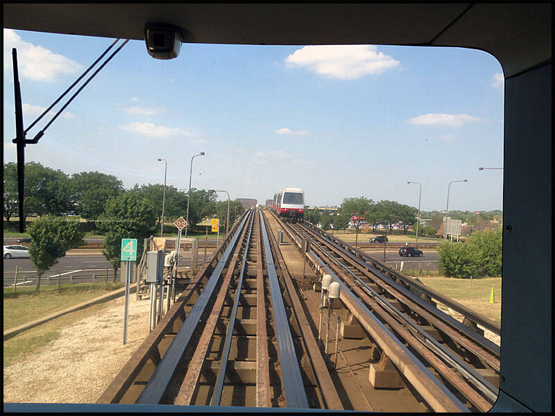
We caught the bullet train back to the city, making a few stops along the way. One of the highlights was passing Wrigley Field, home of the Chicago Cubs. Unfortunately, there was nothing on at the stadium, so we didn’t hang around too long and continued on our way back into the city.
The day had clearly taken its toll on Graz—he crashed hard and was soon snoring away during his afternoon siesta, while Leigh and I were busy planning our next move. (Doesn’t he look way too comfortable?)

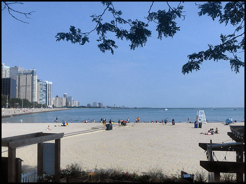
We spent the next day exploring more of Chicago on foot. We started off at Lake Michigan and followed the Lakefront Trail, taking in the beautiful views and stopping to look back at the city skyline from the waterfront. There’s even a small beach along the trail—a nice surprise right in the heart of the city.
We made our way down to Navy Pier again, soaking in the atmosphere, and then set off in search of the Sears Tower (yes, we know it's called Willis Tower now—but it’ll always be the Sears to us). After all that walking, we took a well-earned break at Gloria Jean’s for an iced coffee.
That evening, we had dinner down on Rush Street—always a lively spot—before calling it an early night to recharge for the next day’s adventures.

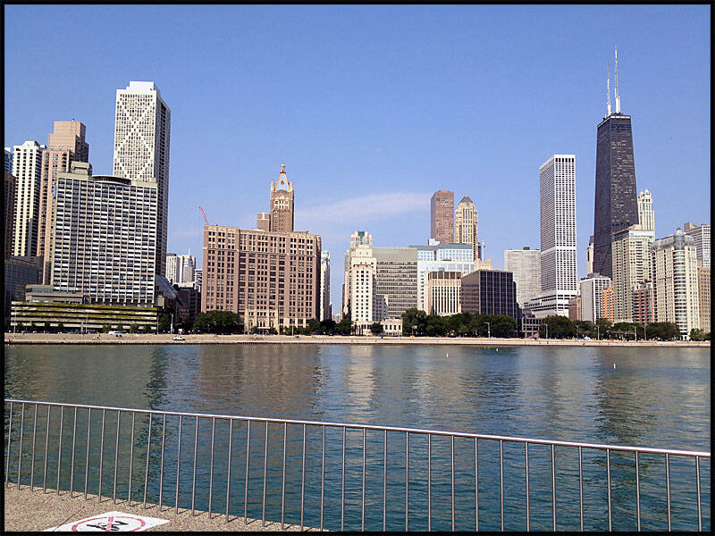
We walked around to Navy Pier, pausing along the Lakefront Trail to take in the stunning view of the Chicago skyline behind us.
We spent most of the morning down at Navy Pier, enjoying breakfast and taking in the sights. I couldn’t help but laugh at Graz—he saved half of his breakfast to eat for lunch later. No way was he going to let a good Subway sandwich go to waste!
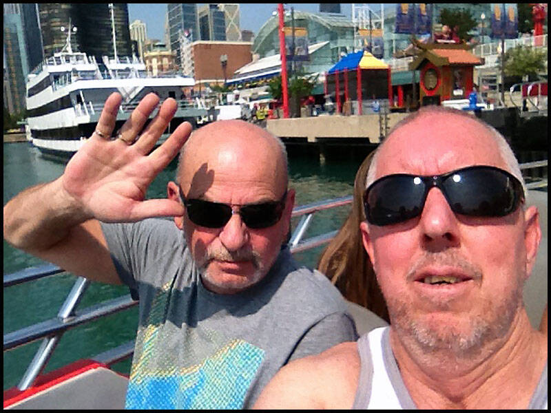
Leigh was very generous and treated us to a jet boat ride on The Sea Dog down on Lake Michigan—and it was absolutely worth it. (Thanks, Leigh!)
Time for another selfie aboard The Sea Dog.
Here’s a shot looking back at Navy Pier from the jet boat—such a great perspective!
We left Navy Pier to visit the Sears Tower, with the Trump International Hotel and the Shakespeare Theater visible against the city skyline.


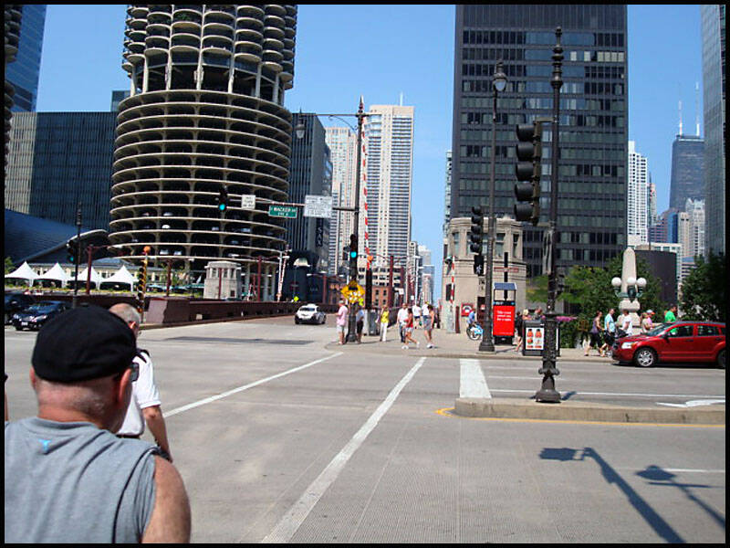
We followed the Chicago River as it wound its way into the heart of the city, making our way toward the impressive Trump International Tower and Hotel, the tall building that dominated the skyline in the distance. The city’s mix of modern skyscrapers and historic architecture created a stunning backdrop as we navigated the busy streets.
Our plan was to visit the famous Sears Tower, but finding it proved more challenging than expected. We took a few wrong turns and ended up wandering around unfamiliar parts of downtown. Frustrated, we finally decided to give up the search for the moment. Later on, we learned that the Sears Tower had been renamed the Willis Tower, which explained some of our confusion. It was hard to believe we had missed the tallest building in Chicago, especially since it’s such an iconic landmark. Despite the detour, the experience gave us a chance to explore the city more freely and appreciate the vibrant urban landscape in a way we might not have otherwise.

We were down on Rush Street to get dinner. I took this picture for a friend who used to live in Rosebud—hey Rose!

We woke up early, eager to get the day started, and made our way to West Egg, just around the corner from where we were staying. We treated ourselves to a big, hearty breakfast that was nothing short of a feast—pancakes stacked high, eggs cooked just right, crispy bacon, and fresh coffee. Somehow, despite the generous portions, we managed to get it all down, fueled up and ready for the adventure ahead.
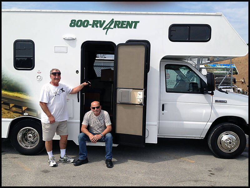
After breakfast, we headed back to pack our bags and make sure everything was organized for the trip. Once packed, we caught a taxi to Cruise America to pick up the RV that would be our home on wheels for the next part of our journey. There was a mix of excitement and a little nervousness as we stepped up to the vehicle, but mostly pure anticipation for what lay ahead.
And just like that, the three amigos—well, maybe more like the three stooges—were finally on the road. With the RV loaded and the open highway ahead of us, our long-awaited road trip officially began. The sense of freedom, the promise of new sights, and the joy of traveling together made the moment unforgettable. The adventure was truly underway!


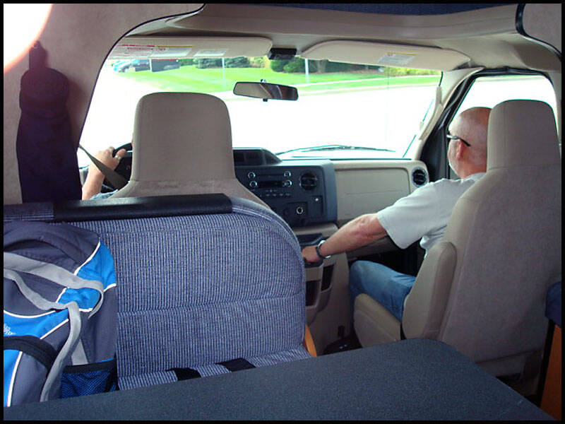
Trying to navigate our way out of Chicago—everyone’s on the wrong side of the road over here! Snapped a few pics inside the RV along the way.

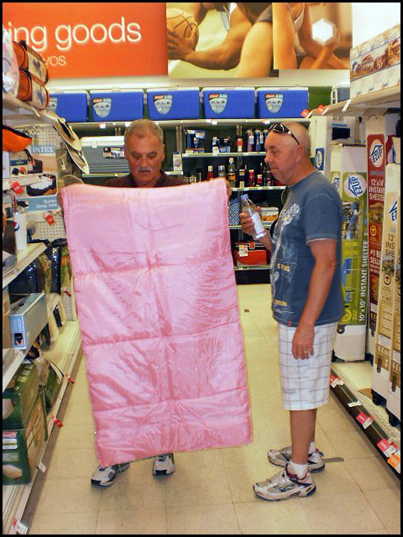
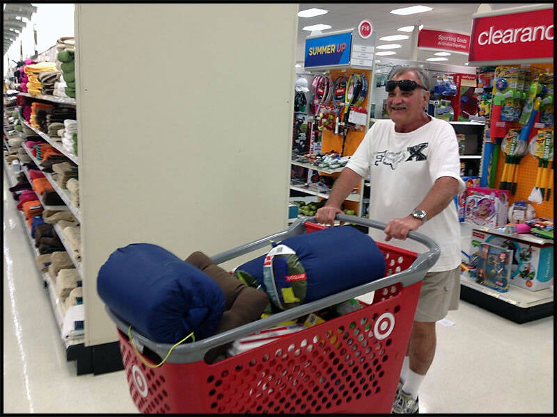
We made a necessary stop at Walmart to stock up the RV with food, drinks, and all the essentials we’d need for the next leg of our journey. As we wandered through the aisles, I spotted a bright pink sleeping bag that immediately caught my eye. I really liked it—it was cheerful and cozy-looking, perfect for the road trip. Just as I reached out to grab it, Graz swooped in and snatched it away. Apparently, he really wanted it for himself. (Seriously, was anyone even paying attention to what I was doing?)
Graz has been absolutely over the moon with his new pink sleeping bag ever since. At first, though, he was missing a pillow, which seemed to bother him a bit. But once we found a matching pillow to complete his setup, he was all set and ready for some serious comfort on the road. The only problem now? Something tells me that with all his enthusiasm and that bright pink sleeping bag, we’re probably never going to get a good night’s sleep again! It’s safe to say this little addition has definitely brought some extra fun—and a bit of chaos—to our camping nights.


We traveled a total of 484.4 kilometers through Illinois, starting our journey from the bustling city of Chicago. Our first stop was Joliet, but instead of a quick visit, we found ourselves lost for about an hour trying to navigate the streets—definitely a sign that this trip was going to be full of unexpected adventures! Once we finally got our bearings, we continued on and stopped in Dwight for a quick bite to eat, enjoying a moment to stretch our legs and refuel.
From there, we passed through Pontiac, a town known for its rich Route 66 history and murals, and then on to Bloomington, soaking in the small-town charm along the way. We made a brief stop in Lincoln to take care of some RV maintenance and ensure everything was in order before nightfall. It was important to get everything set up early so we could travel safely the next day.
After rolling through Springfield—the state capital with its own unique attractions—we finally pulled into Edwardsville as evening approached. We settled in for the night at the Red Barn Rendezvous RV Park, a quiet spot where we could relax and recharge after a long day on the road. Despite the challenges and detours, it was a satisfying day filled with new sights and experiences, setting the tone perfectly for the rest of our Route 66 adventure.
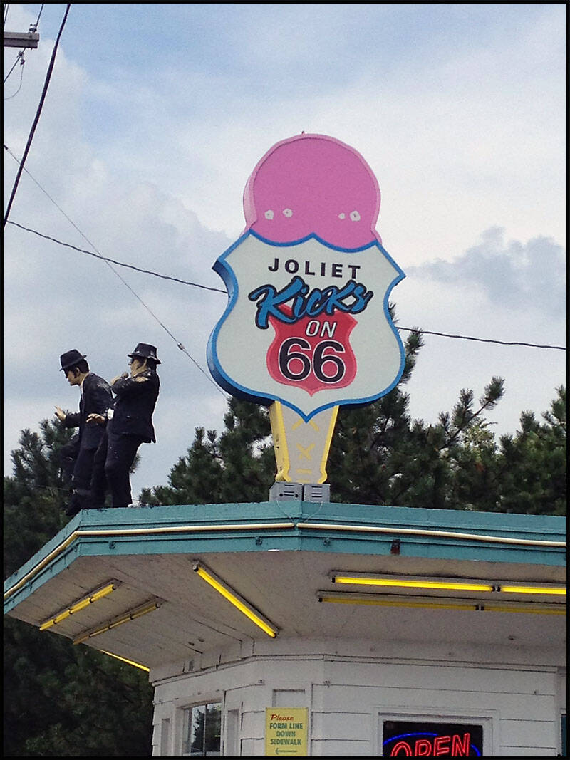
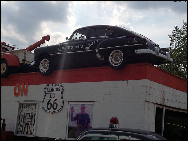
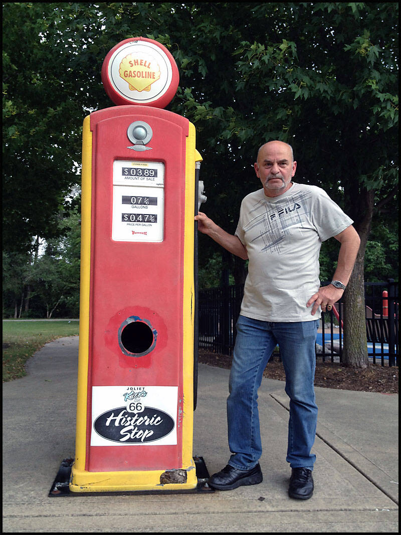
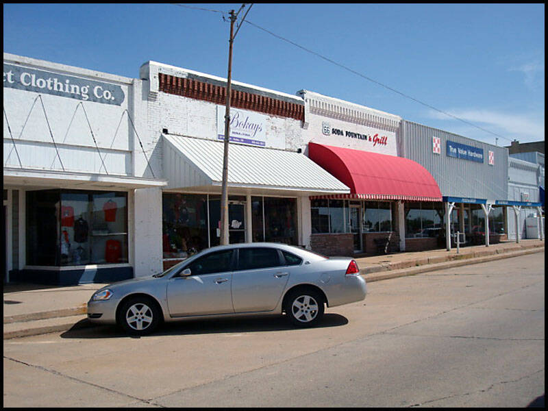
Joliet Illinois


Joliet was the first town we stopped in—but only because we managed to get lost for about an hour trying to find our way. And to clear things up, I wasn’t the navigator this time—it was Leigh sitting in the passenger seat, map in hand, trying her best to guide us. Sometimes, no matter how hard you try, those back roads have a mind of their own!
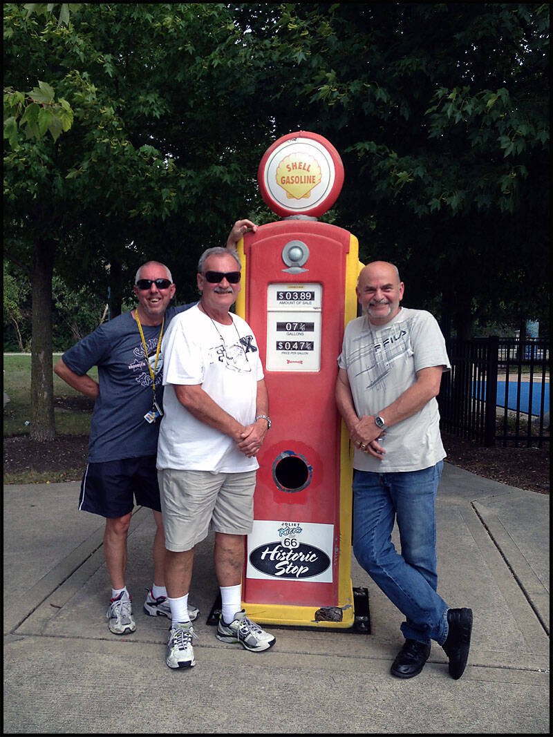
Fortunately, while wandering around trying to figure things out, we came across a friendly couple who noticed our confusion. They kindly offered to take a few photos of us, which was a nice gesture after the frustrating detour. They also shared some helpful local tips about places to see along Route 66 and gave us clear directions to get back on track. Their warmth and kindness turned what could have been a stressful moment into a pleasant experience, reminding us that the journey is just as much about the people you meet as the places you visit.


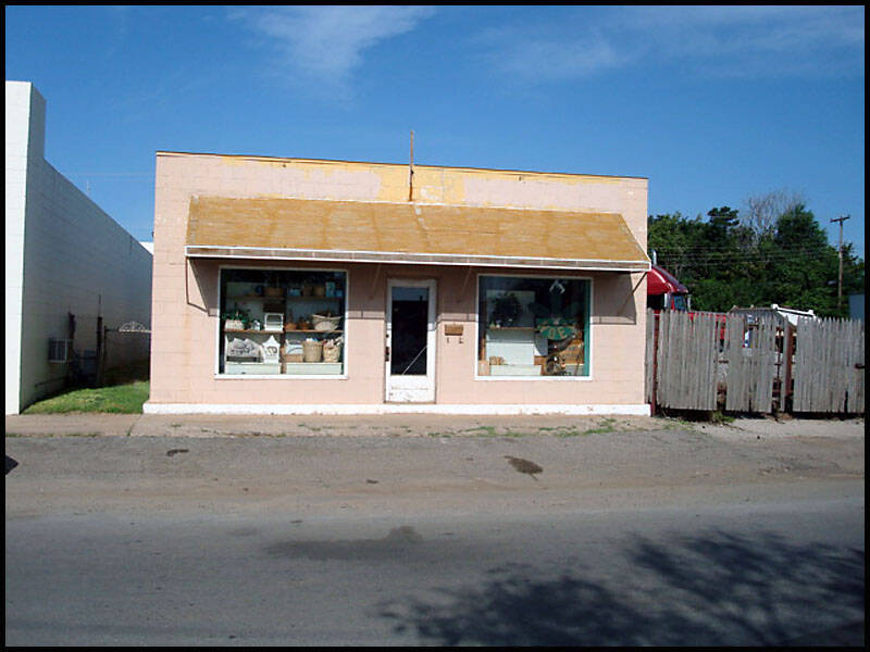
We stopped at this little ice cream café, and just as I walked up to the window, the guy shut it and walked away—left me standing there like an idiot. (No comments on that, please!)
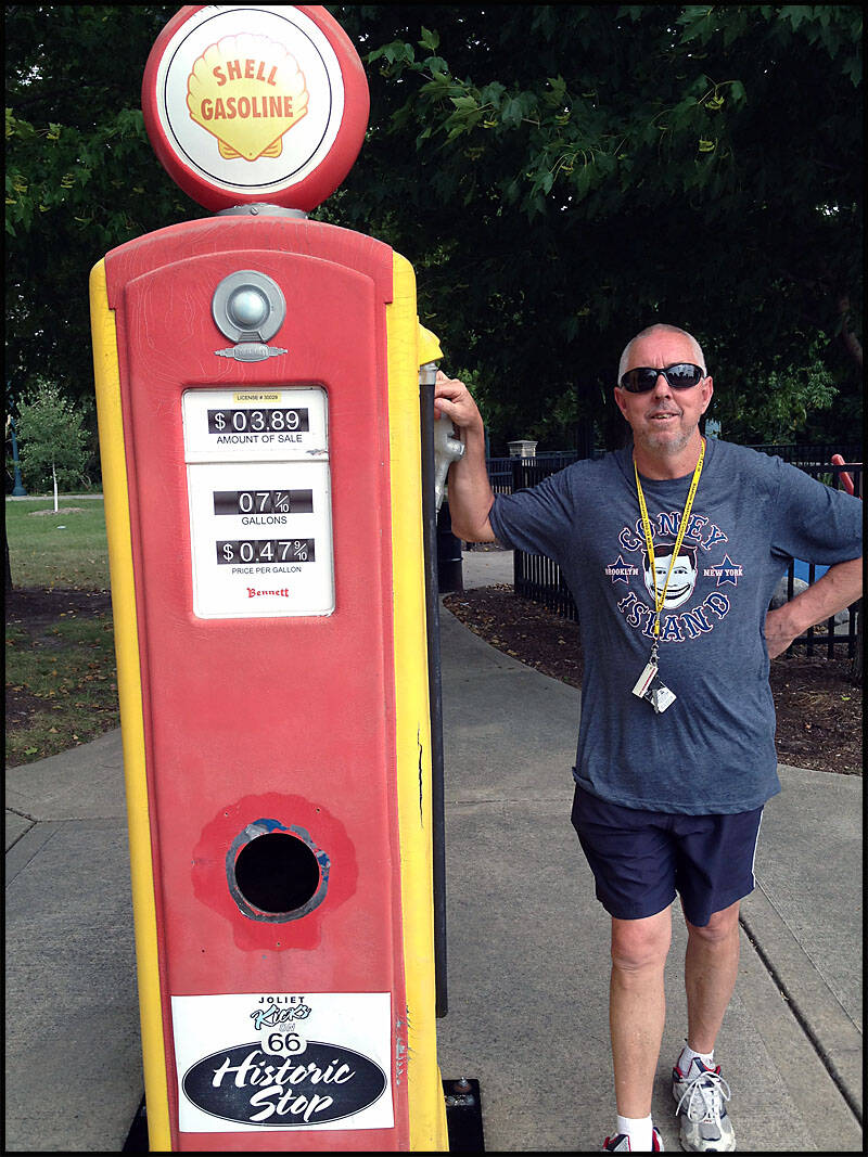
Right across the road was Dick’s Towing, next to the old petrol pump.


“The couple we met kindly took this photo of us at the old petrol pump.”
We drove on, stopping at Dwight for lunch, then passing through Pontiac and Bloomington. We paused again at a rest spot to set up the RV before finally stopping for the night around 10 p.m. in Edwardsville at the Red Baron Rendezvous RV Park.
http://www.redbarnrendezvousrv.com
Edwardville Illinois


"Waking up at the Red Baron Rendezvous RV Park… not exactly a postcard view."
"Red Baron Rendezvous RV Park — not quite the sunrise we were hoping for."


"Leigh double-checked that we’d unplugged the RV from power and water, and then we hit the road, leaving the Red Baron Rendezvous RV Park behind.

Missouri Illinois
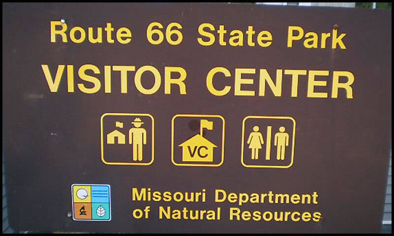
We drove into Missouri, covering 454 km of Route 66 through the state. Along the way, we passed through towns like St. Louis, Cuba, Fanning, Lebanon, Devil’s Elbow, Cimarron, and Joplin. Our first stop was the famous St. Louis Arch, where we also walked down to the Mississippi River waterfront. We dropped into the visitor center to pick up some information and maps.
More info: Route 66 State Park
We reached Cuba and stopped at Shelley’s Café for lunch. After that, we drove down to Fanning to see the world’s largest rocking chair at the Fanning 66 Outpost.
We continued our drive through Devil’s Elbow, one of the more historic stretches of the Mother Road. In the afternoon, we stopped in Lebanon, wandered around town, did a bit of shopping, and browsed a local car yard—cars are incredibly cheap here in the USA. As evening approached, we searched for somewhere to stay and ended up at the NRO (Niangua River Oasis) RV Park. We parked the RV, lit a fire, and relaxed with a few beers under the stars.
More info: NRO Canoe Rental & Campground
We hit the road again and stopped in Cimarron to explore the massive Picker’s antique mall. From there, we continued on to Joplin, where we had lunch at Cooper’s 66 Café. We also took some time to visit the Will Rogers Memorial.
St Louis Missouri


Rusty, one of the friendly folks at the RV park, gave us detailed directions to the St. Louis Riverfront, by the mighty Mississippi River and the iconic Gateway Arch. Following his guidance, we made our way through the bustling streets toward the Missouri border, excitement building as we got closer.
As we approached the riverfront, the view of the Arch came into full focus—towering majestically against the skyline and shimmering in the sunlight. The area around the river was alive with activity, from boats cruising the water to people enjoying the parks and walkways. Standing there, taking in the impressive monument and the vast Mississippi River flowing beside it, we felt the weight of history and the spirit of adventure that Route 66 embodies. It was a memorable moment, capturing the blend of natural beauty, urban energy, and iconic American landmarks.


Leigh went down for a little paddle in the Mississippi River (though I think he might’ve needed more than just a paddle!).
We also walked down to check out the Spirit of Peoria riverboat cruises along the Mississippi.


Looking north up the Mississippi River, you can see the Eads Bridge in the foreground, with the Martin Luther King Bridge just behind it.
To the south is the MacArthur Rail Bridge. A long barge was making its way along the river—just one of many that travel up and down the Mississippi all day, every day.


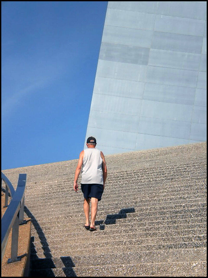
We began our walk up to the Jefferson National Expansion Memorial Park to get some photos of the Gateway Arch. Standing at 192 metres, the Arch is the tallest man-made monument in the United States and the second tallest freestanding monument in the world, just behind the Eiffel Tower.
More facts: Gateway Arch History
On our way to the Arch, we had to climb what felt like a thousand stairs to reach it.
Whoever took the photo up there definitely managed to catch my better side!


We began our walk back to the RV, passing through Jefferson National Expansion Memorial Park.

“We are looking back at the Arch, with the Eads and Martin Luther Bridges visible in the background.”

Just outside of St. Louis, we stopped at the State Park Missouri Route 66 Visitors Center. We took a good look around, bought some maps, and gathered plenty of useful information about Route 66.
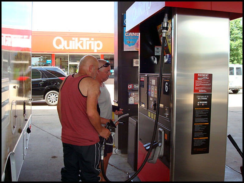
We also had to stop for fuel—if I remember correctly, it cost around $200 to fill up. It took the two of us a while to figure out how to operate the petrol pump.

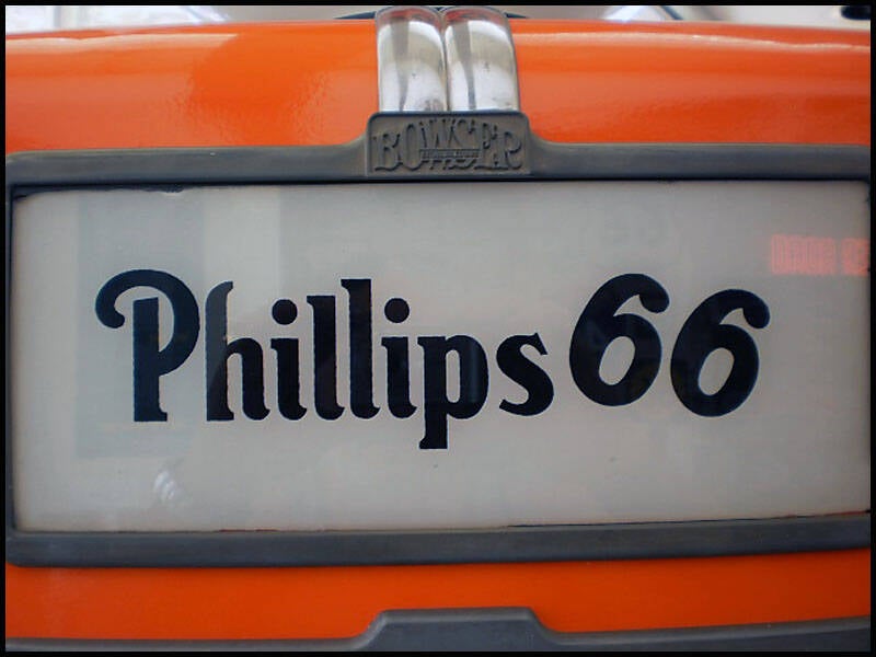
Phillips 66 gasoline began in 1917, and its iconic shield logo was created to reflect its connection to the famous Route 66 highway.
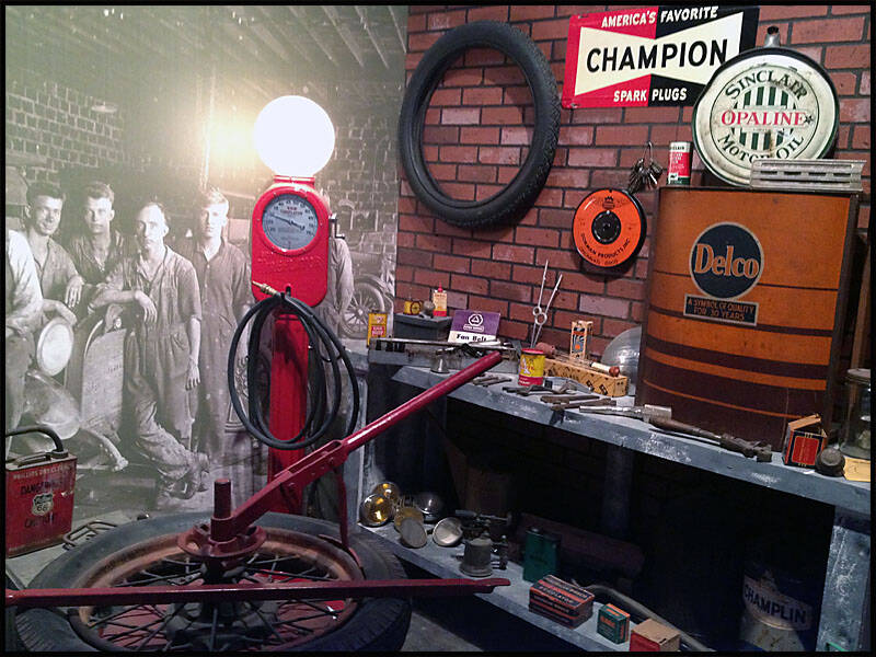
Inside the visitors center, there was a small museum showcasing some of Route 66’s history.
We spotted a cool Harley-Davidson Route 66 bike and a couple of vintage signs.


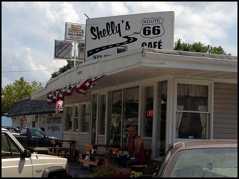
Cuba Missouri


Using one of the maps we had picked up along the way, we discovered a great spot to stop for a meal in the small town of Cuba—Shelly’s Cafe. From the moment we stepped inside, the atmosphere was warm and welcoming, with Shelly herself greeting us like old friends. The food was excellent—comforting and hearty, exactly what we needed after a morning of driving.
The cafe had a cozy, down-to-earth charm, filled with locals and travelers alike, all sharing stories and enjoying good company. During our visit, we decided to pass along some of the pots and pans from our RV that we no longer needed. Shelly was incredibly grateful, saying they would be a big help for her kitchen. It felt good to give back a little and connect with someone along the route. Shelly’s Cafe was more than just a meal stop—it was a memorable part of our journey through Route 66.

Shelly’s Cafe — look who made it into the photo again!
This is the entrance to the very friendly Shelly’s Cafe. Inside, there’s a wall map showing exactly where we are on Route 66, just like many other cafes and diners along the way.
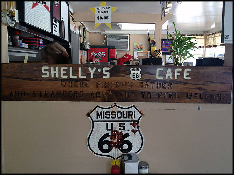
Most cafes along Route 66 have a map on the wall, and at Shelly’s Cafe, there’s one showing exactly where we are on the route.


What a decision—what should we eat? Whatever we ended up choosing, I’m sure Leigh had dessert.

We’re back on the road, sharing the driving. Next stop: Fanning, home of the world’s biggest rocking chair.
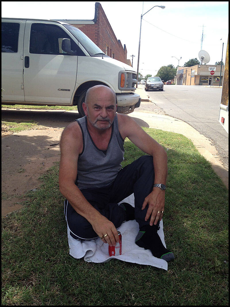
Graz is keeping an eye on us from the back of the RV—though I think one of his eyes was on the beer.


Fanning Missouri


Fanning, also known as The Outpost, was just a short drive down the road from Cuba, so we decided to stop and take a closer look. The small town caught our interest partly because we remembered seeing it featured on Billy Connolly’s Route 66 tour show on TV. It was cool to stand in the same spot he had visited and imagine the stories behind the place.
As usual, our sense of direction wasn’t perfect—we got lost again navigating the back roads around the area. It was a little frustrating, but also part of the adventure, and we knew it definitely wouldn’t be the last time we’d lose our way on this trip. Getting a little turned around just gave us more time to explore and discover hidden gems along the way.


We went inside the Outpost, a small museum filled with old Route 66 memorabilia, including a few vintage petrol pumps.


I really should have bought that flag—what a great picture it would have made!


We snapped a few photos at the world’s largest rocking chair.


I had to take a picture of this—some clever redneck hillbilly definitely thought a little too hard on this one. (I love it.) He was probably sitting on his verandah, drinking moonshine, thinking, “How can I cut the grass and get some exercise at the same time?”
Around the side was Danny’s Gas Hole.


Lebanon Missouri


After leaving the previous town, we drove on to Lebanon and made a stop downtown for a refreshing iced coffee and to ask for some directions. While wandering around, we noticed a 2013 Mustang sitting in a car sales yard, priced at $33,000—definitely a hefty price. Nearby, a 2000 Harley caught our eye, going for just $3,700, which seemed like a real bargain compared to the car.
With our curiosity satisfied, we stocked up on more food and drinks for the road ahead before looking for a place to spend the night. Our first stop was at an RV park that felt off—the grounds were quiet, no one came out to greet us, and it seemed almost abandoned. Not wanting to settle for that, we decided to push on a bit further.
Eventually, we arrived at the Niangua River Oasis (NRO) RV Park, nestled alongside the peaceful Niangua River. We parked the RV in a nice spot, gathered some firewood, and got a fire going to warm up the cool evening. We cooked up some bacon, egg, and cheese sandwiches, enjoying the simple comfort of a homemade meal after a long day on the road. To top it off, we relaxed by the fire, washing the food down with a few cold beers, soaking in the calm, quiet atmosphere of the NRO campsite. It was the perfect end to the day.


The Harley—I think I could have gotten it down to $3,000, ride away. (But who snuck into the photo again?)

We got the fire going—it was about 30 degrees, but we just had to light a fire. That’s what camping’s all about.


Enjoying a few beers by the fire.


It was a damn good night. Leigh turned in for the night—time to get some sleep and get ready for the next day.

I got up early and started cooking up a storm—bacon and eggs with a fresh coffee.


Devils Elbow Missouri

Devil’s Elbow, Missouri, gets its name from a particularly sharp and treacherous bend in the Big Piney River that has challenged travelers along Route 66 for decades. Back in the late ’80s, this area was more than just a tricky curve—it was a charming resort community where visitors could stay in cozy cabins and enjoy canoeing on the scenic Piney River. The peaceful surroundings and outdoor activities made it a popular getaway spot, especially during the warmer months.
Driving through Devil’s Elbow requires extra caution because of the winding roads and limited visibility around the bend. It was Graham’s turn behind the wheel as we navigated this stretch of Route 66, which is known for its mix of beauty and danger. The experience was a reminder of how the old Mother Road challenges travelers with both its history and its landscape. Despite the risks, the drive offered stunning views of the river and the surrounding forest, making it a memorable part of our journey.

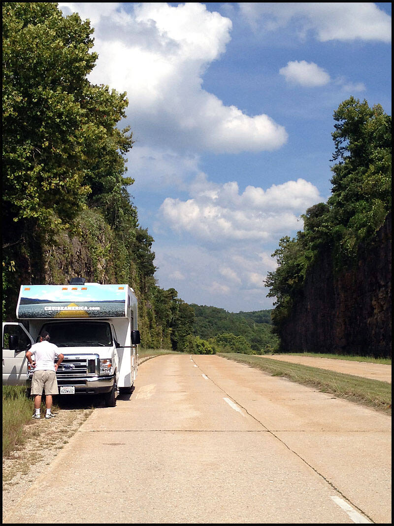
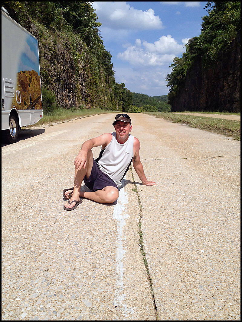
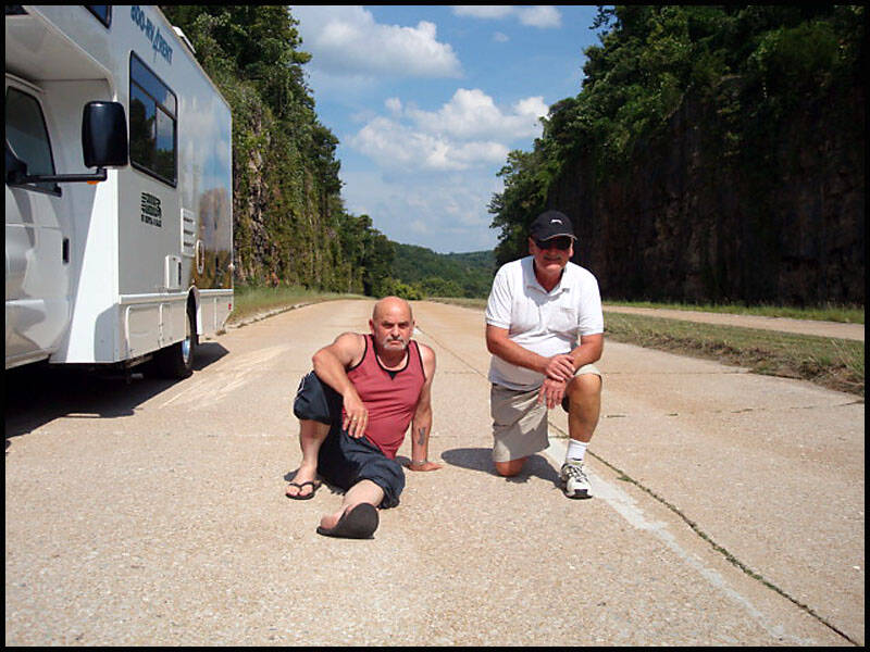
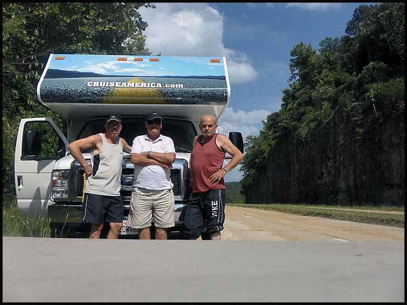
Part of the Old Mother Road.
We stopped for a little look around and took some pictures of us on the Old Mother Road.
Cimmaron Missouri
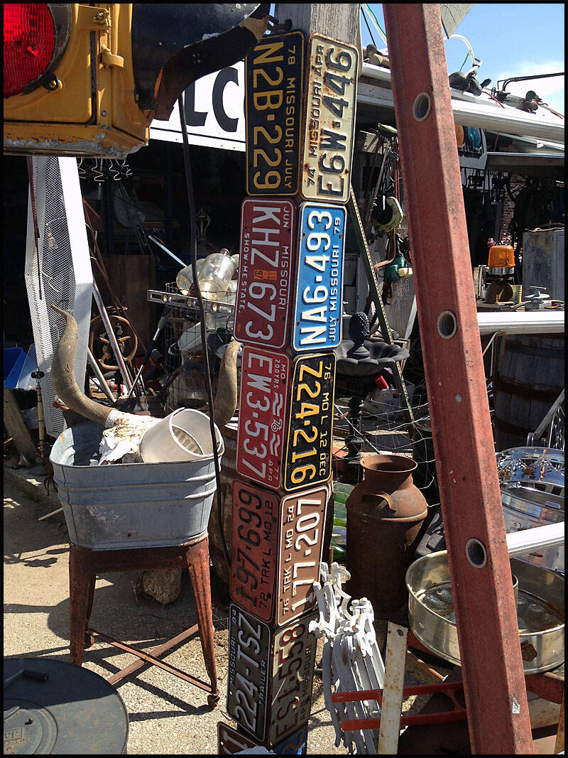
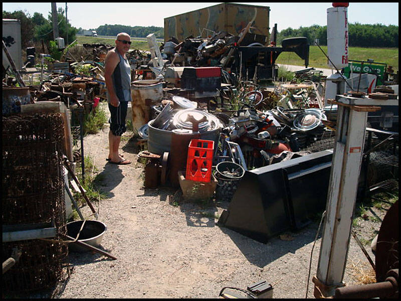
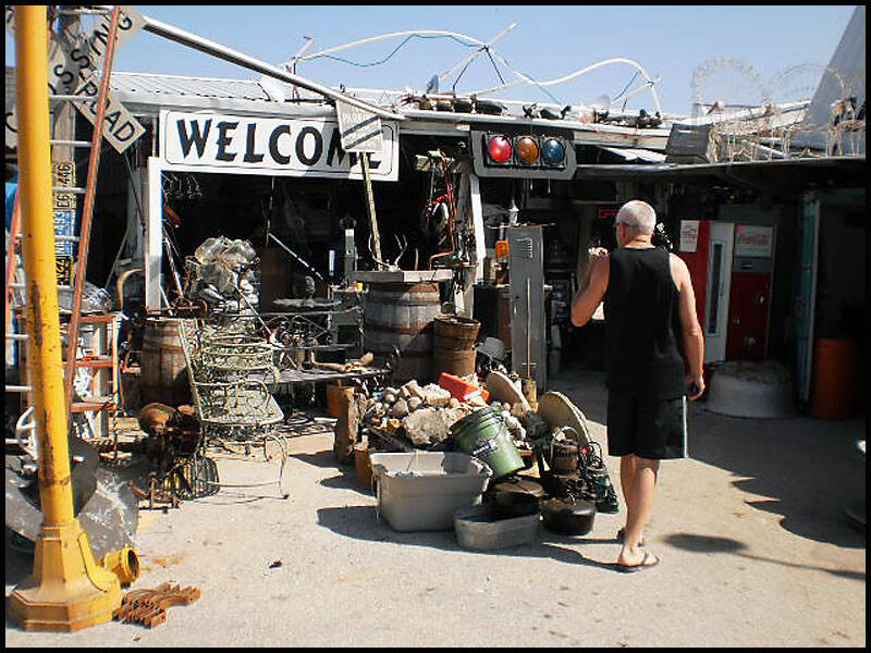
We stopped at an antique mall in Cimarron, hoping to find some unique treasures. However, once inside, it quickly felt more like a junkyard than a carefully curated collection. The aisles were cluttered with all sorts of items piled high—old tools, worn-out furniture, rusty signs, and a mishmash of forgotten memorabilia. Despite the chaos, there was something fascinating about the place, as if every item had its own story waiting to be discovered. While it wasn’t the most polished or organized spot, for those who enjoy hunting through hidden corners and unexpected finds, Cimarron’s antique mall offered a glimpse into the past, even if it was a little rough around the edges.

An American Picker would have a field day here—this guy had everything.
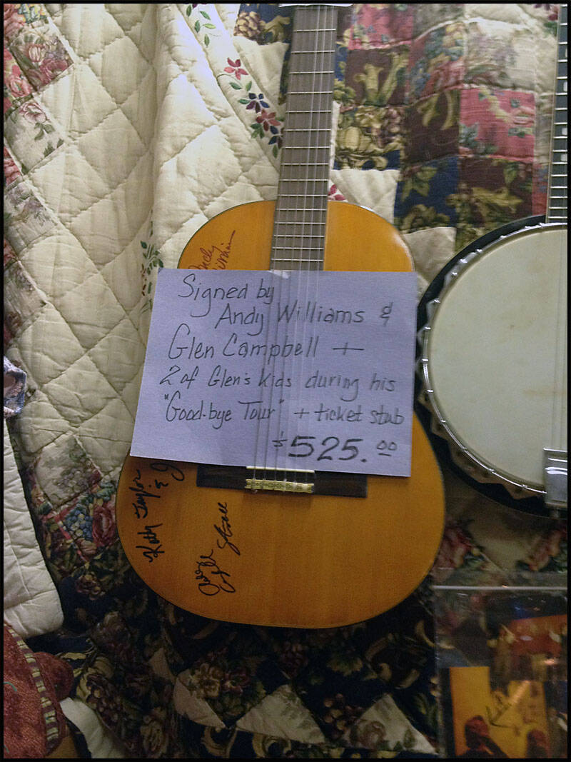
You can find anything you want, even a signed guitar by Glen Campbell and Andy Williams. If I read it correctly, buying the guitar also comes with two of Glen Campbell’s kids and a couple of ticket stubs from his Goodbye Tour. (How old are his kids now?)
Leigh made a good friend here. This guy didn’t say much, but if Leigh grew a beard, they’d be twins.

We left Cimarron empty-handed and headed toward Springfield, but there wasn’t much to see, so we continued on to Joplin, Missouri. There, we found a nice little café on the busy Main Street—Cooper’s 66 Café, located at the corner of Main Street and 2nd Ave.
After a great meal, we walked to the Will Rogers Highway Museum, named after the famous Hollywood actor Will Rogers. It was interesting to learn that Route 66 was also known as the Will Rogers Highway.
Joplin Missouri


Joplin was our last stop in Missouri before we crossed into Kansas. It’s a small, sleepy town that felt almost deserted during lunchtime, with only about four cars scattered along Main Street. We parked the van and took a stroll down the quiet street, searching for a place to eat. After a bit of wandering, we finally found Cooper’s 66 Diner, a classic spot that looked inviting with its retro Route 66 vibe. The food was hearty and satisfying, just what we needed after a morning on the road.
After lunch, we continued our exploration by walking up to the Will Rogers Highway Museum. The museum offered an interesting glimpse into the history of Route 66 and the man it was named after—Will Rogers, the famous actor and humorist. Although the museum was small, it was packed with memorabilia, photos, and stories that helped bring the heritage of this iconic highway to life. Despite Joplin’s quiet streets, the town carries a strong connection to the spirit of Route 66.
Main Street, Joplin—such a busy place in its own quiet way!


We spotted some great art of Joplin and Route 66 as we walked around town.
Like in every town we pass through, there are murals celebrating the local history.


At Cooper’s 66 Diner on Main and 2nd Avenue in Joplin, the interior is, of course, themed around Route 66.


We stopped at the Will Rogers Highway Museum, but there wasn’t much to see.
We took a few shots inside—some old cars and vintage business names like Kendall Motor Oils, Atlas Tires, and Texaco fuel. It wasn’t the best museum, with not much inside.


Kansas


Kansas may have the shortest stretch of Route 66 of any state—just 12.8 miles—but this small section packs a lot of history and charm. The old Mother Road winds through the town of Galena, where you can see remnants of its heyday. From there, it crosses the iconic Rainbow Arch Bridge at Riverton, a beautiful example of early 20th-century engineering and a beloved local landmark. Continuing on, Route 66 passes into Baxter Springs before cutting through the lower eastern corner of the state.
Along this stretch, you’ll find some lovely old buildings that tell stories of a bygone era—classic diners, motels, and shops, many with vintage signage still clinging to the facades. However, there’s also a bittersweet feeling, as many of these structures appear abandoned or neglected, reminders of how the route’s significance has faded over time. Despite this, the character of Kansas’s Route 66 section remains undeniable, offering travelers a glimpse into the past and a peaceful, less crowded experience compared to other parts of the highway.

Along the side of the highway, we spotted a massive fireworks shop—its colorful displays and towering stacks of fireworks kits catching our attention from a distance.


Galena, Riverton and Baxter Springs, Kansas
The charming old buildings in Galena played a big part in inspiring the community of Radiator Springs in the Pixar movie Cars. With their vintage storefronts, weathered signs, and classic small-town architecture, these structures capture the spirit of a bygone era along Route 66. Walking through Galena feels like stepping back in time, with the buildings telling stories of bustling days when travelers and locals gathered in these shops and cafes. The town’s unique character and nostalgic atmosphere perfectly embody the heart of Radiator Springs, making it a fitting real-life muse for the beloved animated community in the film.


The Route 66 logo is painted right onto Main Street in Galena. Much like Radiator Springs, the road shows its age—it could use some work, but that only adds to its charm.


We drove through town and over the Rainbow Arch Bridge, following the worn but storied path of Route 66


On the side of the road, a beautiful old pickup truck catches your eye. Turning left with Route 66—now Main Street—you’ll pass a row of interesting old buildings. Some are lovingly preserved, while many stand abandoned, reminders of the town’s past.


Oklahoma
Oklahoma has 602.9 km of Route 66—the nation’s longest drivable stretch of the Mother Road. It winds through Tulsa, El Reno, Hydro, Clinton, and other authentic hometowns where we met friendly people and stumbled upon unique shops, diners, and even a small museum
By late afternoon, we needed a place to stay for the night, so we stopped in Tulsa at the Warrior RV Park
http://www.tulsawarriorrv.com/
The next morning, we continued to El Reno, where we visited the Cherokee Trading Post. From there, we passed through Hydro, a tiny and quiet town where most businesses were closed.
In Clinton, we stopped for lunch, but the town felt almost deserted—nothing seemed to be moving. Just outside of town, however, we found the Oklahoma Route 66 Museum, which made the stop worthwhile.
Tulsa Oklahoma


We continued driving on to Tulsa, Oklahoma. Between Kansas and Tulsa, there wasn’t much to see along Route 66. We arrived late in the afternoon and stopped at the Warrior RV Park, where we stayed overnight.


Once we got settled at the RV park, we relaxed with a few beers. Later, we walked across the highway to grab a pizza for dinner—our supplies in the RV were running a little low.


The next morning, we pulled into a truck stop to fill up—again—and to stock up on a few essentials. I also decided to try my luck with the Oklahoma lottery. I’ll let you know later if I win.


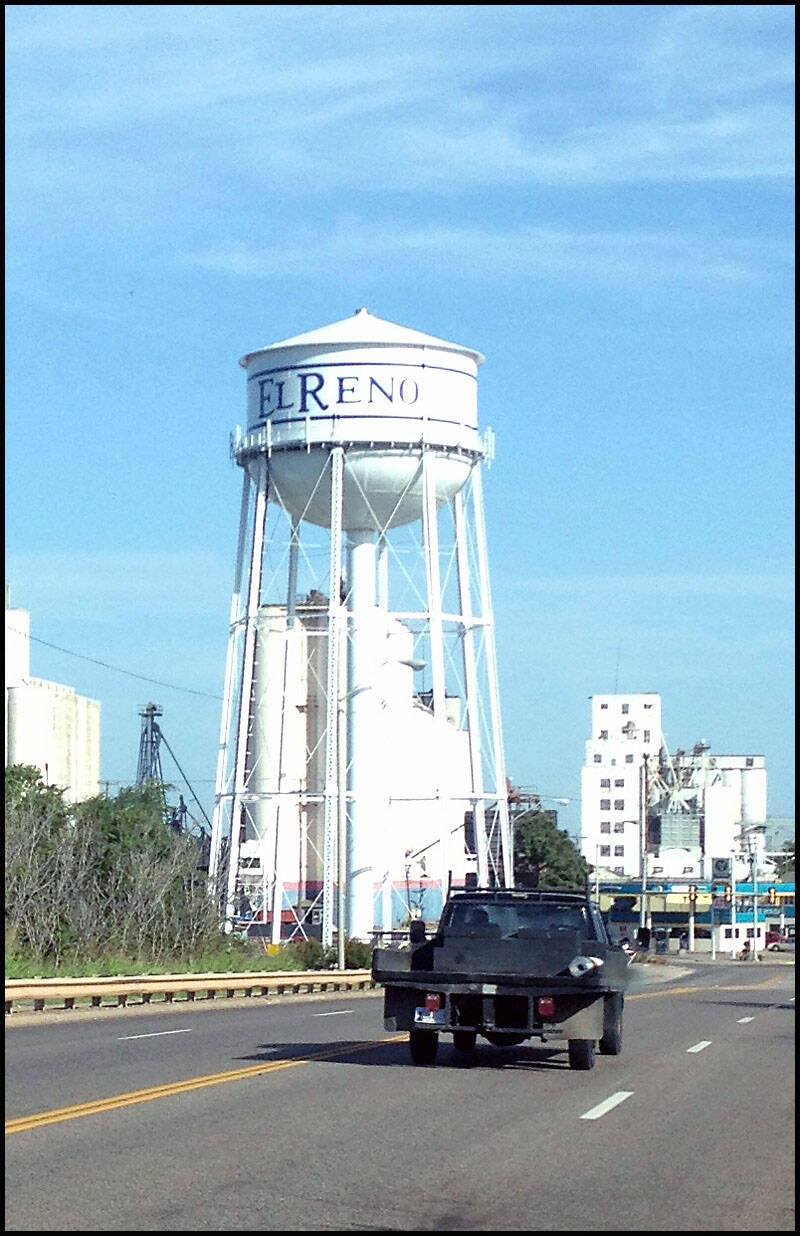
El Reno Oklahoma


Most of the towns along the route have a large water tank displaying the town’s name. To my surprise, El Reno features a mural on one of its buildings. Along the side of the road, a few old businesses had closed down, giving the area a quiet, almost forgotten feel.


Squawk and Skoot? I have no idea what this place was. It was closed, and there was no one around to ask, so it remains a mystery.

Just outside of El Reno, we stopped at the Cherokee Trading Post and the Cherokee Restaurant.

Just outside El Reno, we made a stop at the Cherokee Trading Post and the Cherokee Restaurant.
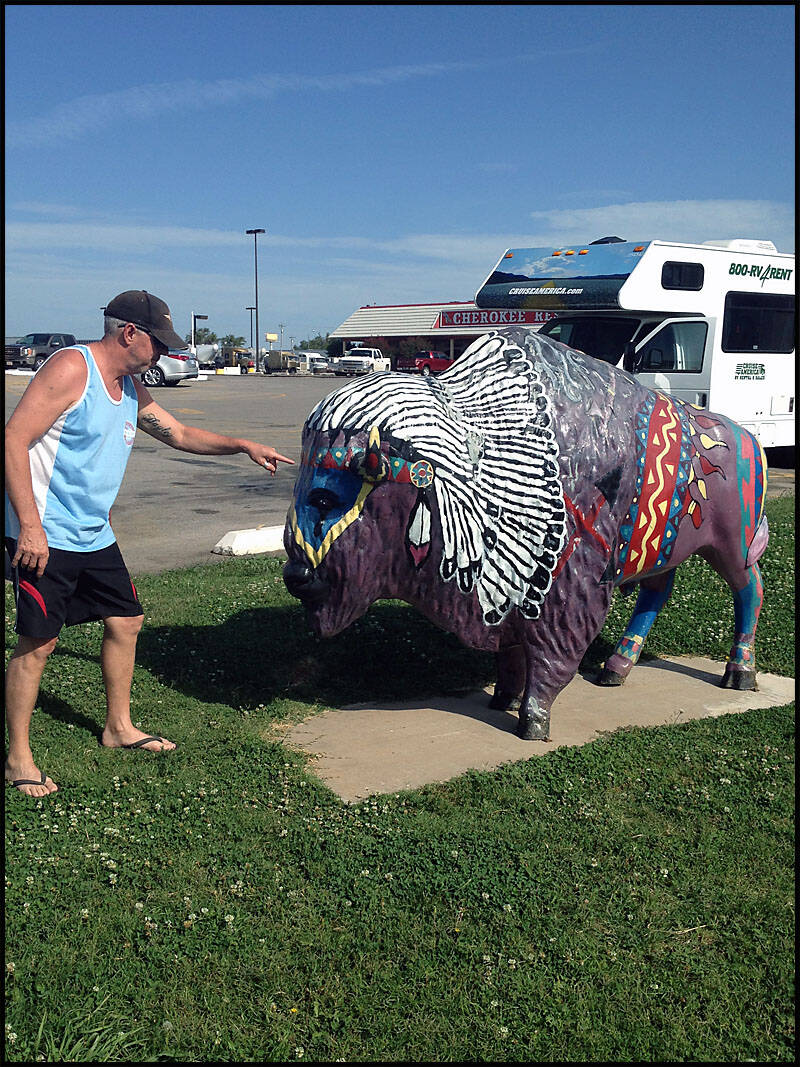
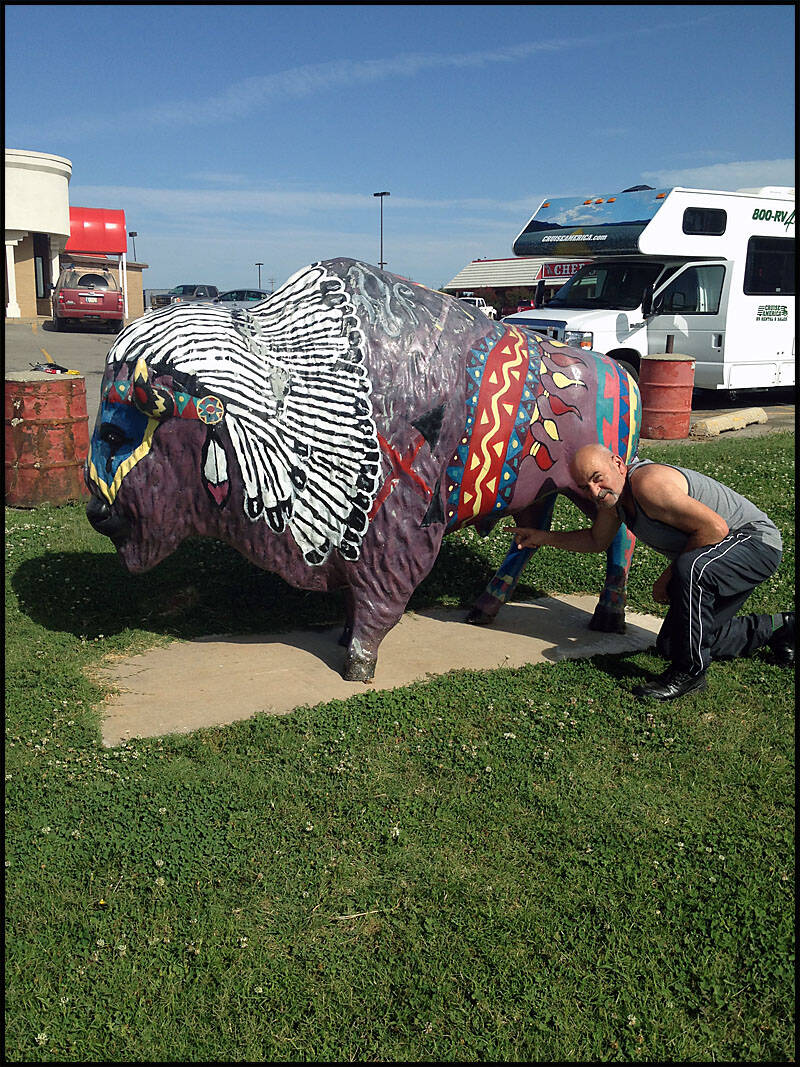
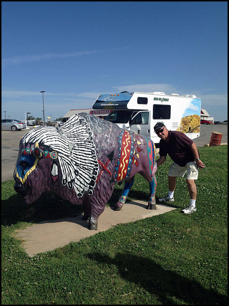
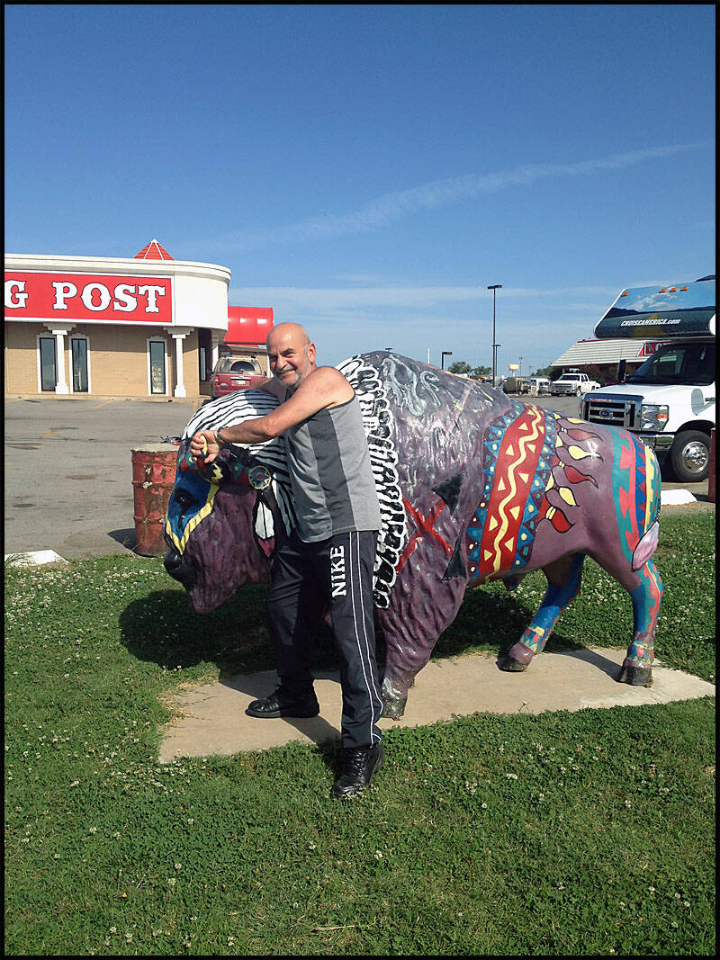
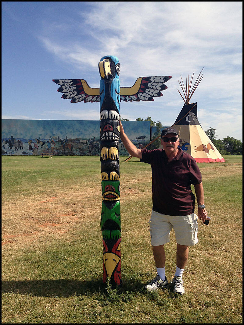
The stop featured a striking Indian mural and an original teepee, adding a unique touch to the Cherokee Trading Post.

Notice who’s in the picture? They’re hiding inside the teepee! Leigh again.

Graz posed with the Indian totem pole, and we had a little fun with the Chief.


Hydro Oklahoma


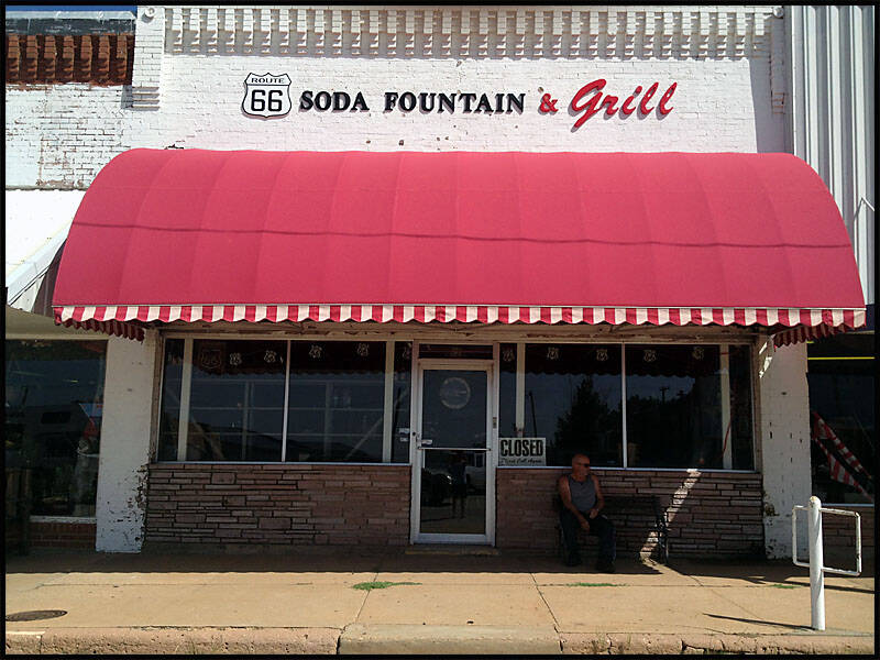
After leaving the Cherokee Trading Post, we continued on to Hydro. It was a sleepy little town, but I managed to capture three of my favorite photos there: Graz and Leigh waiting to get into the Hydro Bar, which wasn’t open early; Graz waiting for a haircut, only to find the barber’s hours were from 2 pm to 4 pm; and Leigh waiting at the Soda Fountain Grill, which was also closed.


Graz and Leigh were knocking on the door of the Hydro Bar, eager for a drink, but unfortunately, it wasn’t open. With no luck at the bar, Leigh tried the Soda Fountain Grill, only to face another long wait.

While Graz decided to get a haircut, he faced yet another long wait—this town was clearly asleep.

We walked to the Hydro Library to gather some information—guess what? It was closed. Out of all the businesses in town, I think only this shop and one other were open. The shop that was open sold a wide variety of knick-knacks.


We took a few pictures of Main Street in Hydro—how busy is it?! Cars were parked right down the middle of the road. Another old gas station was closed, and next to it, a service centre was also shuttered.

Clinton Oklahoma


We left Hydro and drove on to Clinton, our last stop in Oklahoma. We arrived around lunchtime, so we pulled over on a side street to make some lunch and take a little rest. After eating, we drove just outside Clinton, as there wasn’t much in town, and stopped at the Route 66 Museum. Leigh stayed outside while Graz and I went in to explore the museum.
Lunchtime on a quiet back street in Clinton, Oklahoma.

Leigh relaxed in the shade, taking a break before we headed to the Route 66 Museum.

After lunch, we drove to the Route 66 Museum in Clinton, Oklahoma. The museum’s galleries took us on a journey through the history of the nation’s iconic highway, the Mother Road. We explored images and videos showcasing life along Route 66, watched a 20-minute video about the highway’s history, touched the counter, and even sat in a 1950s diner booth. The museum really captures the full Route 66 experience.

A 1954 Dodge pickup was parked outside the museum, complete with its original license plate.


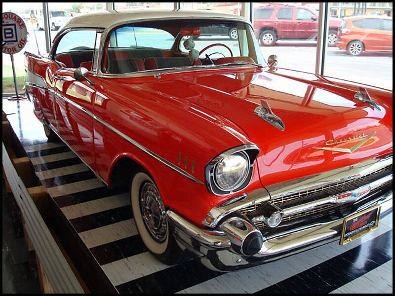
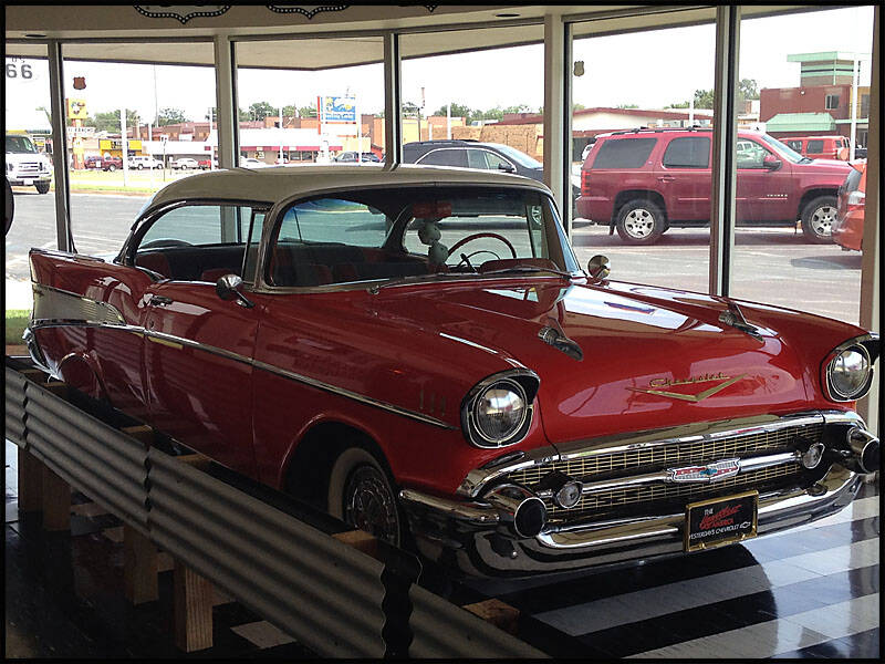
A classic 1957 Chevy was proudly displayed in the front window, its gleaming chrome and iconic tailfins catching the light. The car’s polished red paint and its interior, visible through the glass, were meticulously restored to reflect the style of the 1950s.
Along one wall of the museum, Route 66 highway signs from each state were displayed, showcasing the full stretch of the historic highway. From Illinois to California, each sign represented a different section of the Mother Road, giving visitors a sense of the journey across multiple states. The worn paint and vintage design of some signs contrasted with the newer ones, reflecting decades of travel and the highway’s enduring legacy. It was a striking way to visualize the scope and history of America’s most famous road.


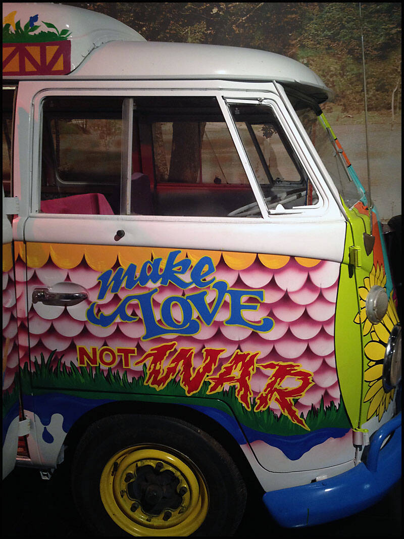
The Kombi Love Machine stood out as a colorful, eye-catching display.

The museum also featured a collection of old cars alongside a beautifully restored vintage jukebox.


One striking exhibit was an old black-and-white photograph showing men attending to an accident on Route 66. The image captured a moment frozen in time, reflecting the challenges and realities of travel along the Mother Road in earlier decades.

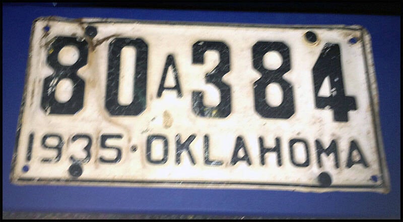
The museum also displayed a collection of old Oklahoma license plates, each one a small piece of automotive history. The plates varied in color, design

The museum featured an old Sinclair gasoline pump and air pump dating back to the early 1900s, offering a fascinating glimpse into the service stations of the past. Nearby, a vintage Mobil Oil sign was added to the display.
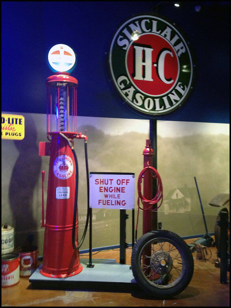

The museum also showcased the famous Phillips 66 petrol pump and sign, iconic symbols of the Mother Road.
One of the highlights of the museum was a beautiful 1950s diner booth paired with a classic jukebox.
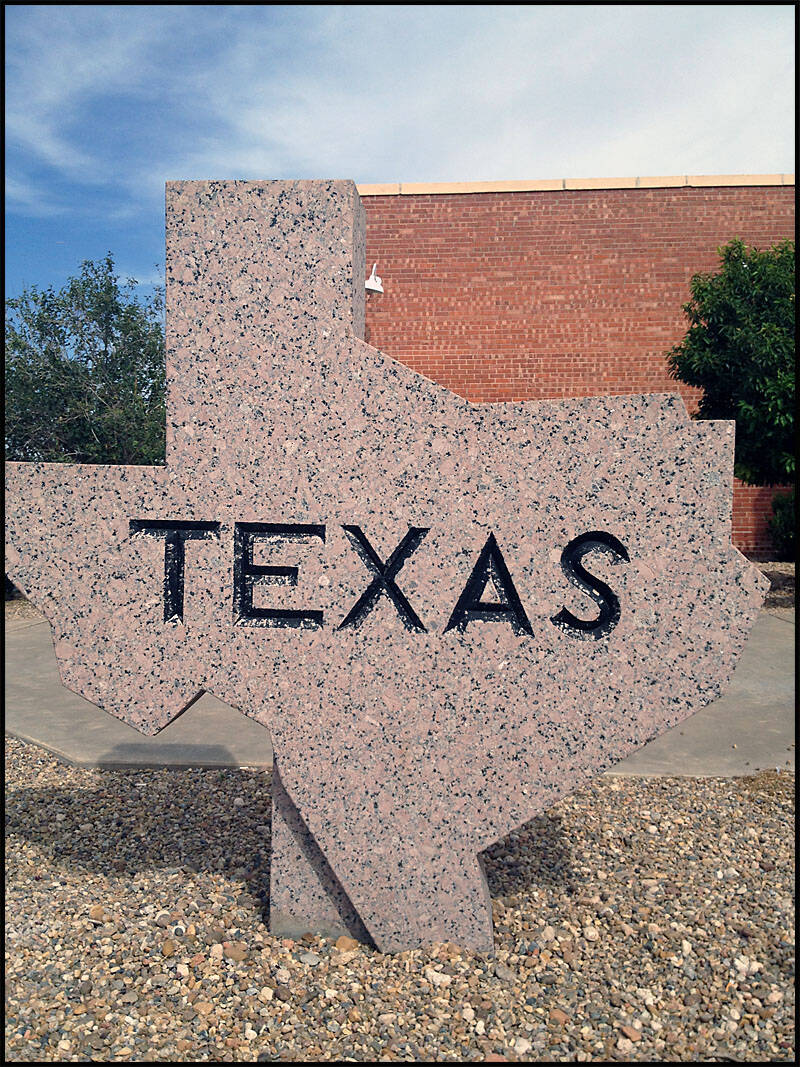
Texas
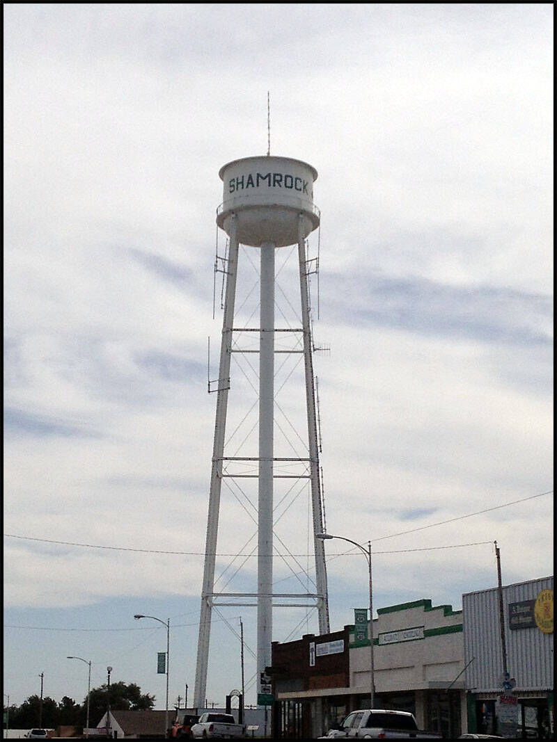
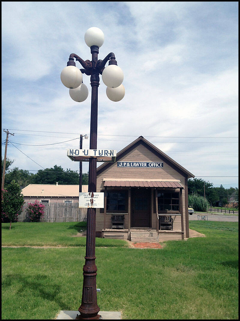
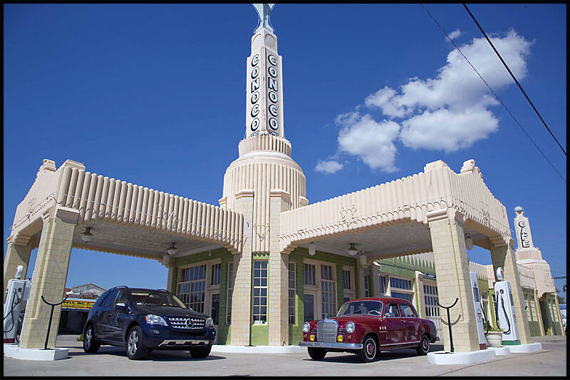
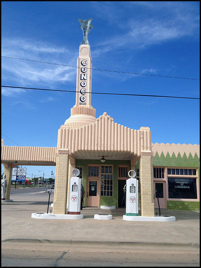
Shamrock Texas


Of course, the water tower on the way into town was impossible to miss. Standing tall against the skyline, it proudly displayed the town’s name and served as a classic landmark for travelers arriving along Route 66.

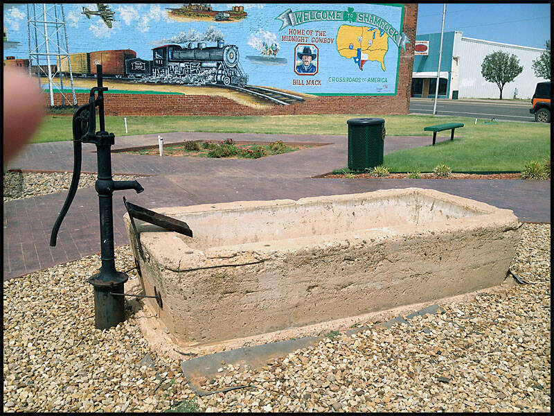
The town also featured a mural celebrating Route 66, vividly painted on the side of a building.

One of the sights along the route was Shamrock Butchers, accompanied by an old-style water trough out front

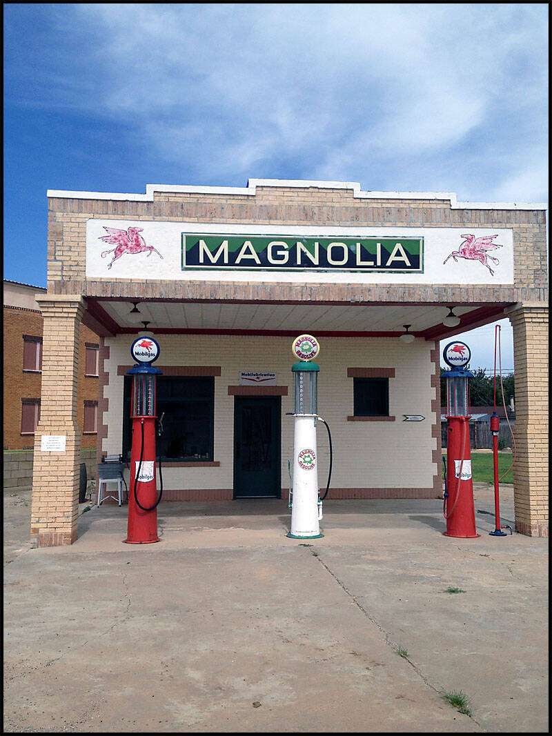
We also spotted the famous Magnolia petrol station, a historic brand that started in the early 1920s in the USA. Its vintage signage and classic architecture perfectly capture the golden age of roadside travel. Standing there, it’s easy to imagine the countless travelers who once stopped for fuel and refreshments, keeping the spirit of the open road alive along Route 66.

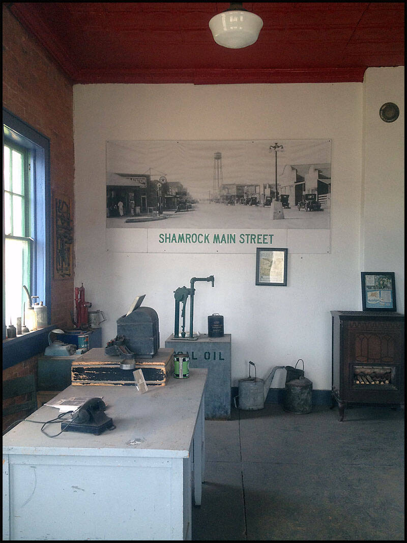
We noticed a lawyer’s office, which, apparently, was the first building in town to have electric lighting.
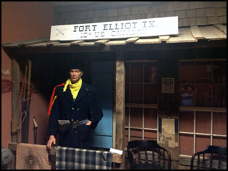
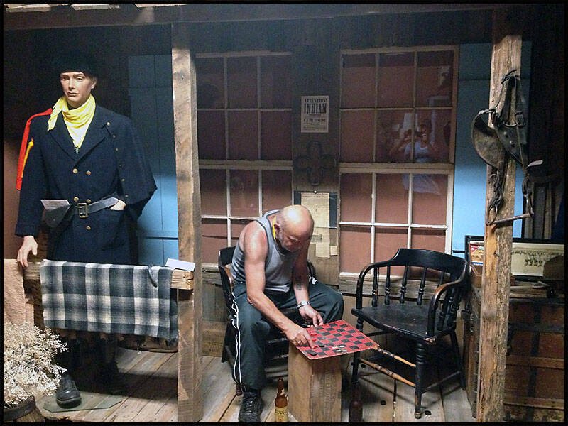
We came across an old Texan Fort museum, and to our amusement, we found Leigh playing chess by himself—definitely not a dummy! It was a fun, unexpected moment that added a bit of humor to our visit.
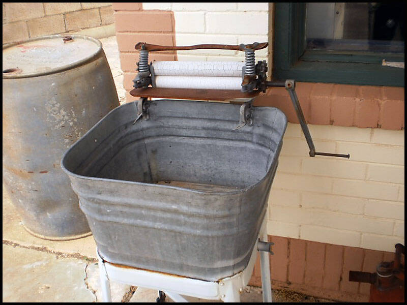
We spotted a double dunny and an old clothes wringer, both quirky reminders of how life used to be along Route 66. The double dunny, with its side-by-side seats, offered a glimpse into past bathroom designs, while the clothes wringer showcased the labor-intensive way people used to wash their laundry.

We came across the famous Tower Station and U-Drop Inn Café, the iconic inspiration for the movie Cars. The building’s unique architecture and vintage charm immediately stand out. If you look closely at the bottom right of the picture, you can spot Leigh—he’s practically playing a real-life game of Where’s Wally


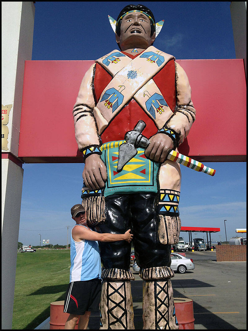
Amarillo Texas

We arrived late at the KOA RV Park in Amarillo and checked in, did some laundry, and tidied up a bit. Just a few sites away, a group of guys were gathered with their trikes. It turned out there was an annual trike convention at the park that weekend. Many of the trikes were homemade, showcasing incredible creativity—machines that would never be allowed on our roads back in Australia.


We met Hillbilly Bob on his trike, a true character of the convention. One trike was a Harley-Corvette hybrid with a 327 engine, while another was a garage-built marvel powered by a 389 Ford engine. The creativity and engineering on display were amazing—these weren’t just trikes; they were rolling works of art, each with its own personality and story.
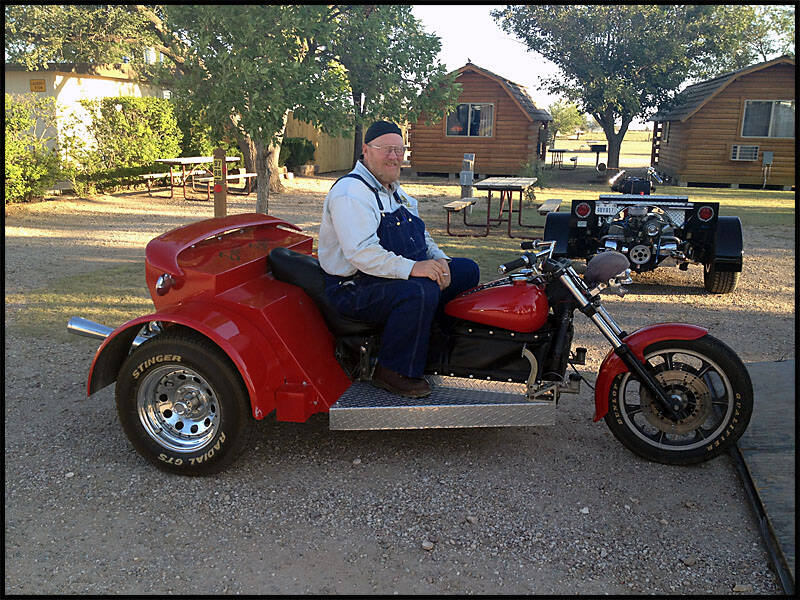

One of the guys had built a trike in his garage, powered by a 389 Ford engine, standing out among the many others at the convention. Each trike was unique, showcasing the incredible creativity and skill of their builders.

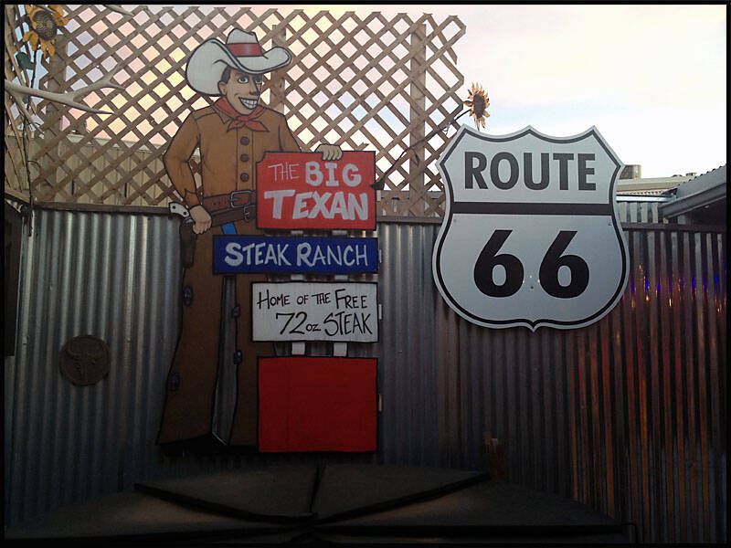
We decided to go to the Big Texan Steakhouse for dinner. Guests at the KOA RV Park can enjoy a free ride in a stretched Cadillac Limo to and from the restaurant; tipping the driver is customary. Our tip ended up being around $20, but it was well worth it.
The Cadillac stretched limo ride was incredibly smooth—like gliding over the road. You couldn’t feel a single bump, making the journey to the steakhouse as enjoyable as the destination itself.

It was “3 Amigos” picture time in front of the Big Texan Steakhouse, with the Cadillac limo parked proudly nearby. Of course, the spotlight was also on the restaurant’s famous 72‑oz steak, a true Texas icon that draws visitors from all over, just to see and maybe even attempt to conquer it.

Graz couldn’t find his glasses, so he borrowed mine. Don’t they look cute and happy? Earlier, they had enjoyed a snooze in the park at Niagara Falls, and now they were cozying up, sharing a seat.

Of course, the famous 72‑oz steak at the Big Texan Steakhouse stole the show. This colossal meal is legendary.
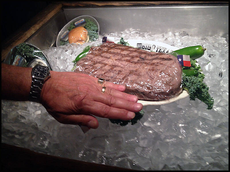

The famous 72‑oz steak challenge comes with a full meal: shrimp cocktail, baked potato, salad with a roll and butter, and, of course, the massive 72‑oz steak. To get it for free, you must follow these rules:
- The entire meal must be finished within one hour. Anything left uneaten means you lose.
- Before starting, you may cut into the steak and take one bite to check doneness and taste. If satisfied, the timer starts upon your approval. Once the contest begins, the clock doesn’t stop—so make sure you’re ready.
- You cannot leave your table or have anyone else touch your meal once the contest begins.
- Assistance in cutting, preparing, or eating is not allowed—this is your contest alone.
- You don’t have to eat the fat, but it will be judged.
- If you become ill, the contest ends immediately—you lose. (Containers are provided if needed.)
- Full payment is required upfront; if you win, the $72 will be refunded.
- You must sit at the assigned table.
- If you fail, you can take leftovers with you, but they cannot be consumed or shared in the restaurant.
-
Failure to complete the challenge requires payment of the full $72.
Graz was over the moon—he’d found the large beers! We asked our host, Laura Jean, to snap a photo of the moment, capturing everyone’s happy, celebratory smiles.


We all had our picture taken with Laura Jean, who was incredibly sweet and had a charming Texan accent. Her friendly personality made the moment even more memorable, adding a warm, local touch to our visit.


After finishing at the Big Texan Steakhouse, we waited for our Cadillac limo to take us back to the KOA RV Park.
It was the perfect end to a fun and indulgent evening.


The next morning, we drove into Amarillo to visit Cavender’s Boot City. Graz was on the hunt for the perfect pair of boots among over 6,000 options, but he couldn’t quite find the right pair. I, on the other hand, had better luck—picking up a few pairs of jeans and some shirts, so I came away pretty happy with my haul.

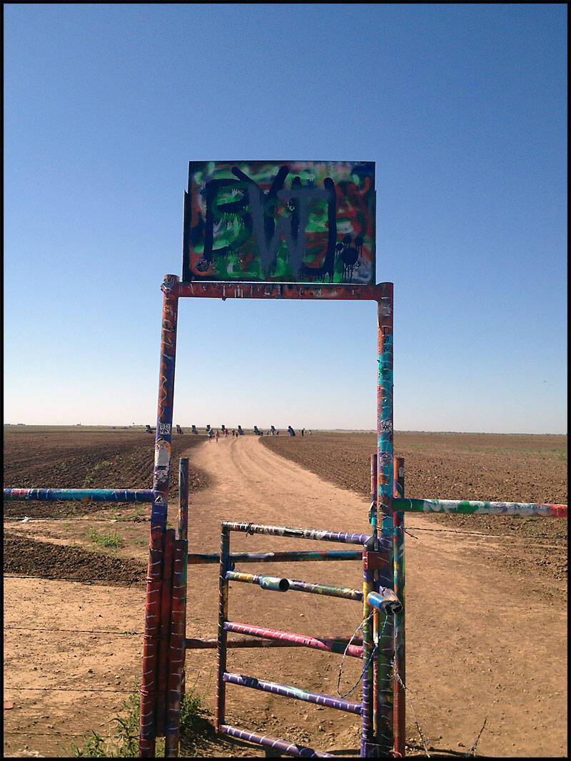
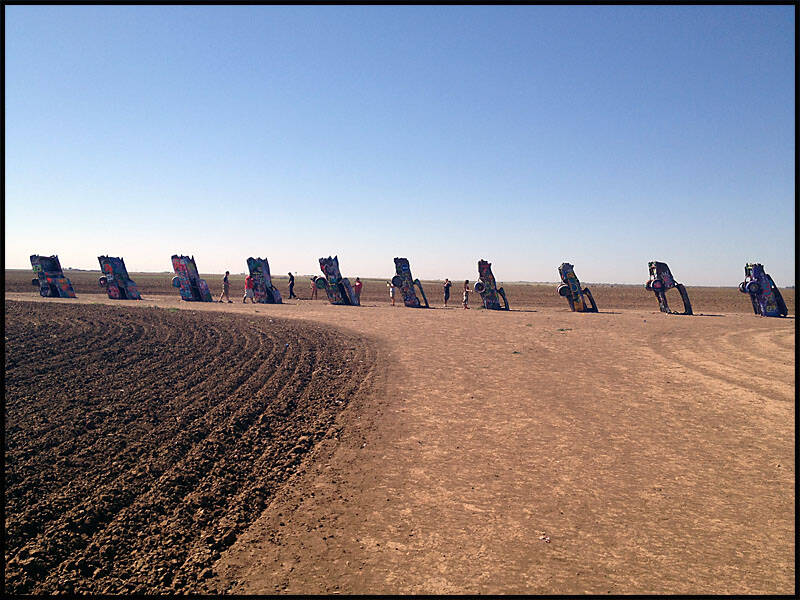
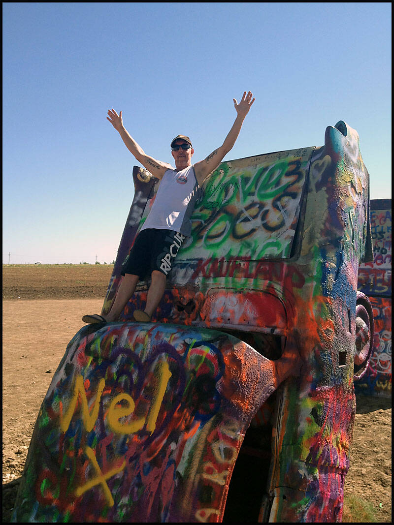
We left Amarillo and drove a short distance down the road to the Cadillac Ranch, which is visible from the highway. Walking through an unlocked gate onto private land, visitors are free to spray or draw graffiti on the half-buried Cadillacs. At one point, all ten cars were painted flat black to honor the passing of Ant Farm artist Doug Michels and to provide a fresh canvas for future visitors. It’s a constantly evolving, colorful tribute to art, creativity, and the spirit of Route 66.
Cadillac Ranch Texas

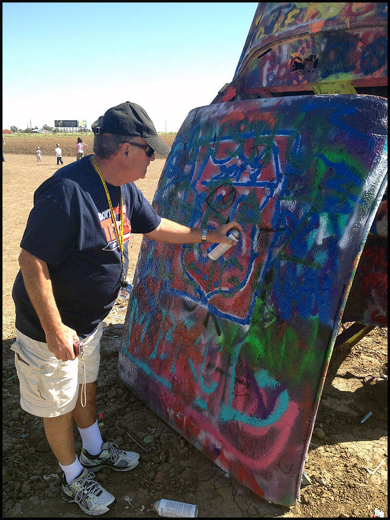
The entrance to Cadillac Ranch immediately sets the scene for this iconic roadside attraction, with its ten Cadillacs half-buried nose-first in the ground, lined up in a striking row. Visitors can purchase paint or spray cans to add their own artwork or messages to the cars, turning the installation into a constantly changing canvas. Graz is visible on the right, carefully deciding what to write and where to place it, studying the cars as if planning a masterpiece.


I climbed inside one of the Cadillacs to get a good photo—well, at least I think it turned out well! Meanwhile, Leigh was relaxing on top of another Cadillac, enjoying the quirky, colorful environment of the ranch.
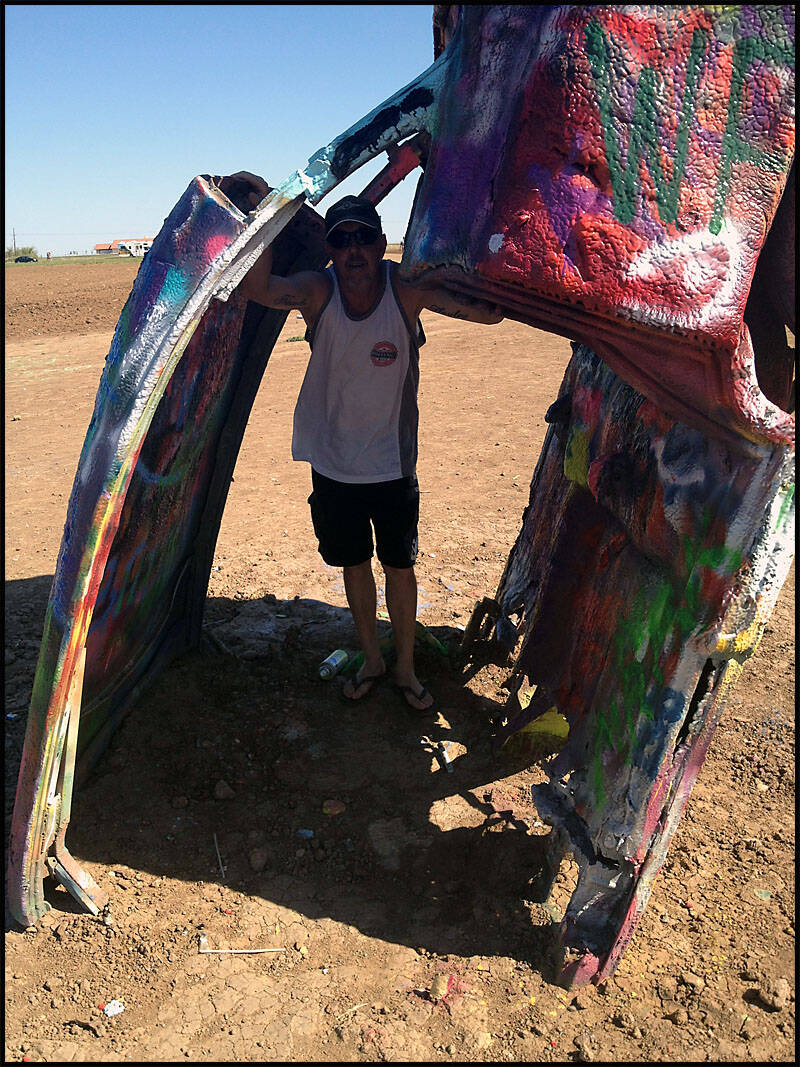

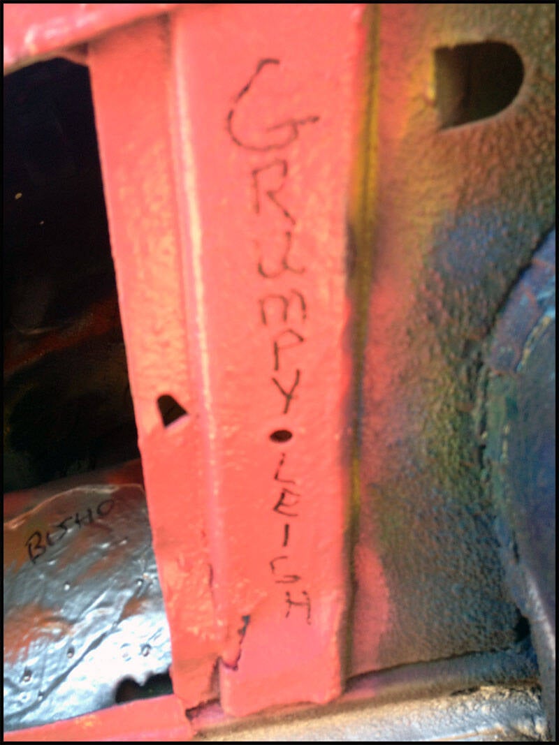
I’m pretty sure Leigh wrote this—there’s no way it was Graz or me; I wouldn’t write anything like that! Our names will probably last only a couple of days, maybe even just 20 minutes, since there are people at Cadillac Ranch all day, every day, constantly adding new layers of paint and messages to the cars.


Graz was still busy spraying graffiti everywhere, and we couldn’t get the spray can away from him. He seemed completely absorbed, probably having flashbacks to his teen years.


New Mexico
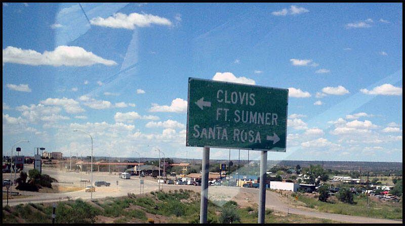
In New Mexico, we covered 610 km of Route 66, traveling through many Indian reservations in the western half of the state. Our journey took us through the towns of Tucumcari, Santa Rosa, Laguna, and Gallup.
In Tucumcari, we stopped at the famous Blue Swallow Motel, a classic Route 66 icon. Santa Rosa surprised us with a fantastic Hot Rod Museum, showcasing vintage cars and automotive history. Laguna was one of many stops through Indian reservations and Spanish settlements, offering a glimpse into the rich cultural heritage of the area.
We arrived in Gallup late in the afternoon and checked into the USA RV Park for the night
We enjoyed a refreshing swim, with Leigh claiming he won the 100-meter race. Afterward, we did our laundry, and Leigh and I decided to have a game of BIG chess. I came out victorious, though Leigh still disputes it! And as for the swimming race… well, I’ll just let him think he won.
Tucumcari New Mexico


We stopped in Tucumcari just around lunchtime and took a walk around town. One of our highlights was the famous Blue Swallow Motel, which has been welcoming guests since 1941 and still turns on its neon lights every night. The motel features 12 clean rooms equipped with TV and air conditioning, maintaining its classic Route 66 charm while offering modern comforts.


We caught a glimpse of one of the 12 rooms, with the owner busy cleaning and preparing it for guests. In another view, you can see the owner standing at the door, just finishing up the cleaning, keeping the motel running smoothly after all these years.


Just down the road, we strolled to a diner for lunch, passing by a few old gas stations and motels along the way. Many of the businesses had classic cars displayed out front, adding to the nostalgic Route 66 atmosphere. One of the old gas stations we passed was no longer in operation, standing as a quiet reminder of the road’s storied past.


At one of the old gas stations, there was a classic Hudson parked at the pump, looking like an early 1960s model. Its polished chrome and vintage design perfectly complemented the nostalgic feel of the station and the surrounding Route 66 scenery.


Across the road, we spotted an old Ford in front of the Motel Safari, which was still open for business. Nearby, we came across something unusual—a drive-up tattoo shop, though it wasn’t open at the time. A little further along, there was yet another abandoned café, with an old car slowly rotting away out front, a quiet reminder of the town’s past along Route 66.


We also visited the Tucumcari Welcome Center, where more colorful murals adorned the surrounding buildings. The artwork showcased local history, Route 66 nostalgia, and vibrant scenes of life in the town.


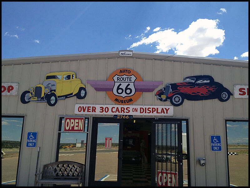
Santa Rosa New Mexico


Driving through Santa Rosa, you could see how the town is evolving. We stopped at the Route 66 Auto Museum, which houses some truly extraordinary cars. Many of the vehicles were so unique and special.


We passed by other old businesses that were closed, including a Chinese restaurant. It was time to fill up the tank again, and Leigh had finally figured out how to work the pump, making the stop quick and efficient.


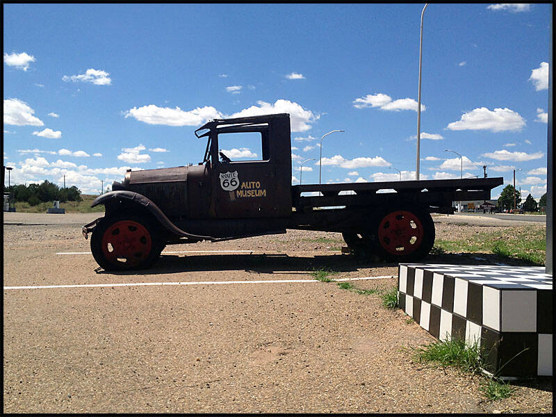
We visited the Route 66 Auto Museum, a standout stop on our journey. From far down the road, you could spot an old car seemingly driving, drawing attention to the museum. Outside, a few classic cars were parked in the lot, hinting at the treasures inside. Overall, this was one of the best car museums we had come across so far, offering a fantastic display of automotive history and creativity.


Among the cars on display was a big yellow taxi, its bright color and classic design standing out in the museum.

Inside the museum, you could see a wide variety of cars, from Corvettes, Buicks, and Chevys to many custom vehicles—far too many to name. One of the most popular colors on display was the classic Chevy blue. Since I couldn’t get the Harley in Lebanon, this museum offered the next best option for some automotive eye candy. Among the standout pieces was a custom Chevy dual-cab truck, showcasing impressive craftsmanship and creativity.


This old car clearly needed some attention, so Leigh pulled out his tool kit and gave it a quick tune-up. After a bit of tinkering, it was running a lot better, showing off Leigh’s handy skills and making the vintage vehicle come alive again.


The museum featured three different Corvettes, each showcasing the evolution of this iconic American sports car. From sleek classic designs to more modern models.
Among the standout cars at the museum were a 1933 Ford Coupe and a 1956 Chevy in bright orange. The Ford Coupe showcased classic 1930s style.


Leigh definitely looked the part perched on an old pickup truck out front of the museum. With the vintage vehicle as a backdrop, he fit perfectly into the classic Route 66 vibe.

Laguna New Mexico


As we traveled through New Mexico, we began noticing many Indian and Spanish settlements along the roadside. We made a stop just outside Laguna at one of these settlements, taking the time to appreciate the rich cultural heritage and unique architecture that reflected the area’s history.


Along the roadside, there were stalls where locals sold handmade jewelry and other crafts, showcasing the artistry of the community. One of the stalls even featured a mile marker, blending the heritage of Route 66.


There was absolutely nothing happening in Laguna as we drove through. It was quiet and still, giving the town a sleepy, almost frozen-in-time feel.


Along the route, we crossed one of many rail bridges. These bridges are often weathered and add a sense of industrial charm alongside Route 66.

Gallup New Mexico


Just arriving in Gallup, we were on the lookout for the USA RV Park. We got there late, so didn’t have much time to explore. After settling in and doing a bit of cleaning, we went for a late swim. Leigh and I even had a swim race—he claimed victory, and alright, I’ll admit it, he did win. But later, when we played chess in the dark, I came out on top. He said he couldn’t see well, but that’s no excuse—I still beat him.

The entrance to the USA RV Park was welcoming and well-maintained, making it a very nice place to stay. Outside the reception area stood a Statue of Liberty replica.


The RV Park also had some old western wagons, including an authentic horse-drawn wagon. Around the park, we noticed some massive RVs traveling through, a reminder of how Route 66 continues to attract adventurers and road-trippers of all kinds.


We had dinner and then turned in for an early night, knowing we had a long drive ahead to the Grand Canyon the next day.


As we left Gallup, we noticed more of the Indian roadside stalls lining the highway. The funny thing was, no matter how many we passed, they never seemed to be open.
Arizona

Route 66 in Arizona stretched for 645.3 km heading west, with the scenery becoming more desert-like as we passed through old mining towns. We stopped in Holbrook for a big breakfast at Mr. Maestas’ diner, where she served up a hearty meal surrounded by Route 66 memorabilia. After a short stroll around town, we continued on, but with rain most of the morning, we skipped Flagstaff and drove straight up to the Grand Canyon for the afternoon.
Leaving the Canyon, we passed through a string of small towns—Little Colorado Ridge, Cameron, Tuba, Tsegi, and Kayenta. These places had virtually nothing to see, not even much Route 66 character. From there, we headed straight up to Monument Valley in Utah.
Holbrook Arizona


Another water tower in Holbrook, standing along Navajo Boulevard—the town’s main street and central thoroughfare.


We stopped for breakfast at Mr. Maestas Diner, where, as you can see below, she had everything in the shop. I think I was eyeing the bacon Graz ordered. The placemats in the diner were a good read, and on the walls, there were license plates from all over the USA.


I can’t remember whether I was taking a picture of Route 66 or Leigh’s head. The ceiling and walls were filled with bikes, trikes, push cars, and all sorts of other memorabilia from the 1940s, ’50s, and ’60s.


In one corner of the diner, there were a few old stoves and heaters, along with an antique petrol pump.


The Winner’s Circle Pub was on the corner where we parked the RV—of course, it was too early for a drink, Graz. Nearby was a Route 66 shop, though there wasn’t much inside.

Along the side of the road, we passed yet another closed business. Its windows were dusty, and the faded sign hinted at a place that had once been lively, perhaps a diner or small shop catering to travelers along Route 66.

Flagstaff Arizona


We finally reached Flagstaff and then left Route 66, heading north toward the Grand Canyon on Interstate 180. The weather wasn’t great—rain accompanied us the entire way—but that didn’t dampen our excitement. Once at the Canyon, we spent a solid three to four hours exploring.
Each lookout point revealed a completely different angle, from dramatic cliffs to sweeping valleys.


We took Interstate 180 north toward the Grand Canyon, leaving Route 66 behind


Along the way, we spotted an old train museum, but with the rain, it wasn’t practical to stop, so we kept moving. Interstate 180 is a smaller road, just one lane in each direction, quite different from the wider main highways we were used to.


Grand Canyon Arizona
The Grand Canyon is a steep-sided canyon carved by the Colorado River in Arizona, United States. Stretching 277 miles (446 km) in length, it reaches up to 18 miles (29 km) wide and plunges to depths of over a mile (6,093 feet or 1,857 meters). The canyon features both a north and south rim, each offering unique perspectives and experiences. Much of the surrounding area is protected within Grand Canyon National Park and Kaibab National Forest. At the same time, adjacent lands include the Grand Canyon–Parashant National Monument, the Hualapai and Havasupai Indian Reservations, and the Navajo Nation. The broader region is also part of the Baaj Nwaavjo I'tah Kukveni – Ancestral Footprints of the Grand Canyon National Monument, preserving the cultural and natural heritage of this iconic landscape.


Once we arrived at the Grand Canyon, we headed to the visitor center to learn more about the incredible natural wonder. As we explored, we discovered that each viewpoint offered a completely different perspective. Walking along the rim, the canyon seemed to change with every step—different rock formations, colors, and depths revealed themselves, making it impossible to tire of the scenery.

Time for a photo with the three amigos! We tried a selfie, but my arms just weren’t long enough to get everyone in. Graz, meanwhile, was hanging on for dear life, right on the edge—definitely adding a bit of thrill to the shot!


When the sun finally came out, Graz realized he’d forgotten his hat, so he improvised with the next best thing—a plastic bag
Every angle of the canyon was breathtaking, and it seemed like no matter where you looked, the landscape kept revealing something new.


Anyway, I’ll just let you enjoy the magnificent pictures of the Grand Canyon. Each photo captures a glimpse of its vastness, the dramatic cliffs, and the ever-changing colors—truly a sight that’s impossible to forget..


As we left the Grand Canyon, we headed west on Highway 64, passing through the Little Colorado River Gorge. The drive offered striking views of rugged ridges and deep valleys, the landscape of northern Arizona.
Little Colorado Ridge Arizona

In the background, the Little Colorado Ridge stretched out before us. It’s like a mini Grand Canyon.


We then joined Interstate 160 heading west, just outside the Little Colorado Ridge. The ridges displayed striking layers and colors, each one telling a story of the landscape’s geological history. Along the way, we spotted one of the old, unused bridges leading into Tuba City, a quiet reminder of the roads that once carried travelers through this rugged terrain.


Tuba – Kanyeta Arizona

There wasn’t much happening in Tuba City or Kayenta as we passed through. The towns were quiet, with only the occasional vehicle or local resident going about their day, giving the area a calm, almost timeless feel.


The Kayenta water tower marked the town as we rolled in. We stopped at the Anasazi Inn for some directions, and it felt like the whole town was in the café bar—maybe all ten of them! The inn itself had only eight rooms. I imagine it might fill up around Christmas, though I’m not quite sure why.


We’re now leaving Kayenta and heading toward Monument Valley in Utah. The landscape begins to change as we drive, with red rock formations rising in the distance, hinting at the iconic scenery that awaits us.


Utah

We left Route 66 at Flagstaff to head north toward the Grand Canyon, and then continued northwest to Monument Valley in Utah. Monument Valley is part of the Colorado Plateau, is famous for its cluster of vast, isolated sandstone buttes with steep, often vertical sides and relatively flat tops—the largest rising 305 meters above the valley floor. Its dramatic landscape has been featured in countless western movies. Monument Valley sits on the Arizona-Utah state line, near the Four Corners area, where four states meet: Colorado, the northwestern corner of New Mexico, the northeastern corner of Arizona, and the southeastern corner of Utah..


Goulding Utah-Arizona
It was getting late, and we were starting to worry we wouldn’t find a place to stop, but then we came across a fantastic RV park in Goulding. We took a few pictures, wandered around, enjoyed a nice dinner, and called it an early night. This place is an absolute must-visit—it’s truly unbelievable.
http://www.gouldings.com/


From the RV park, the views of Monument Valley were spectacular.


A daytime shot from the same spot as the night photo, this time looking toward West Mitten, taken right from the RV park. The sunlight brings out the rich reds and textures of the iconic butte, making the view even more striking.


Monument Valley Navajo Tribal Park Arizona
Monument Valley, meaning “valley of the rocks,” is a striking region of the Colorado Plateau, defined by a cluster of towering sandstone buttes, the largest rising around 1,000 feet (300 meters) above the valley floor. The most famous formations are located in northeastern Arizona along the Utah–Arizona state line. The valley lies within the Navajo Nation and is considered sacred by the Navajo people.
Monument Valley has captivated audiences since the 1930s, featuring prominently in films, especially the Westerns of director John Ford. Today, the Navajo Nation’s Monument Valley Navajo Tribal Park offers visitors the chance to experience one of the most majestic—and most photographed—landscapes on Earth. The valley’s sandstone masterpieces, standing 400 to 1,000 feet tall, are the result of natural forces: wind and water have spent the last 50 million years eroding and sculpting the plateau, peeling away layers to create the dramatic formations we see today.


We got an early start and drove down to the Monument Valley Navajo Tribal Park to see the iconic buttes of Tse Bii’ Ndzisgaii, also known as the Valley of the Rocks.


On our way down, we stopped to refuel at a small hub at the base of the big plateau. There was a gas station, a café, and a hotel—all conveniently located together. We passed the Goulding Café Diner and the Goulding Lodge, a classic stop for travelers exploring Monument Valley.


A panoramic view of the Goulding Lodge and gas station, nestled at the base of the plateau—a convenient and iconic stop for travelers exploring Monument Valley.

Indian huts nestle at the base of the valley. Looking back toward Goulding RV Park from Monument Valley, the park sits just off-center between the two buttes known as the King on His Throne and the Stagecoach.


Panorama of Monument Valley from the Visitor Center, showcasing the iconic 'Mittens' and the scenic loop road that winds through the park.


On our way out, we found a new friend—clearly someone who’d enjoyed a bit of fun in the mud.


ome striking views of Monument Valley, featuring the East and West Mittens rising dramatically from the desert floor, alongside the imposing Merrick’s Butte. The play of light and shadow across these iconic formations highlights the rugged beauty and timeless grandeur of this landscape.


Looking back at Monument Valley as we depart, taking in the vast, iconic landscape one last time.


Coppermine Plateau Utah
Driving through Coppermine Plateau and past Glen Canyon Dam—vast, open landscapes with not much in sight, but the scenery still carries a quiet, rugged beauty.

In the late 1800s, this area was a booming mining region. The rocks of the plateau contain pockets of coal, oil, natural gas, and uranium, with the dominant minerals changing over time. Today, a few large coal-mining operations remain, including the Kayenta/Black Mesa complex, the largest strip mine in the world. As we drove through the plateau, however, there was no visible activity anywhere, giving the landscape a quiet, almost abandoned feel.


Alongside the road stood an abandoned building with a windmill, completely isolated with no houses in sight. These photos were taken on the Copper Mine Plateau, near Geronimo’s Indian Reservation outpost, located between the plateau and Glen Canyon Dam.


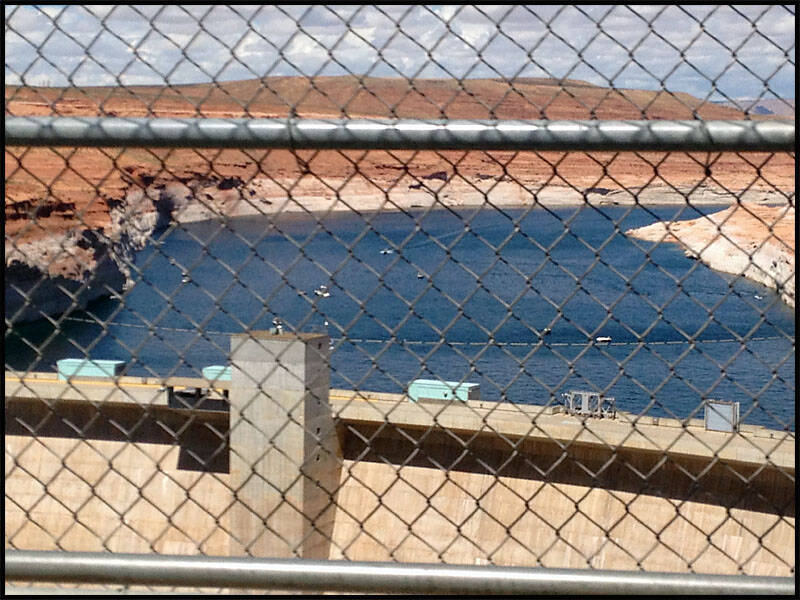
Glenn Canyon Dam Arizona
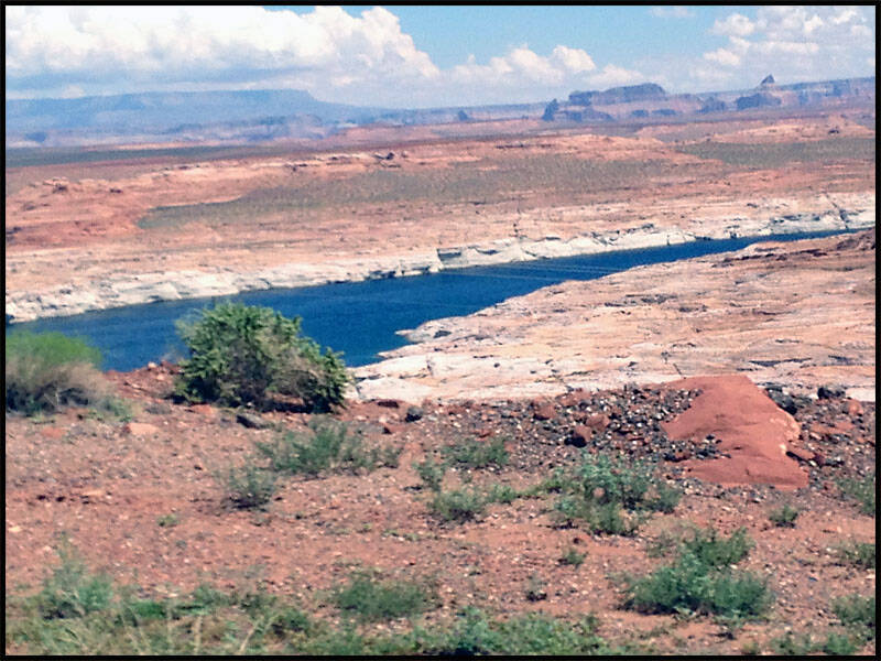
Glen Canyon Dam, located on the Colorado River in northern Arizona near the town of Page, was built to provide hydroelectric power and regulate the flow from the Upper Colorado River Basin to the Lower Basin. The dam created Lake Powell, the second-largest artificial lake in the United States, which extends into the state of Utah. Named after the colorful Glen Canyon gorge, the project’s main purpose was to store water to ensure a reliable supply during years of drought. When the reservoir filled in 1966, the dam began delivering a regulated flow of water downstream along with electricity to the region. Today, Lake Powell is a major recreational destination, renowned for activities such as houseboating, water skiing, boating, fishing, jet skiing, and hiking. The view here captures the approach to the dam, highlighting its impressive scale and the surrounding landscape.


Looking down on Lake Powell, a few boats can be seen dotting the water, adding life to the vast, shimmering expanse.

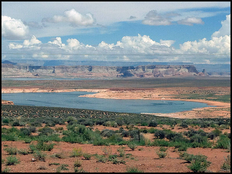
Watching a storm roll across the landscape, its dark clouds and rain.

St George Utah
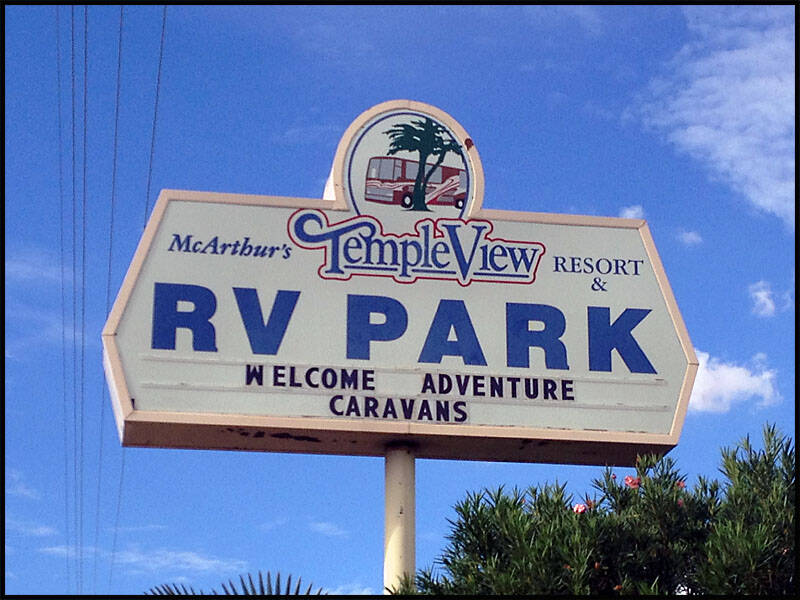
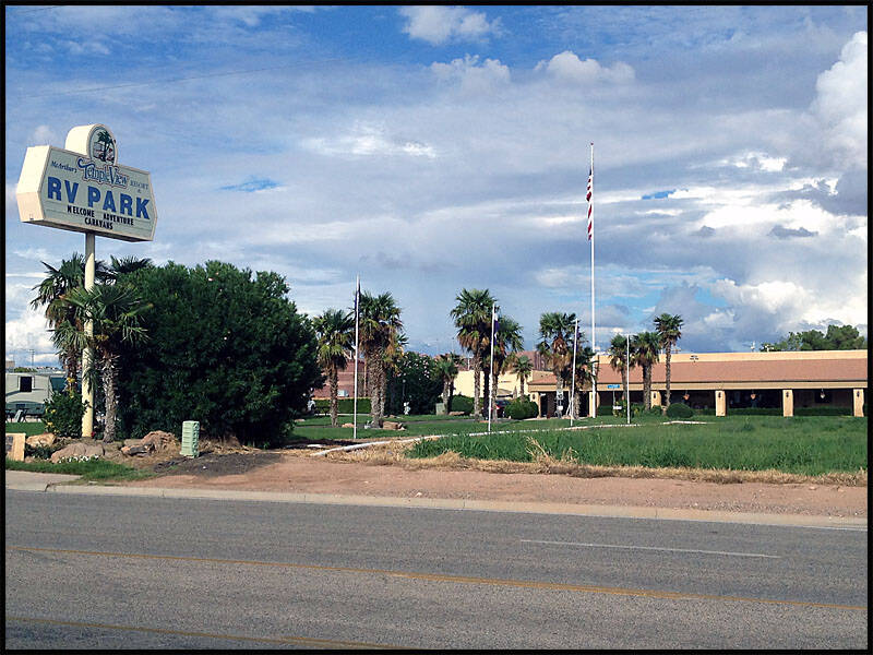
We drove back into Arizona, heading west along Highway 160 through the Copper Mine Plateau—mostly desert with little to see. After passing Glen Canyon Dam, we stopped for lunch before heading north on Highway 89 through Kanab. We just missed a massive storm, so we pulled over to watch it roll past. From there, we continued west on Highway 389, crossing in and out of Arizona and Utah, and eventually stopped for the night at the Temple View RV Park in St. George, Utah.


After checking into the RV park, we took a walk around the nearby streets to see what was around. Later, we returned for a swim, played a few games of pool, and finished the day with a delicious Chinese buffet dinner.
Temple View RV Park in St. George, Utah. The office was closed when we arrived, but a sign directed us to pick any available bay and hook up—we would check in with them in the morning. We followed the instructions and settled in for the night, enjoyed the convenience and simplicity of the setup.

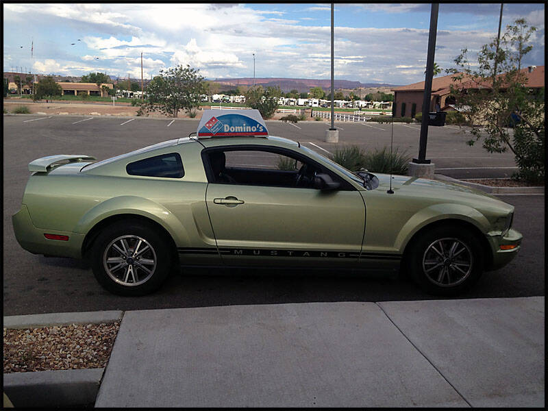
We spent some time in the air-conditioned recreation room, enjoying a few games of pool to relax. Later, we took a walk around the town to see what was nearby and discovered a nice Chinese buffet for dinner. On the way back, I couldn’t resist taking a photo of the local pizza delivery car—a sleek Mustang. The next morning, we enjoyed a hearty breakfast before continuing our journey


Nevada
Leaving St. George, Utah, we drove briefly through a corner of Arizona before entering Nevada, finally making our way toward Las Vegas. Today marked our last day in the RV, and it was time to drop it off and settle in for a few days of fun in the city. We checked into the KOA Circus Circus RV Park, conveniently located just behind the Circus Circus Hotel, putting us right in the heart of the action.
Las Vegas Nevada


"We all went for a walk down the Las Vegas Strip, soaking in the lights and energy of the city. Leigh and I decided to get our Route 66 tattoos at the Rock Star Tattoo Shop, which took a few hours, but was worth it for the memories. When we returned, Graz had the RV sparkling clean and ready to drop off the next morning. We spent several days exploring Vegas, staying the rest of our time at the Circus Circus Hotel. One day, we took a trip to Rick’s Pawn Shop and Rick’s Restoration, and wandered through most of the nearby casinos to see the sights. I tried my luck at a table but lost $100 in about ten minutes—not exactly the thrill I was hoping for.


KOA Circus Circus RV Park with the Stratosphere Hotel rising in the background, capturing the iconic Vegas skyline from the park.


Leigh and I getting our Route 66 tattoos at the Rock Star Tattoo Shop—a lasting memento of our journey along the Mother Road.


When we got back, Graz had already finished giving the RV a full clean from top to bottom. It was sparkling inside and out, every surface wiped down, windows shining, and the floors swept so neatly you could hardly tell we had spent days living in it.


On the Vegas Strip, the neon lights stretched endlessly in every direction, flashing in a constant rhythm that made the whole street feel alive. The sidewalks were crowded with people from all over the world—some dressed to the nines heading to shows and casinos, others in casual clothes just soaking in the atmosphere.


The Venetian Hotel stood out on the Strip with its stunning architecture modeled after the romantic city of Venice. Its grand façade featured ornate columns, arched windows, and detailed frescoes, giving it an elegant, old-world charm that felt completely out of place in the middle of the desert—but in the best way.

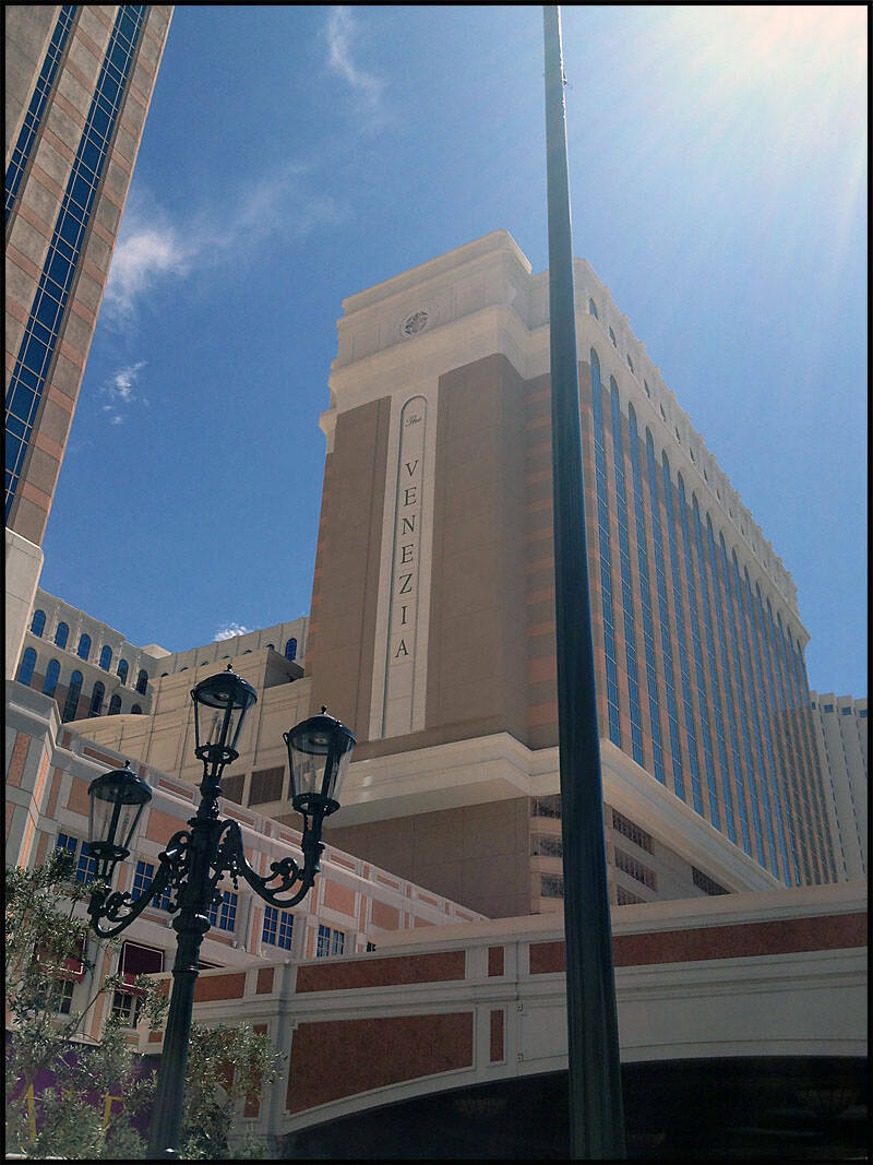
Inside, the luxury continued with high ceilings, marble floors, and lavish chandeliers. The canals winding through the hotel, complete with gondolas and singing gondoliers, created a whimsical and immersive experience, making you feel like you had stepped straight into Italy


Graz couldn’t resist trying his luck and wandered over to the pokies, a mischievous grin on his face.


The Treasure Island Hotel loomed ahead with its bold, pirate-themed exterior, instantly catching the eye with giant skulls, sails, and towering masts that made it feel like a ship had docked right on the Strip.

At least this guy was honest about what he wanted the money for—he didn’t beat around the bush or make up some excuse. He straight-up asked for $10, saying it was for weed, which made the situation amusing.


By night, the Vegas Strip transformed into a dazzling spectacle of light and energy. Neon signs and LED screens bathed the streets in vibrant colors—pulsing reds, electric blues, and golden yellows that seemed to compete for attention. A mix of tourists, street performers, and party-goers, all moving to the rhythm of the city. Music spilled from every casino, club, and bar, blending into a constant, hypnotic hum. The fountains at the Bellagio danced in perfect synchronization with the lights and music, while the volcano at Treasure Island erupted in fiery bursts, illuminating the night sky.


The Luxor and MGM Grand stood as two of the most iconic landmarks on the Vegas Strip, each with a distinct personality that made them impossible to miss. The Luxor, with its massive black pyramid and bright beam of light shooting straight into the sky, is like something out of a sci-fi movie. Its interior continued the Egyptian theme, with towering statues and ambient lighting that gave the place a dramatic, almost theatrical atmosphere.
A short walk away, the MGM Grand contrasted sharply with its sheer size and bold green exterior. Known as one of the largest hotels in the world, it radiated energy and excitement, with a casino floor buzzing with activity, countless restaurants, bars, and entertainment venues, and the famous lion statue guarding the entrance. Both hotels offered a glimpse into the extravagance and variety of Las Vegas, each with its own unique charm, making them must-see stops on the Strip.


The Circus Circus Hotel, where we stayed, had a playful and slightly nostalgic vibe that set it apart from the glitzier resorts on the Strip. with circus-themed murals and banners that made it immediately recognizable. Inside, the atmosphere was lively and family-friendly, with carnival games, a big indoor midway, and even live circus acts performing throughout the day—kids and adults alike were captivated by the acrobats and clowns. Our room was comfortable and straightforward, providing a quiet retreat from the bustle of the Strip while still keeping us close to all the action. Despite being a bit more old-school than some of the newer mega-resorts, it had a charm and energy that made our stay fun and memorable.


We had to go and see Rick’s Pawn Shop in person since we’d watched the TV show and were curious to experience it for ourselves. Walking up to the shop, it looked just like it did on screen, with the familiar bright signage and the windows filled with all sorts of intriguing items. Inside, it was a treasure trove of curiosities—shelves crammed with vintage gadgets, rare collectibles, jewelry, and random odds and ends. It was fascinating to see the staff in action, negotiating and examining items with that same street-smart energy we had seen on the show.


Walking further along the Strip, the sheer variety of hotels and casinos was staggering, each with its own theme and personality. There was the Paris Las Vegas Hotel, complete with a half-scale Eiffel Tower and charming French-inspired architecture, and the Flamingo, with its tropical gardens and resident flamingos adding a quirky, retro vibe. The Bellagio dazzled with its elegant fountains, luxurious interiors, and high-end shopping, while Caesars Palace radiated Roman grandeur with massive statues, marble columns, and opulent décor. the sidewalks were buzzing with tourists, performers, and street vendors, and the casinos inside were alive with flashing lights, ringing slots, and the constant hum of excitement. Walking the Strip was like strolling through a city-sized theme park, each hotel and casino offering a unique slice of the Vegas experience.


The Harley Davidson Café was impossible to miss, with its bold signage, oversized motorcycles, and roaring engines on display that perfectly captured the spirit of the brand. Inside, the décor was a biker’s dream—walls lined with vintage bikes, leather jackets, neon signs, and memorabilia that made you feel like you’d stepped into a motorcycle museum mixed with a lively American diner.


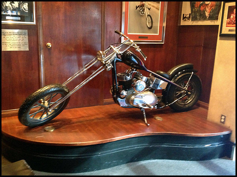
more iconic hotels kept appearing, each more extravagant and themed than the last. The Mirage stood out with its tropical volcano and lush indoor rainforest, offering a mix of spectacle and luxury. Nearby, the New York-New York Hotel recreated the Manhattan skyline, complete with the Statue of Liberty and a roller coaster weaving through the buildings, giving the whole area a playful, larger-than-life energy. Each hotel and casino seemed to compete for attention, lighting up the Strip with neon, LED screens, and fountains, making the walk an endless parade of extravagance, entertainment, and unique Vegas charm.


Leigh had a flight to Canada to spend a few days catching up with his son and his family, so Graz and I took the chance to explore Vegas a little more. We hopped on the bus and made our way down to the old part of town, Fremont Street, which had a completely different vibe from the Strip. The street was lined with classic casinos like the Golden Nugget, Golden Gate, Las Vegas Club, Four Queens, and several others, each with its own history and character. We also passed the Mob Museum, which looked fascinating, but with an entry fee of around $30, we decided to save that experience for another time. After soaking in the old-town atmosphere, we headed back to the Strip for dinner at the Luxor Casino, enjoying a relaxing meal amid the grandeur of the pyramid-themed resort.


Dinner at the Luxor was a real highlight, not just for the food but for the atmosphere of the place. Walking through the massive pyramid-shaped resort, with its soaring ceilings and dramatic lighting, set the tone before we even sat down


On the way back, we couldn’t resist stopping at a few casinos just to take in more of the Vegas atmosphere. Each one had its own unique feel—some buzzing with crowds gathered around the craps and roulette tables, others quieter with rows of pokies flashing and chiming in the background


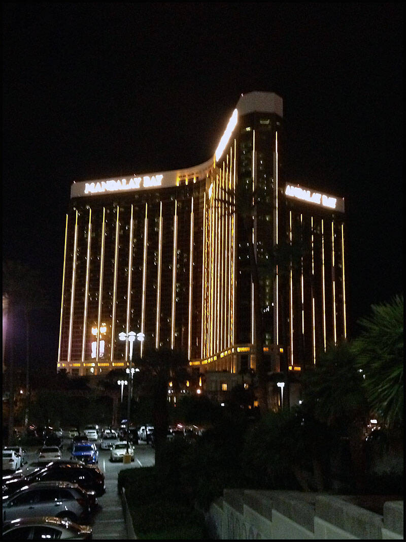
Leigh had just returned from Canada, and with it being our last day in Vegas, we tried to make the most of it. Graz decided he wanted a tattoo as a souvenir, so we found a small shop off the Strip that looked decent enough at first glance. The so-called tattoo artist, however, was a bit of a character—he kept disappearing into the back room, and when he came out a couple of times, there was a suspicious bit of white powder under his nose. Leigh and I couldn’t help but exchange looks and have a quiet laugh about it, wondering what exactly we’d gotten Graz into. Despite the odd behavior, the tattoo itself actually turned out pretty good, and Graz was happy with it, which was the main thing. It definitely added one more wild story to our Vegas adventures before it was time to move on.
Leigh shared a couple of photos from his time in Canada with his grandkids, and you could tell right away how much it meant to him. In one shot, he was sitting on the couch with the kids piled around him, all of them smiling and laughing, the kind of candid moment that showed just how close they are.


When Leigh got back, we decided to head over to Rick’s Restoration to check it out. Having seen it on TV, we were curious to see the workshop in real life. The place had a rugged, industrial feel, with old signs, vintage furniture, and all sorts of classic pieces waiting to be brought back to life. You could see the crew’s handiwork in the restored items on display—everything from retro appliances to antique gas pumps—each one polished up to look better than new. Walking around, it felt a bit like stepping into the show itself.


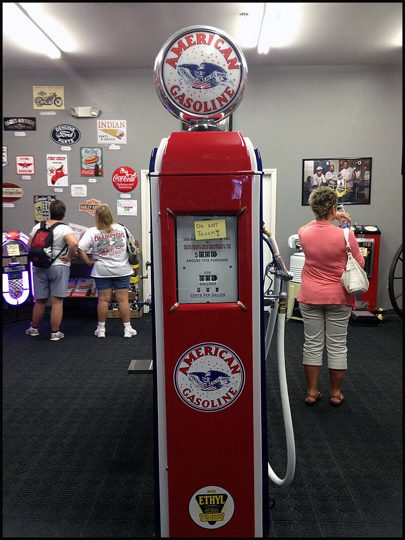


That afternoon, Graz finally went ahead and got his tattoo. He’d been talking about it for a while, and with it being our last day in Vegas, he figured it was now or never.


On our last night, we decided to keep things simple and just walked the Strip, taking in the sights one more time.
The Bellagio fountains danced to music, sending sprays of water glistening in the lights, while the Mirage’s volcano erupted with bursts of fire that warmed the night air. Caesars Palace glowed with golden grandeur, the Eiffel Tower in Paris sparkled against the sky, and the Luxor’s beam stretched straight into the heavens like a lighthouse over the desert. Crowds moved shoulder to shoulder, street performers put on their acts, and the air buzzed with music, laughter, and the endless hum of Vegas energy. It was the perfect way to say goodbye—wandering beneath the lights that make this city unlike anywhere else in the world.


We stood at the Bellagio both during the day and at night to watch the fountains, and each time felt completely different.


On the Strip, we came across a street performer putting on an incredible show, playing pots, pans, and tubs like a full drum kit. The rhythm was surprisingly catchy, and the crowd couldn’t help but stop and watch,


Of course, Leigh couldn’t resist getting dessert once again, even with all the excitement around us. Whether it was a rich chocolate treat, a colorful ice cream cone, or something sweet he spotted from a street vendor, he just had to have it.

On our way back to the hotel, I stopped to take a few night shots of the Circus Circus Hotel. The neon lights glowed brightly against the dark sky, casting colorful reflections on the street and creating that unmistakable Vegas energy.


Leaving Vegas, we decided to rent a 2009 Mustang convertible to drive down to LA. Leigh and I couldn’t resist playing a little trick on Graz—he was convinced we were getting a standard Ford Focus, so we kept quiet about the upgrade. When we pulled up and he saw the Mustang, his eyes nearly popped out of his head; he looked like we’d somehow taken someone else’s car by mistake. We let him stew for a few hours, enjoying his disbelief, before finally confessing the truth. Graz wasn’t exactly thrilled at first, grumbling about our prank, but there was no denying the thrill of cruising down the highway in a sleek, open-top Mustang, wind in our hair (my hair) and the California sun ahead.
Leaving Las Vegas Nevada


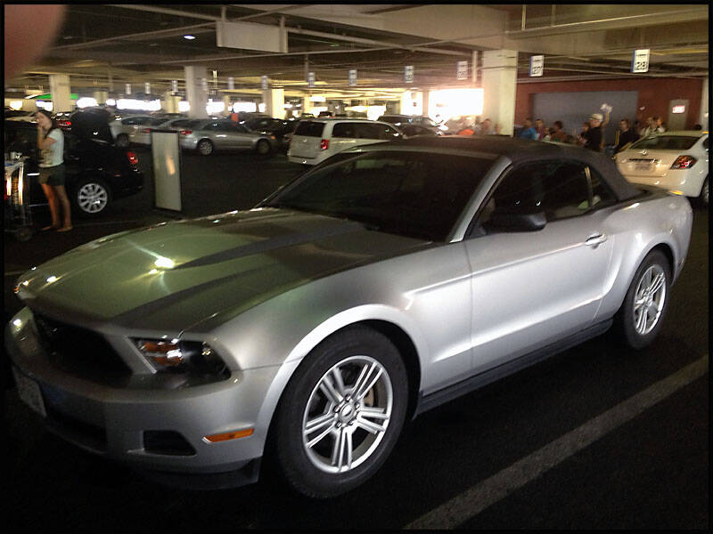
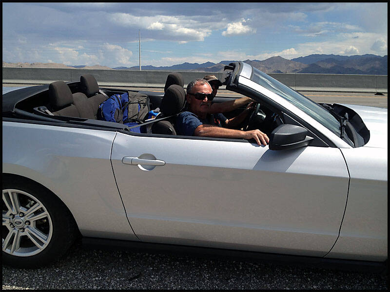
We managed to pull over a few times along the way to snap some photos of us in the Mustang. The convertible top was down, the wind tousling our (my) hair. In some shots, we were still seated behind the wheel, looking ready to hit the open road. The desert landscape stretched out behind us in golden tones, giving the images a classic road-trip vibe. Each photo perfectly captured the excitement and freedom of that drive from Vegas to LA.


California.
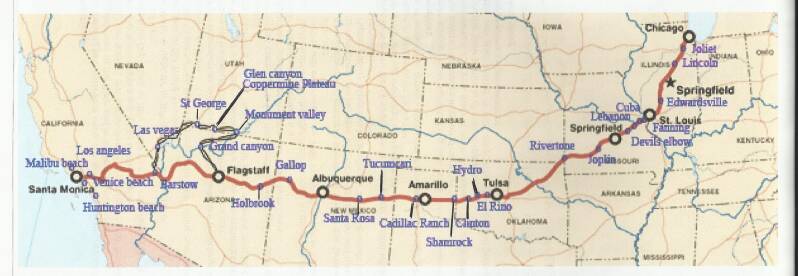
We left Vegas and began the final 435 km stretch of our journey to Los Angeles, driving through small towns along the way. Our first stop was Primm, where we pulled over at Whiskey Pete’s for a quick break. The town had that classic roadside charm, with a few small businesses still operating and the familiar desert backdrop stretching endlessly. Continuing, we crossed the Steel Truss Bridge over the Mojave River, a sturdy structure that felt like a gateway into California.
Soon after, we passed through Victorville, a city in the Victor Valley of southwestern San Bernardino County. Victorville has an interesting history, including the large George Air Force Base nearby. After decades of service to the U.S. Air Force, the base was closed, and the housing area now sits vacant, almost like a ghost town, with old tanks, jeeps, planes, and other military vehicles left behind. Today, the site is used for military training by U.S. Army and Air Force troops, giving it a mix of eerie abandonment and continued purpose.
Once we reached Los Angeles, we decided to take a drive down Sunset Boulevard to the iconic Chinese Theater. We spent a few hours walking along Hollywood and Sunset Boulevard, soaking in the famous sights, the energy of the street performers, and the bustling crowds. The next day, we drove out to Santa Monica Beach, where Route 66 officially ends. Standing at the end of the trail, taking a few pictures, and feeling that sense of accomplishment was a really special moment—knowing we’d traveled the length of this legendary road from Chicago all the way to the Pacific Ocean.

We stopped at Primm Valley, at Whiskey Pete’s, to stock up for the last leg of our amazing trip. The casino and gift shop offered a mix of snacks, drinks, and souvenirs, perfect for keeping us fueled and entertained as we headed toward Los Angeles. The town had that classic roadside charm, with the desert backdrop, giving us one last little taste of the iconic Nevada vibe before leaving the state. It was a quick stop, but a fun one, adding a final bit of character to our journey down Route 66.
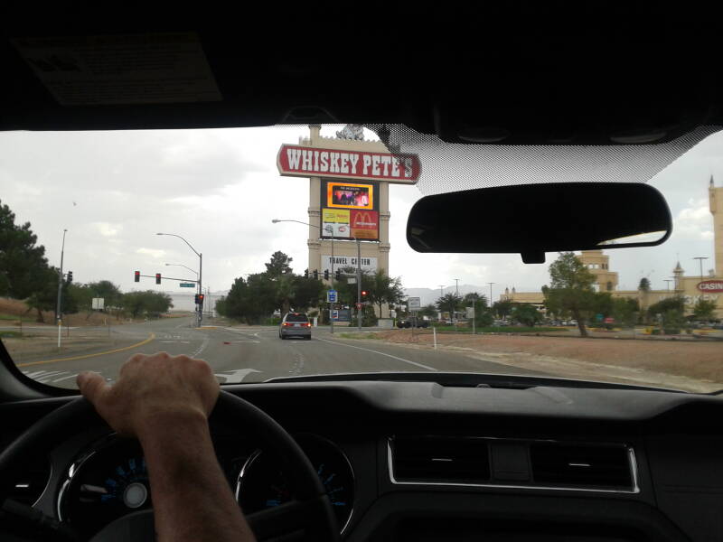
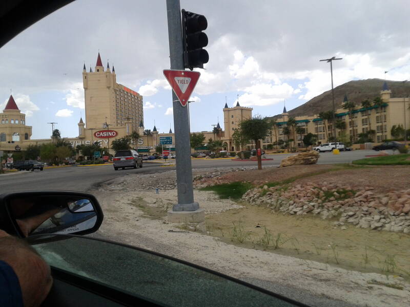
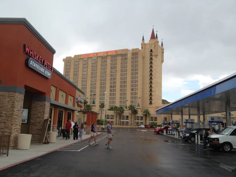
As we drove along Route 66, it was hard to miss the many closed and abandoned businesses that once thrived along this legendary highway. Old diners with faded signs, gas stations with rusted pumps, and motels with peeling paint gave the landscape a haunting, nostalgic feel. Some had “For Sale” signs still clinging to the windows, while others seemed completely forgotten.


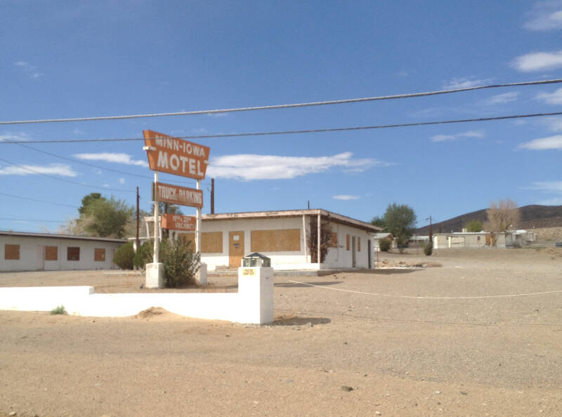
Our next stop was the small town of Yermo, and it was amazing to see that, despite the passage of time, a few businesses were still operating here. Tucked along the old Route 66, A handful of diners, gas stations, and small shops were still welcoming travelers, giving a glimpse into life on the highway decades ago.

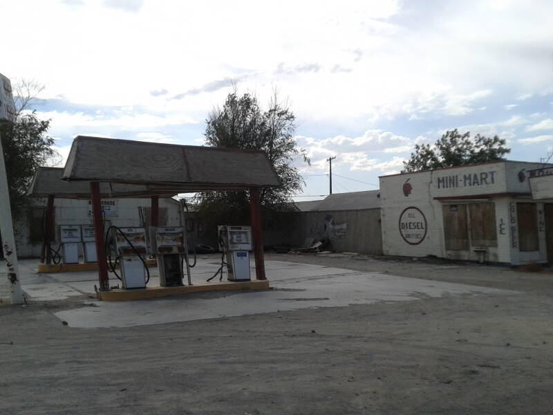

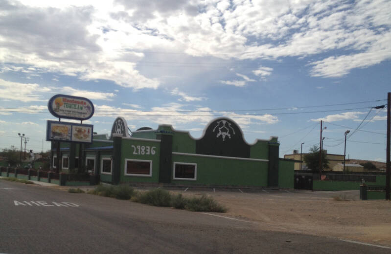
We drove over the Steel Truss Bridge, which spans the Mojave River. The riverbed was mostly dry, a reminder of the harsh, arid environment surrounding the route. Soon after, we passed through Victorville, a city nestled in the Victor Valley of southwestern San Bernardino County.


Our next town was Barstow. We drove through the city, taking in its mix of desert scenery, roadside shops, and the familiar sights of Route 66 running through the center. Just outside of town, we pulled over to snap a few pictures with the iconic Route 66 markings painted on the road.

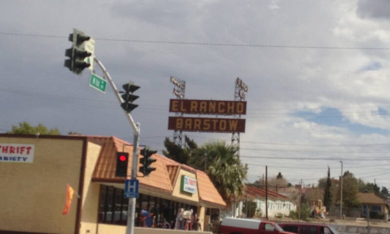
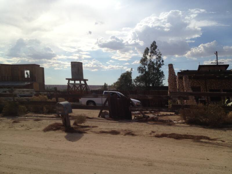
Just outside of Barstow, we stopped to take a few photos of the Route 66 markings painted on the road. The iconic shield logo stood out boldly against the asphalt, a perfect symbol of the highway’s long history.

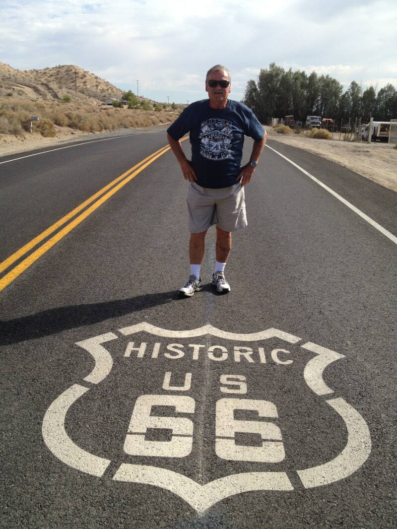
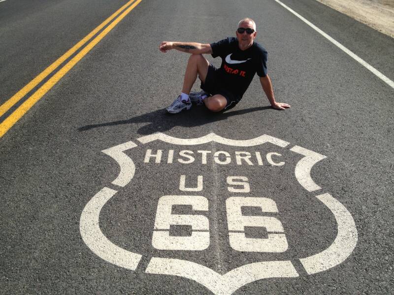


Los Angeles

We finally arrived in Los Angeles and found a nice motel near Venice Beach, the perfect spot to rest after our long drive. Graz decided to have an early night, probably to recharge after all the travel. Leigh and I, however, couldn’t resist heading into the city. We drove around Hollywood, taking in the famous sights and vibrant energy, then parked to walk along Hollywood Boulevard and Sunset Boulevard. From the Walk of Fame stars underfoot to the bustling shops and theaters, it was an exciting evening exploring the heart of the city.
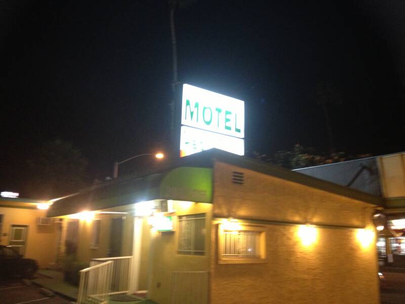


Walking along Hollywood Boulevard, we spotted some of the famous stars embedded in the sidewalk, each one honoring a different actor, musician, or entertainer. The gold-and-black plaques glinted in the sunlight, and crowds of tourists paused to take photos, point out favorite names It was fun to see the mix of legendary icons and modern stars, each commemorated in a way that made you feel connected to Hollywood’s long history of film, music, and entertainment.


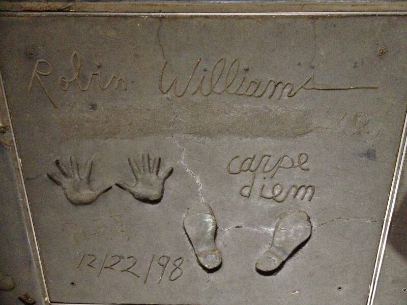


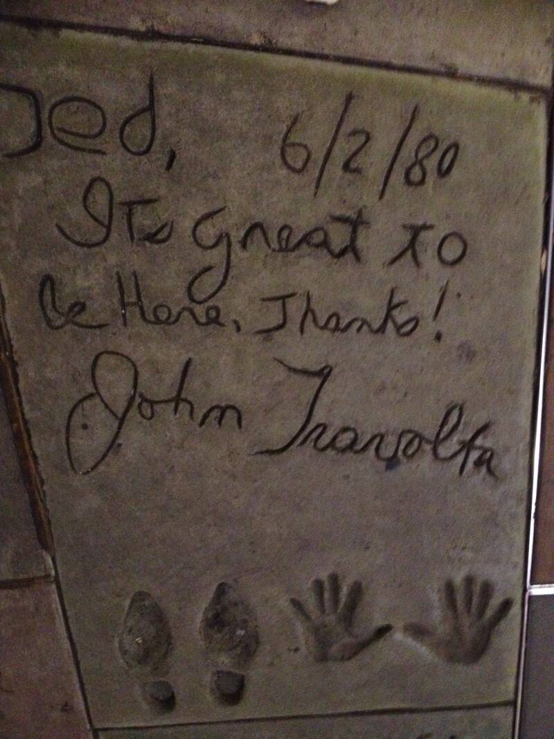
After exploring Hollywood, we drove up the coast to Malibu Beach, taking in the stunning ocean views and the iconic coastline dotted with luxurious homes. The drive itself was a highlight, winding along the Pacific with waves crashing against the cliffs. On the way back down, we stopped at Huntington Beach for lunch, enjoying the relaxed, beach-town atmosphere. In the afternoon, we returned to Venice Beach to soak in the vibe, street performers, colorful murals, and the bustling boardwalk. Since Leigh had to leave a few days earlier than expected, we started looking for a cheaper hotel and eventually found one in Inglewood. It wasn’t the nicest part of LA, but it was affordable and practical, giving us a base for the remaining days of our California adventure without breaking the budget.


We spent a good while walking along the Venice Beach sidewalk, taking in the atmosphere. Street performers were on the sidewalk—jugglers, musicians, and artists putting on shows. Colorful murals and quirky shops lined the boardwalk, while vendors sold everything from handmade jewelry to fresh smoothies. Skateboarders weaved through the crowds. It was a lively, sensory-filled stroll that perfectly captured the spirit of Venice Beach.
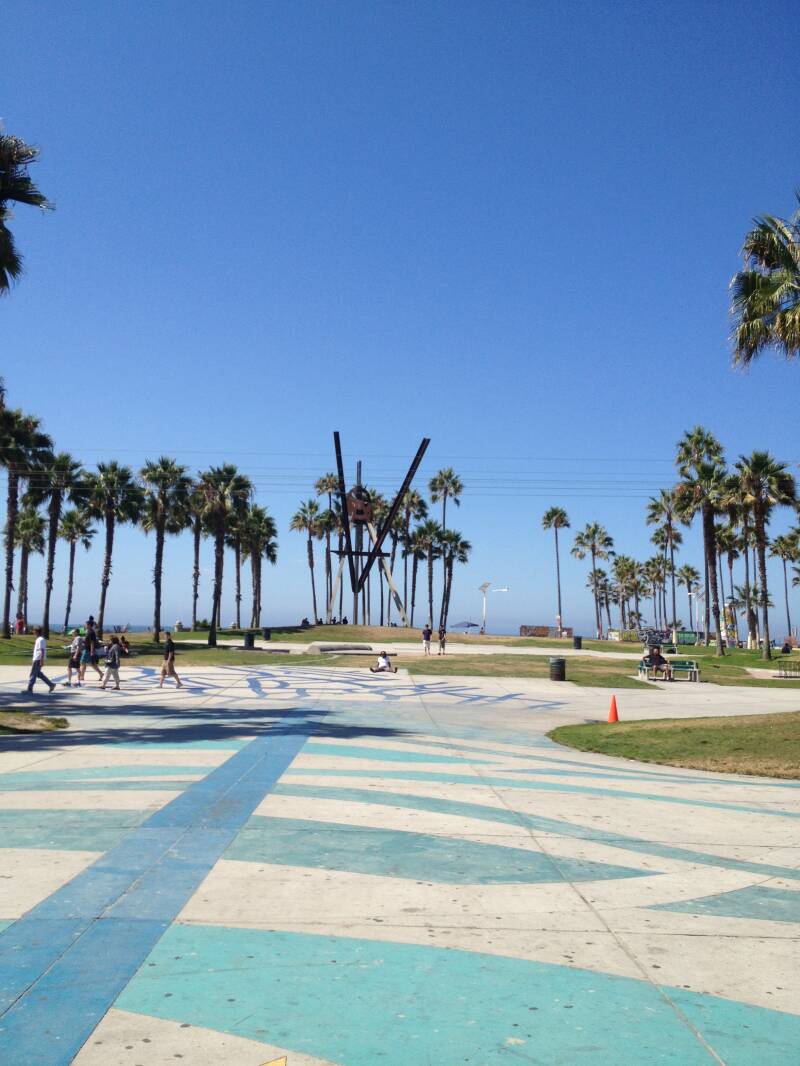
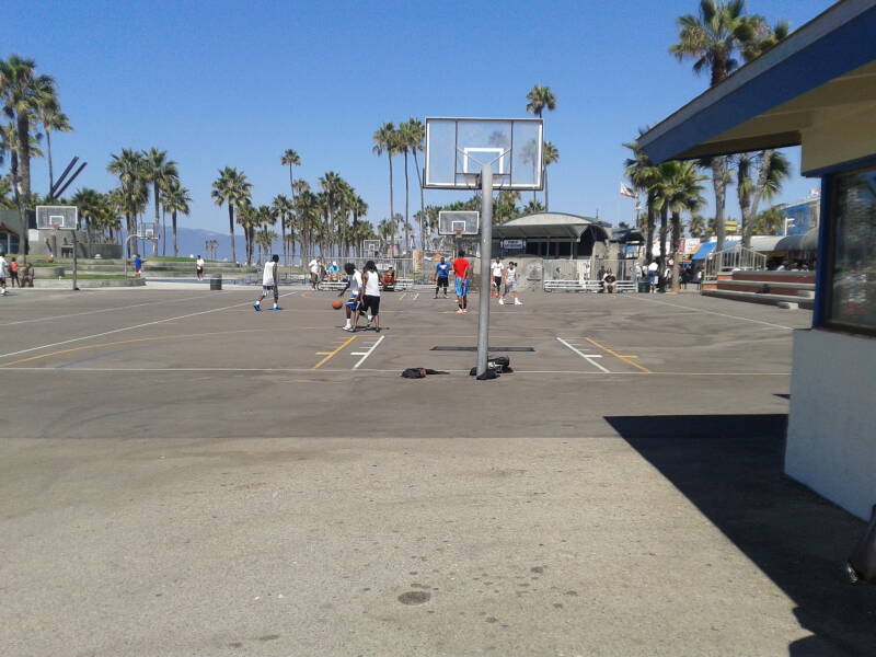
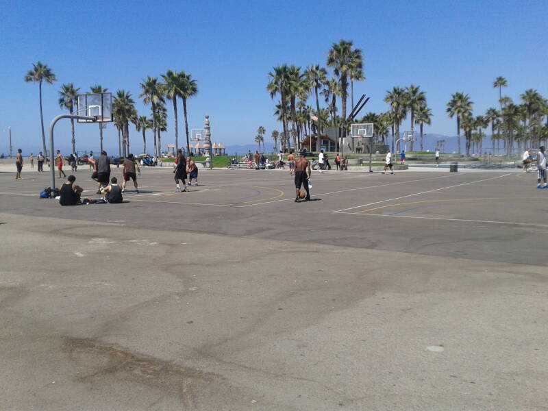
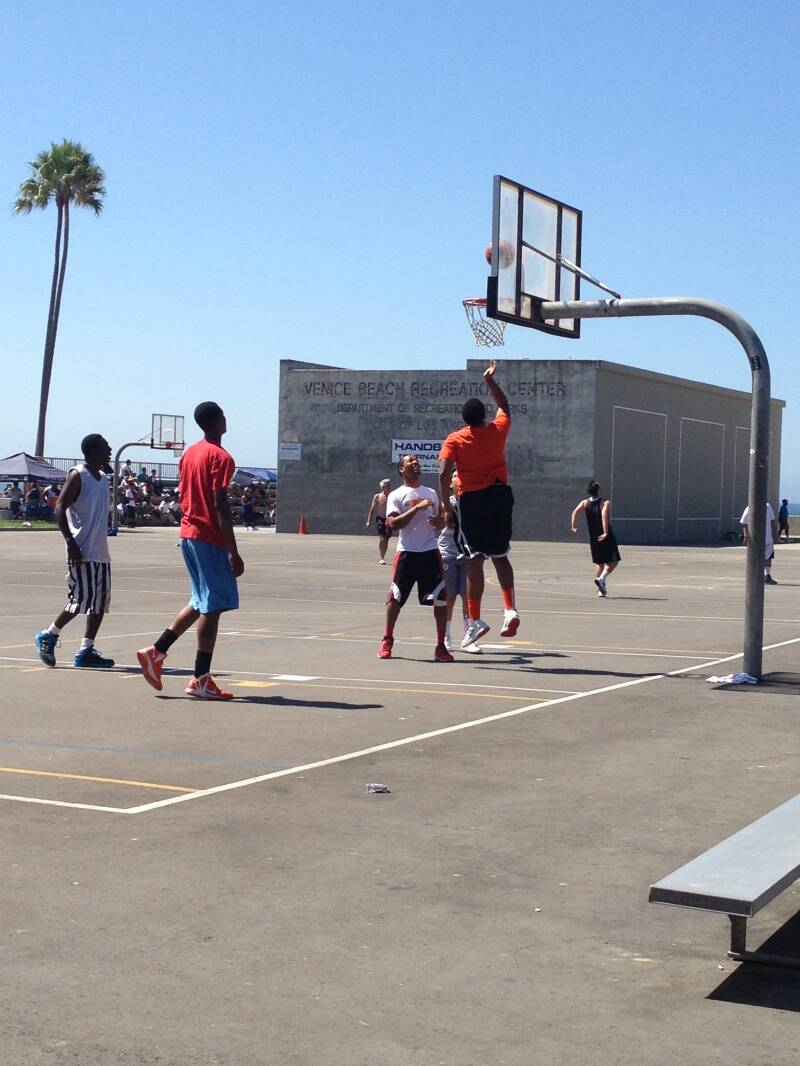
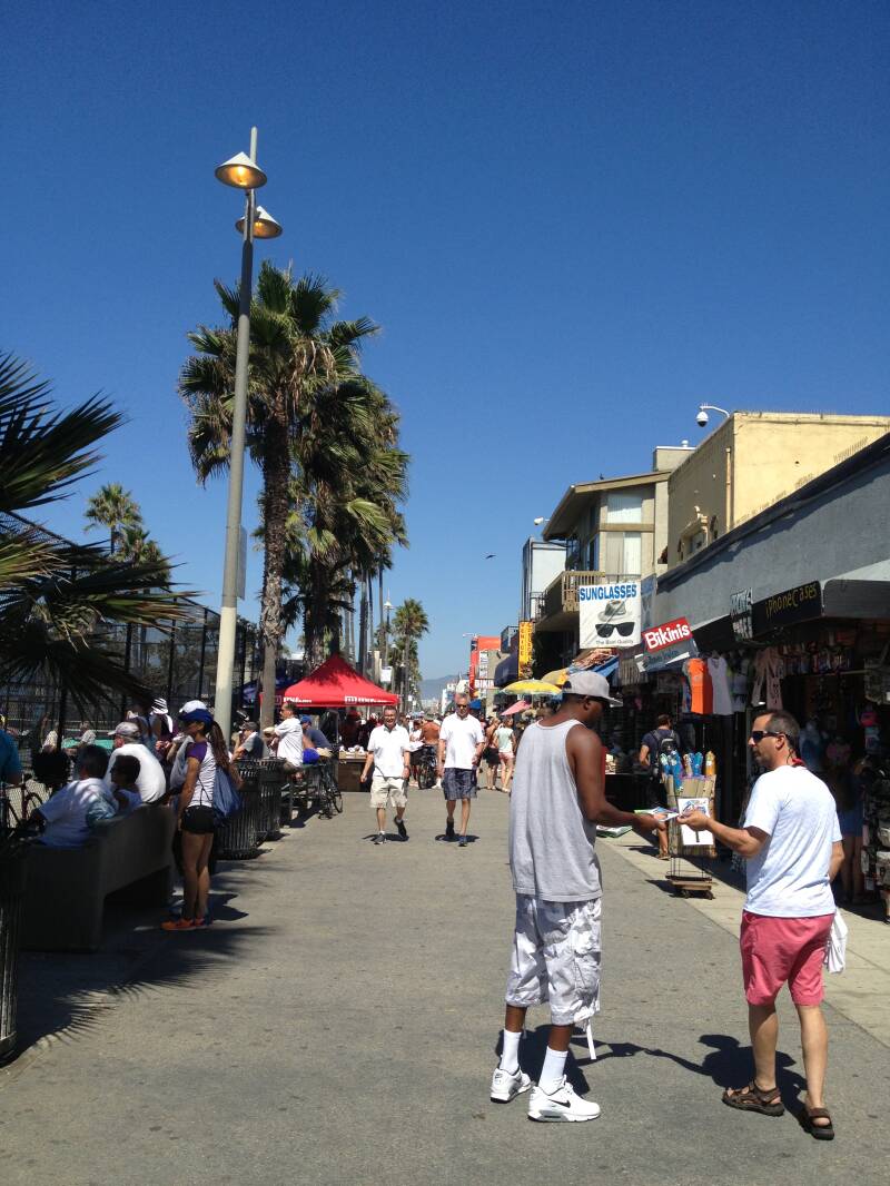
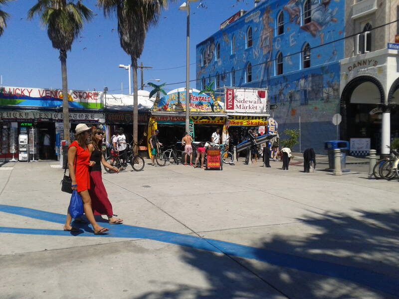


We stopped for lunch at Huntington Beach, enjoying the laid-back, beach-town vibe. We found a casual spot right near the sand, where the menu had all the classic beach-town favorites—fresh seafood, burgers, and cold drinks. Sitting there, watching people stroll along the boardwalk and soaking in the California sunshine, it was the perfect break before continuing our drive back down to Venice Beach.


We returned the Mustang and dropped Leigh at the airport, saying our goodbyes before he headed off. Graz and I picked up a small Ford Focus for the last few days, perfect for zipping around and checking out the sights. Our first adventure was heading up to Mount Lee in the Hollywood Hills to get a closer view of the massive Hollywood sign. What should have been a short drive turned into a bit of an ordeal—we got lost and it took about three hours to finally find the right route.
Along the way, we joked that it would be hilarious if the lights on the sign were out and we couldn’t see it. Well, luck—or misfortune—was on our side, because when we finally arrived, there were no lights at all. Apparently, they no longer illuminate the sign at night because nearby residents complained it was too bright. Even without the lights, seeing the iconic letters up close from the hillside was an incredible experience, and the view of Los Angeles spread out below us made the long, winding drive well worth it.


The next day, we spent some time at the mall doing a bit of shopping before heading off to Lancaster, where my niece and nephew live and run a Thai restaurant. On the way, we made a short stop in Palmdale—Graz knows exactly what I mean, and there’s a funny story there if you ask him. Once we arrived at the restaurant, we had a wonderful lunch and spent a relaxing afternoon with May and Nina. Their hospitality was amazing—thank you again, May and Nina!
Afterwards, we drove back to Los Angeles to do our laundry for the last time. The laundromat we found was in east LA and definitely didn’t feel like the safest place, but we got the job done. It was a practical stop, and once the laundry was done, we felt a little more prepared for the final days of our trip.
.


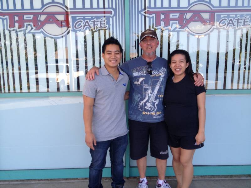
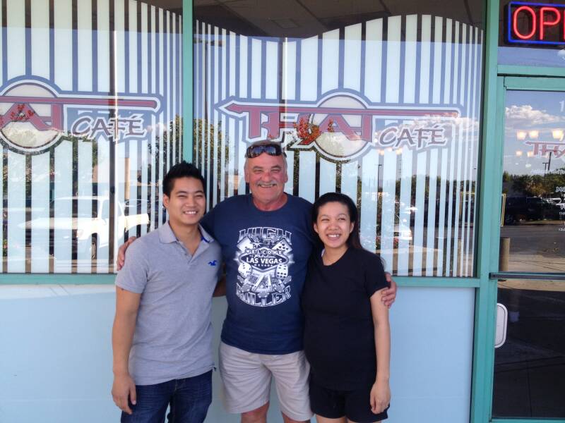
On the second-to-last day, we couldn’t decide where to go—Disneyland or Universal Studios—so we tossed a coin to make the choice. Both of us had been to them before, but the coin landed in favor of Universal Studios, and it turned out to be another fantastic day. We went on every ride, some of them even twice, and made sure to take the famous train tour around the studios, getting a behind-the-scenes look at the sets and soundstages. After a full day of thrills, shows, and exploring, we stopped at Denny’s on the way back for a casual dinner, reflecting on the fun we’d had and gearing up for the final day of our adventure.


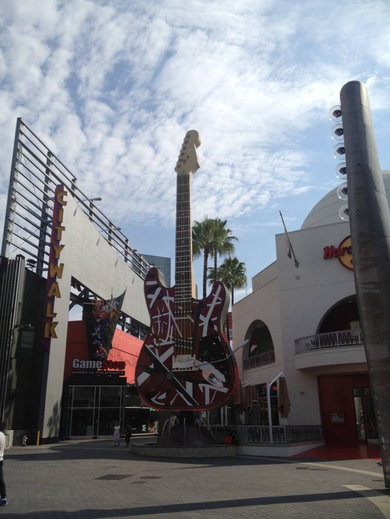
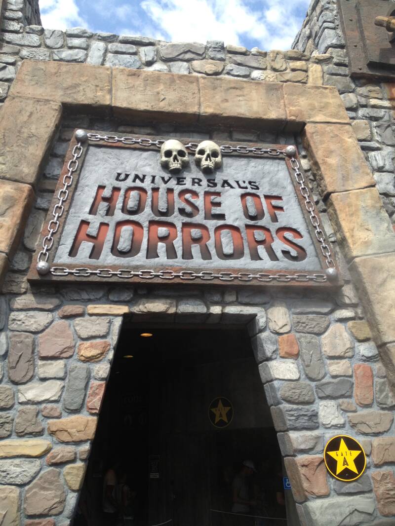
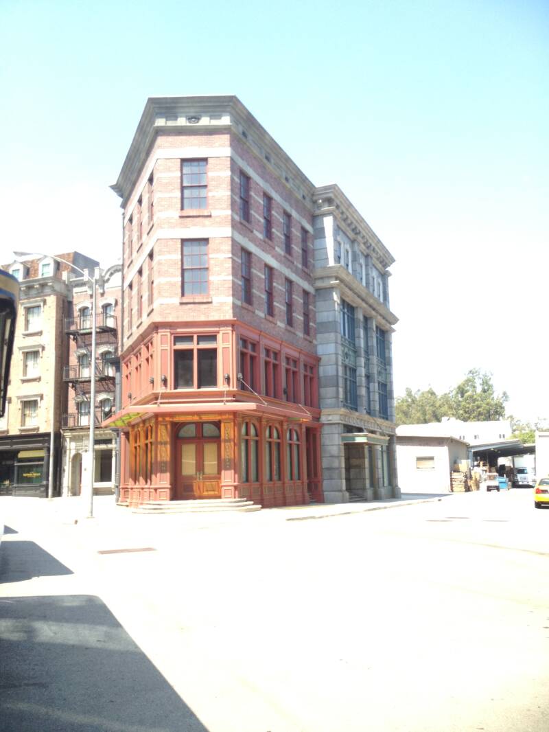
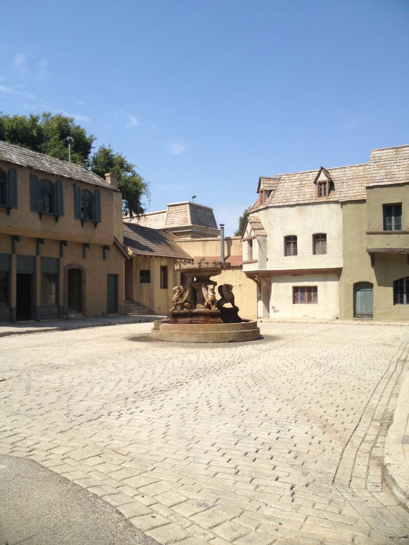


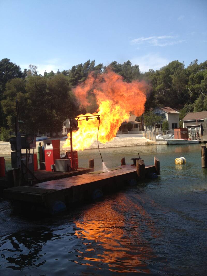

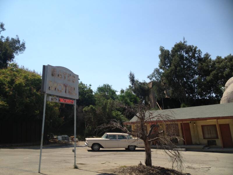
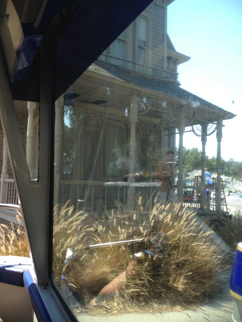


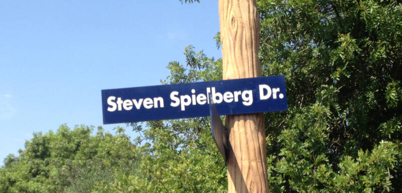


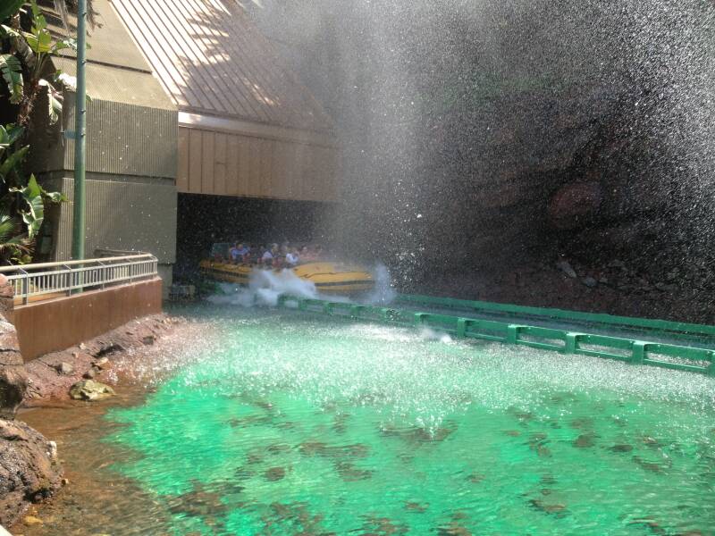
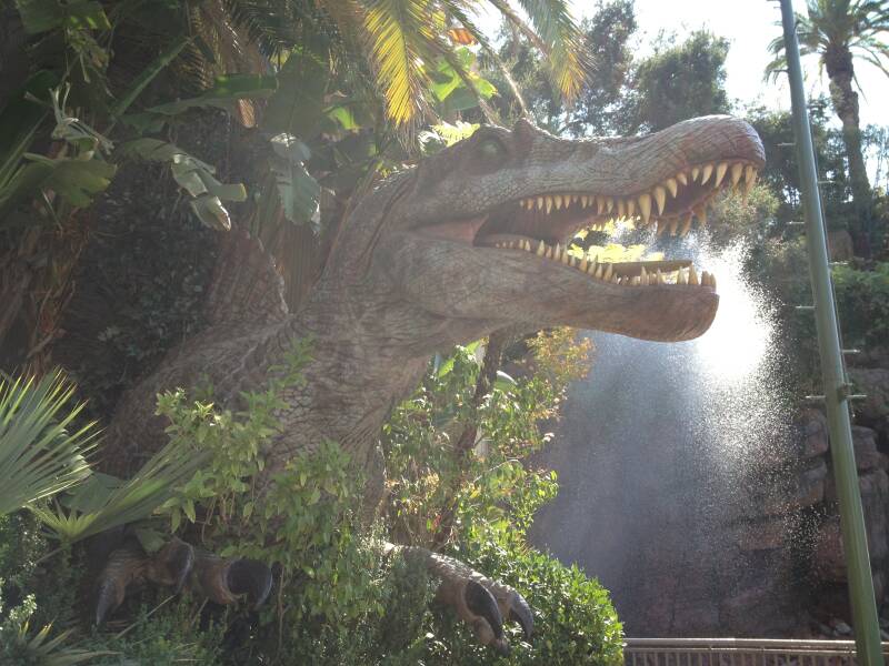
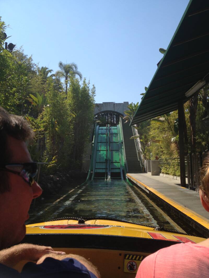
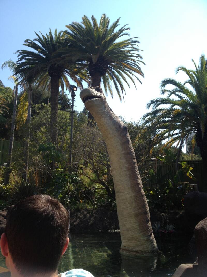
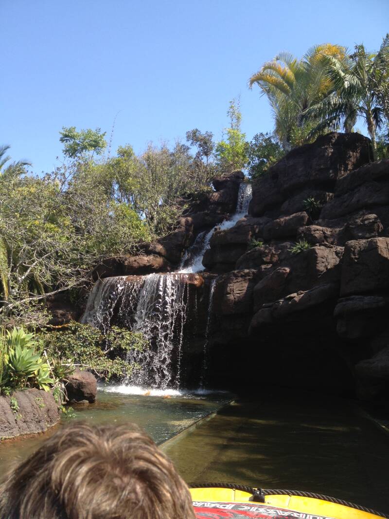

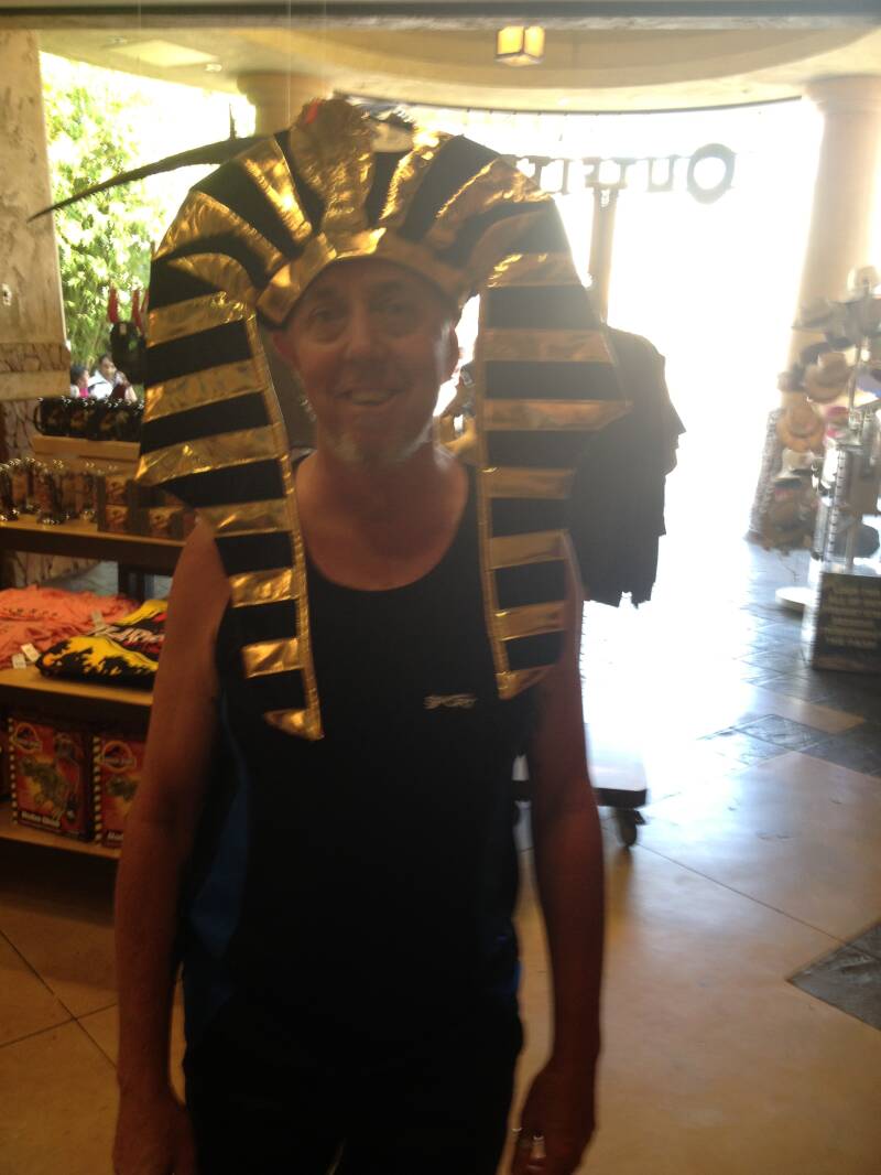

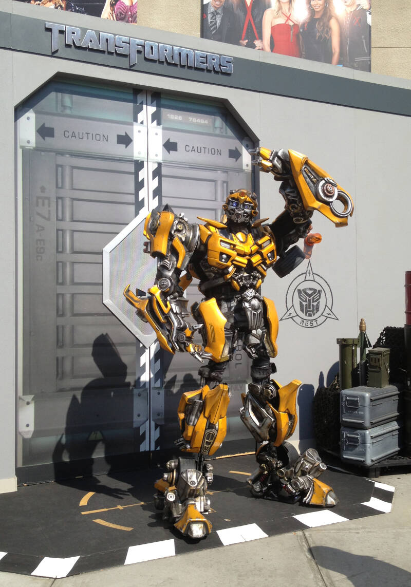


On our last day, we planned an ambitious trip all the way out to the West Coast’s largest Antique Auto, Corvette, Porsche, Street Rod, Volkswagen Swap Meet, and Classic Car Show at Fairplex in Pomona, California. After a long drive, we finally found the place—only to discover it was closed on Tuesdays. And, of course, guess what day we had chosen to go? Yes, Tuesday. It ended up being a frustrating four-hour round trip for nothing.
Not to let the day go to waste, we turned around and drove back to Wilshire to visit the Petersen Automotive Museum instead. We spent the rest of the day exploring the incredible collection of classic and modern cars, enjoying the exhibits, and taking plenty of photos. After a full day immersed in automotive history, we returned to the hotel for a quick shower before heading to the airport to fly back to Sydney, bringing an end to an unforgettable journey across the U.S. and down Route 66.

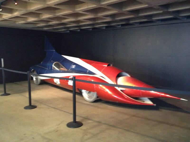
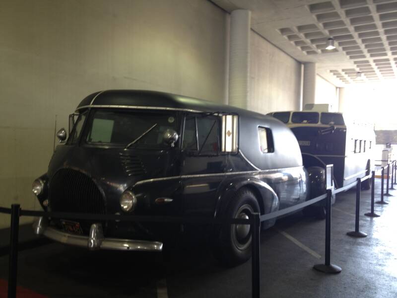


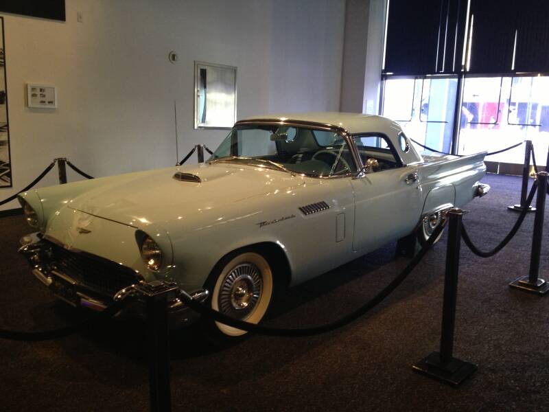

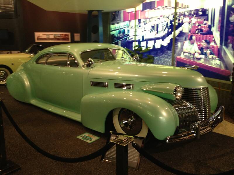
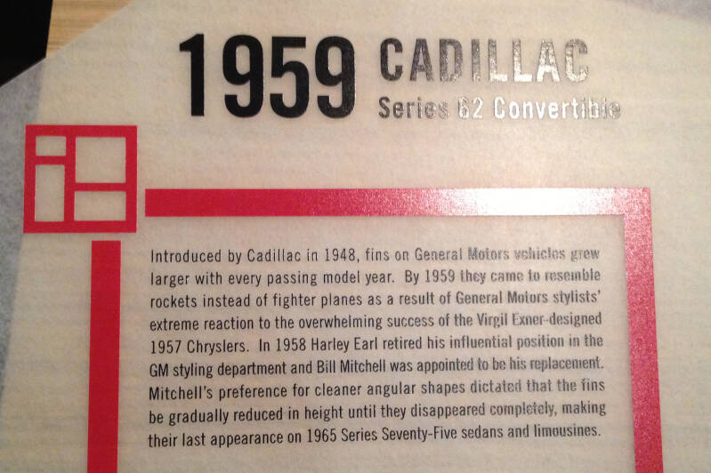
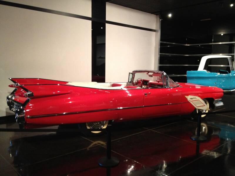
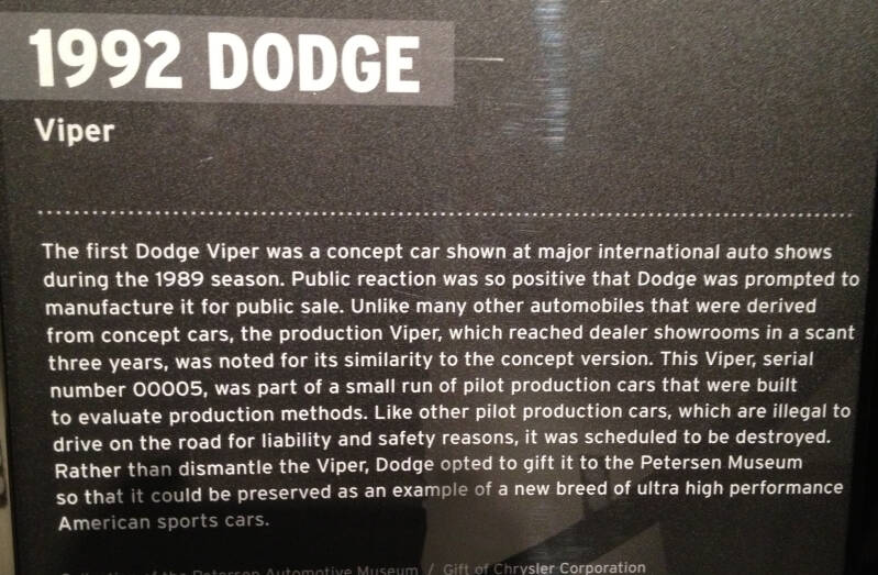


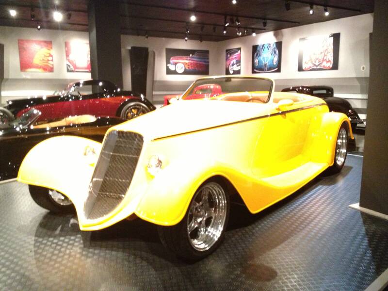

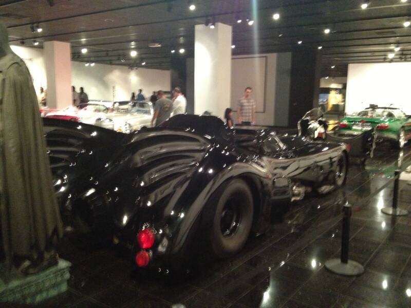
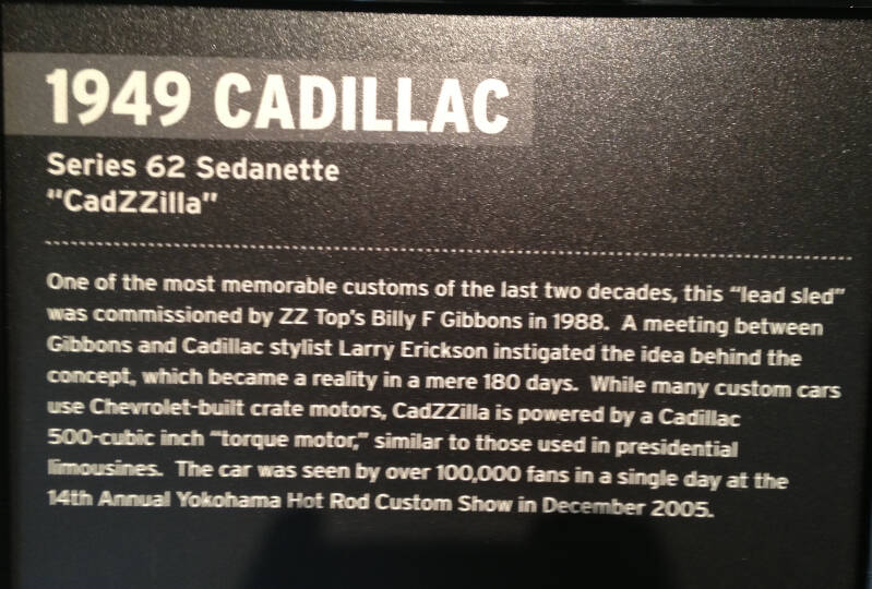


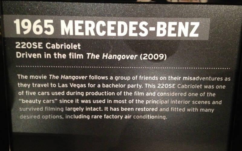

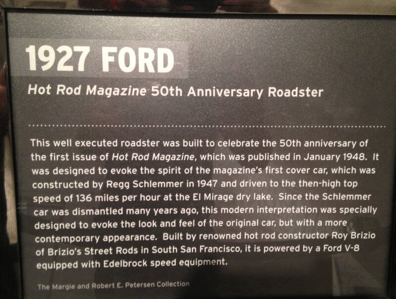
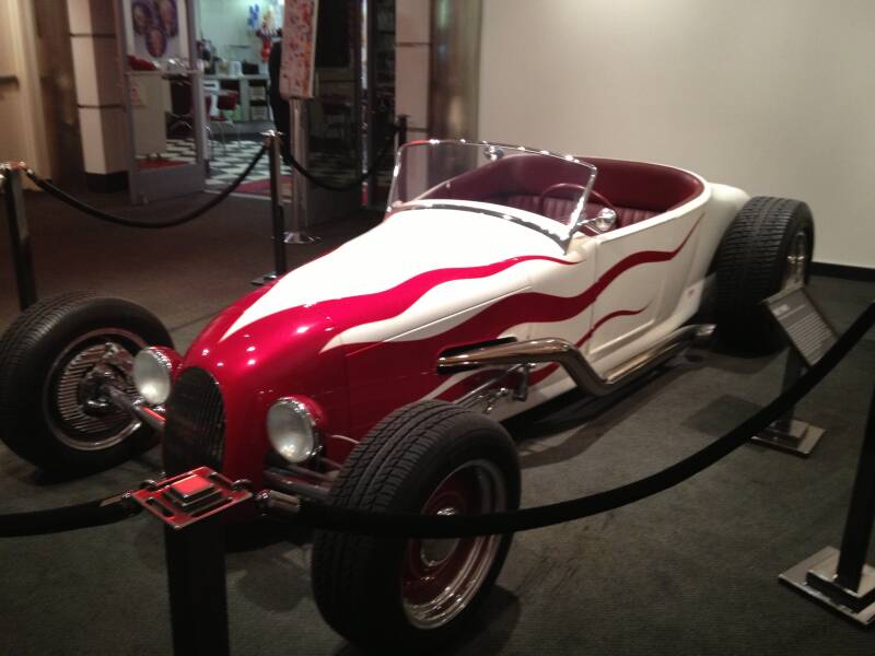
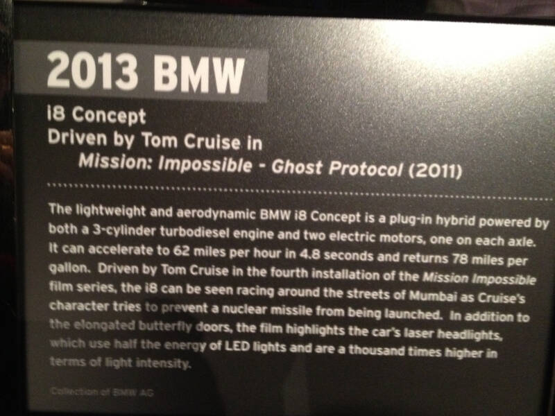
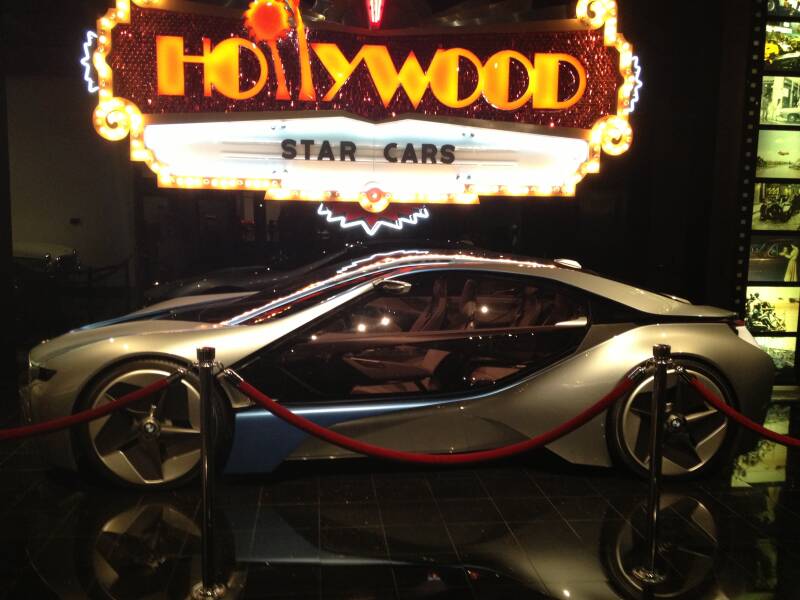
It was finally time to leave and head home. We had our last dinner at Denny’s, a simple but satisfying way to cap off the trip, reminiscing about all the adventures, sights, and laughs along the way. After that, we packed up and made our way to the airport, ready to board our flight back to Sydney, carrying with us a collection of unforgettable memories from an incredible journey across the U.S. Route 66.
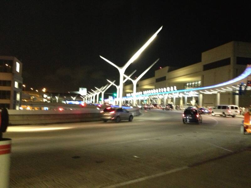
Create Your Own Website With Webador